MOTOSHARE 🚗🏍️
Rent Bikes & Cars Directly from Owners
Motoshare connects vehicle owners with people who need bikes and cars on rent. Owners earn from idle vehicles, and renters get flexible ride options.
Visit Motoshare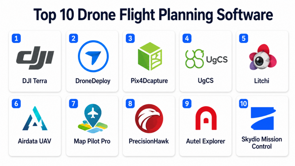
Introduction
Drone Flight Planning Software refers to specialized platforms used to design, automate, and manage drone missions safely and efficiently. These tools help operators define flight paths, set waypoints, control camera actions, monitor telemetry in real time, and ensure regulatory compliance during aerial operations.They are widely used in surveying, agriculture, construction, mining, infrastructure inspection, public safety, logistics, and media production. By combining GPS navigation, terrain modeling, geofencing, and AI-assisted automation, these platforms make drone operations more precise and scalable.
Modern drone planning software is evolving into full aerial intelligence platforms with capabilities like autonomous missions, multi-drone coordination, cloud-based analytics, and integration with GIS and photogrammetry tools.
Common real-world use cases include:
- Aerial mapping and 3D site modeling
- Crop health monitoring and precision agriculture
- Infrastructure inspection (bridges, pipelines, towers)
- Disaster response and damage assessment
- Security surveillance and patrol missions
- Construction progress tracking
Buyers evaluating Drone Flight Planning Software should focus on:
- Mission planning and waypoint automation
- Real-time flight control and telemetry
- Obstacle avoidance and terrain awareness
- Drone hardware compatibility
- Data capture capabilities (images, video, LiDAR)
- GIS and mapping integration
- Offline mission planning support
- Regulatory compliance and geofencing
- AI-assisted route optimization
- Fleet and multi-drone management
Best for: Drone operators, surveying companies, agriculture firms, construction enterprises, defense agencies, and inspection teams.
Not ideal for: Casual hobby drone users who do not require mission planning or enterprise-level data collection.
Key Trends in Drone Flight Planning Software
- AI-powered autonomous flight planning is improving mission accuracy.
- Cloud-based drone operations are replacing standalone desktop tools.
- Real-time obstacle detection is enhancing flight safety.
- Multi-drone fleet management is becoming standard in enterprise use.
- Integration with GIS platforms is enabling spatial intelligence workflows.
- Drone data is increasingly connected to digital twin systems.
- Edge computing is enabling onboard real-time decision-making.
- Automated compliance checks are simplifying airspace regulation.
- 3D terrain-aware flight planning is improving mission precision.
- Integration with photogrammetry and LiDAR tools is expanding rapidly.
How We Selected These Tools
The platforms listed below were selected based on drone ecosystem compatibility, mission planning depth, industry adoption, and geospatial capabilities.
- Evaluated adoption across commercial and enterprise drone operations
- Assessed mission planning and waypoint automation features
- Reviewed real-time telemetry and flight control capabilities
- Considered GIS and mapping integration strength
- Evaluated support for multi-drone and fleet management
- Reviewed AI-assisted navigation and automation features
- Assessed compatibility with major drone hardware ecosystems
- Considered offline and remote mission planning capabilities
- Evaluated data capture and processing workflows
- Reviewed vendor maturity in drone software ecosystem
Top 10 Drone Flight Planning Software
#1 — DJI Terra
Short description: DJI Terra is a professional drone mission planning and mapping software designed for DJI drone ecosystems. It enables automated flight planning, real-time mission execution, and high-precision 2D and 3D mapping. The platform is widely used in surveying, construction, and agriculture industries. It supports photogrammetry processing and terrain-aware flight paths. DJI Terra is especially strong in drone mapping and autonomous mission execution.
Key Features
- Automated waypoint mission planning
- 2D and 3D map generation
- Photogrammetry processing
- Terrain-following flight mode
- Real-time mission monitoring
- High-accuracy data capture
- Drone telemetry integration
Pros
- Deep integration with DJI drones
- High-quality mapping outputs
- Strong automation capabilities
Cons
- Limited to DJI ecosystem
- Requires powerful hardware
- Licensing cost can be high
Platforms / Deployment
- Desktop (Windows)
- Cloud-assisted processing
Security & Compliance
Supports encrypted data storage and secure device communication within DJI ecosystem.
Integrations & Ecosystem
- DJI drone hardware
- GIS platforms
- Photogrammetry tools
- Cloud storage systems
- CAD software
- APIs (limited ecosystem)
Support & Community
Strong DJI enterprise support and global drone operator community.
#2 — DroneDeploy
Short description: DroneDeploy is a cloud-based drone flight planning and analytics platform used for automated aerial missions and data processing. It supports mission planning, real-time flight control, and AI-powered mapping. The platform is widely used in construction, agriculture, and energy industries. It enables end-to-end drone workflow automation. DroneDeploy is especially strong in cloud-based drone operations and enterprise scalability.
Key Features
- Automated mission planning
- Real-time flight control
- Cloud mapping and processing
- AI-based image analysis
- 3D model generation
- Fleet management tools
- Progress tracking dashboards
Pros
- Easy-to-use interface
- Strong cloud capabilities
- Works with multiple drone models
Cons
- Subscription cost is high
- Requires internet connectivity
- Advanced features need training
Platforms / Deployment
- Web / Mobile
- Cloud
Security & Compliance
Supports encryption, RBAC, and enterprise-grade security controls.
Integrations & Ecosystem
- DJI drones
- GIS platforms
- BIM software
- Cloud storage systems
- APIs
- Construction management tools
Support & Community
Strong enterprise support and active global user community.
#3 — Pix4Dcapture
Short description: Pix4Dcapture is a drone mission planning application focused on aerial mapping and photogrammetry workflows. It allows users to design automated flight paths for capturing high-quality imagery. The platform is widely used in surveying and research applications. It integrates with Pix4D’s photogrammetry suite for advanced mapping. Pix4Dcapture is especially strong in mapping-focused drone operations.
Key Features
- Automated flight path planning
- Grid and corridor missions
- Camera control automation
- Terrain-following support
- Real-time flight monitoring
- Photogrammetry data capture
- Multi-drone support
Pros
- Excellent for mapping missions
- Strong photogrammetry integration
- Easy mission setup
Cons
- Limited analytics features
- Best within Pix4D ecosystem
- Fewer enterprise tools
Platforms / Deployment
- Mobile / Desktop
- Cloud processing integration
Security & Compliance
Supports encrypted data transfer and standard drone communication security.
Integrations & Ecosystem
- Pix4D ecosystem
- GIS platforms
- DJI drones
- Cloud storage systems
- CAD tools
- APIs
Support & Community
Strong surveying and research community support.
#4 — UgCS (Universal Ground Control Software)
Short description: UgCS is a professional drone mission planning software designed for complex industrial drone operations. It supports advanced waypoint missions, terrain-aware flight paths, and multi-drone coordination. The platform is widely used in mining, surveying, and public safety. It enables offline mission planning and high-precision geospatial workflows. UgCS is especially strong in complex terrain mission planning.
Key Features
- Advanced waypoint mission planning
- 3D terrain-aware routing
- Multi-drone coordination
- Offline mission planning
- GIS integration support
- Payload configuration control
- Real-time telemetry monitoring
Pros
- Strong industrial capabilities
- Works offline effectively
- Supports complex missions
Cons
- Steep learning curve
- Less modern interface
- Requires training
Platforms / Deployment
- Desktop
- Cloud optional
Security & Compliance
Supports encrypted mission data and secure communication protocols.
Integrations & Ecosystem
- GIS platforms
- DJI drones
- Mapping software
- CAD tools
- Cloud storage
- APIs
Support & Community
Strong enterprise surveying industry support.
#5 — Litchi for DJI
Short description: Litchi is a popular third-party drone flight planning app for DJI drones, offering autonomous waypoint missions and advanced flight automation. It is widely used by drone photographers and mapping professionals. The platform supports immersive flight modes and cloud mission syncing. It is especially strong in cinematic and mapping workflows. Litchi enhances DJI drone automation capabilities.
Key Features
- Waypoint mission planning
- Orbit and panorama modes
- Autonomous flight control
- VR flight mode
- GPS-based route planning
- Camera automation tools
- Cloud mission sync
Pros
- Affordable and flexible
- Strong DJI compatibility
- Easy to use
Cons
- Limited enterprise features
- DJI-only compatibility
- Fewer analytics tools
Platforms / Deployment
- Mobile
- Cloud sync
Security & Compliance
Supports standard encrypted data handling for drone missions.
Integrations & Ecosystem
- DJI drones
- Mapping tools
- Cloud storage systems
- Media tools
- GIS systems
- APIs (limited)
Support & Community
Large global user community with strong informal support.
#6 — Airdata UAV
Short description: Airdata UAV is a drone analytics and mission management platform that supports flight planning, telemetry tracking, and fleet monitoring. It provides deep insights into drone performance and safety compliance. The platform is widely used in enterprise drone fleet operations. It is especially strong in flight analytics and reporting. Airdata UAV complements mission planning with operational intelligence.
Key Features
- Flight data analytics
- Mission tracking dashboards
- Safety monitoring tools
- Fleet management system
- Maintenance tracking
- Telemetry logging
- Compliance reporting
Pros
- Strong analytics capabilities
- Excellent for fleet operations
- Improves flight safety
Cons
- Limited mission planning depth
- Requires integration with drones
- Subscription-based model
Platforms / Deployment
- Web / Mobile
- Cloud
Security & Compliance
Supports encryption, RBAC, and enterprise compliance frameworks.
Integrations & Ecosystem
- DJI drones
- DroneDeploy
- GIS platforms
- Cloud systems
- APIs
- Enterprise dashboards
Support & Community
Strong enterprise support ecosystem.
#7 — Map Pilot Pro
Short description: Map Pilot Pro is a drone mapping and flight planning app designed for automated aerial surveying missions. It enables fast mission setup and high-accuracy data capture. The platform is widely used in construction and surveying industries. It focuses on simplifying mapping workflows. Map Pilot Pro is especially strong in automated surveying missions.
Key Features
- Automated mapping missions
- Grid flight planning
- Terrain following mode
- Image capture automation
- GPS mission control
- Data export tools
- Survey-grade mapping support
Pros
- Easy mapping automation
- Strong DJI integration
- Good for surveying tasks
Cons
- DJI-only ecosystem
- Limited analytics tools
- Mobile-focused interface
Platforms / Deployment
- Mobile
- Cloud
Security & Compliance
Supports encrypted mission data and secure storage.
Integrations & Ecosystem
- DJI drones
- GIS systems
- Mapping platforms
- Cloud storage
- Survey tools
- APIs
Support & Community
Moderate but reliable support ecosystem.
#8 — PrecisionHawk (Drone Operations Platform)
Short description: PrecisionHawk is an enterprise drone operations platform offering mission planning, analytics, and aerial intelligence solutions. It supports AI-driven geospatial insights for agriculture, energy, and infrastructure industries. The platform is widely used for industrial drone workflows. It is especially strong in enterprise drone intelligence. PrecisionHawk focuses on end-to-end aerial analytics.
Key Features
- Mission planning tools
- AI aerial analytics
- Infrastructure inspection workflows
- Agricultural monitoring
- Data processing automation
- Flight insights dashboards
- Geospatial intelligence tools
Pros
- Strong enterprise applications
- AI-powered insights
- End-to-end workflows
Cons
- Complex onboarding
- Enterprise pricing
- Requires training
Platforms / Deployment
- Web / Cloud
Security & Compliance
Supports enterprise encryption, RBAC, and secure cloud infrastructure.
Integrations & Ecosystem
- GIS platforms
- Agriculture systems
- Energy tools
- Cloud storage
- APIs
- Drone hardware systems
Support & Community
Strong enterprise consulting and support services.
#9 — Autel Explorer
Short description: Autel Explorer is a drone control and mission planning software designed for Autel Robotics drones. It supports waypoint missions, flight control, and aerial mapping operations. The platform is widely used in inspection and surveillance workflows. It is especially strong in hardware-integrated drone missions. Autel Explorer provides reliable drone automation tools.
Key Features
- Waypoint mission planning
- Real-time flight control
- Camera automation tools
- Flight telemetry monitoring
- Intelligent flight modes
- Mapping support tools
- Obstacle avoidance integration
Pros
- Strong Autel integration
- Easy mission planning
- Reliable flight control
Cons
- Limited ecosystem
- Fewer analytics tools
- Autel-only compatibility
Platforms / Deployment
- Mobile / Desktop
- Cloud assisted
Security & Compliance
Supports encrypted communication and secure mission data handling.
Integrations & Ecosystem
- Autel drones
- GIS tools
- Mapping systems
- Cloud storage
- APIs (limited)
- Survey tools
Support & Community
Moderate but growing enterprise support.
#10 — Skydio Mission Control
Short description: Skydio Mission Control is an AI-powered drone flight planning and autonomous operations platform designed for Skydio drones. It enables intelligent navigation, automated missions, and real-time fleet control. The platform is widely used in public safety and infrastructure inspection. It is especially strong in autonomous drone intelligence. Skydio is known for advanced AI obstacle avoidance and automation.
Key Features
- AI-based mission planning
- Autonomous flight navigation
- Real-time fleet management
- Obstacle avoidance intelligence
- Live video streaming
- Automated inspection workflows
- Cloud mission control
Pros
- Advanced AI autonomy
- Strong safety features
- Excellent for inspections
Cons
- Limited to Skydio ecosystem
- High hardware dependency
- Smaller ecosystem
Platforms / Deployment
- Cloud / Mobile
Security & Compliance
Supports enterprise encryption, RBAC, and secure mission control systems.
Integrations & Ecosystem
- Skydio drones
- Cloud analytics systems
- GIS platforms
- Public safety systems
- APIs
- Enterprise dashboards
Support & Community
Strong enterprise and public safety support ecosystem.
Comparison Table
| Tool Name | Best For | Platform(s) Supported | Deployment | Standout Feature | Public Rating |
|---|---|---|---|---|---|
| DJI Terra | Mapping & surveying | Desktop | Cloud | Photogrammetry mapping | N/A |
| DroneDeploy | Enterprise automation | Web/Mobile | Cloud | End-to-end workflows | N/A |
| Pix4Dcapture | Photogrammetry | Mobile/Desktop | Cloud | Mapping missions | N/A |
| UgCS | Industrial missions | Desktop | Hybrid | Terrain-aware planning | N/A |
| Litchi | DJI automation | Mobile | Cloud | Easy waypoint missions | N/A |
| Airdata UAV | Analytics | Web/Mobile | Cloud | Flight insights | N/A |
| Map Pilot Pro | Survey mapping | Mobile | Cloud | Automated surveying | N/A |
| PrecisionHawk | Enterprise analytics | Web | Cloud | AI aerial intelligence | N/A |
| Autel Explorer | Autel drones | Mobile/Desktop | Cloud | Hardware integration | N/A |
| Skydio Mission Control | Autonomous drones | Cloud/Mobile | Cloud | AI flight automation | N/A |
Evaluation & Scoring of Drone Flight Planning Software
| Tool Name | Core 25% | Ease 15% | Integrations 15% | Security 10% | Performance 10% | Support 10% | Value 15% | Weighted Total |
|---|---|---|---|---|---|---|---|---|
| DJI Terra | 9.0 | 8.5 | 9.0 | 8.5 | 9.0 | 9.0 | 8.0 | 8.7 |
| DroneDeploy | 9.0 | 9.0 | 9.0 | 9.0 | 9.0 | 9.0 | 8.0 | 8.9 |
| Pix4Dcapture | 8.5 | 8.5 | 8.5 | 8.5 | 8.5 | 8.5 | 8.5 | 8.5 |
| UgCS | 9.0 | 7.5 | 8.5 | 8.5 | 9.0 | 8.5 | 8.5 | 8.5 |
| Litchi | 8.0 | 9.0 | 8.0 | 8.0 | 8.0 | 8.0 | 9.0 | 8.3 |
| Airdata UAV | 8.5 | 8.5 | 9.0 | 9.0 | 8.5 | 9.0 | 8.5 | 8.6 |
| Map Pilot Pro | 8.5 | 8.5 | 8.5 | 8.5 | 8.5 | 8.5 | 8.0 | 8.5 |
| PrecisionHawk | 9.0 | 8.0 | 9.0 | 9.0 | 9.0 | 9.0 | 8.0 | 8.7 |
| Autel Explorer | 8.5 | 8.5 | 8.0 | 8.5 | 8.5 | 8.5 | 8.0 | 8.4 |
| Skydio Mission Control | 9.0 | 8.5 | 9.0 | 9.0 | 9.0 | 9.0 | 7.5 | 8.7 |
Which Drone Flight Planning Software Is Right for You?
Solo / Freelancer
Litchi, Pix4Dcapture, and Map Pilot Pro are ideal for individual drone pilots and mapping users.
SMB
DroneDeploy, Airdata UAV, and DJI Terra are best for small businesses needing automation and mapping.
Mid-Market
UgCS, PrecisionHawk, and DroneDeploy fit industrial drone operations and scaling teams.
Enterprise
Skydio, DJI Terra, DroneDeploy, and PrecisionHawk are ideal for large-scale autonomous drone operations.
Budget vs Premium
Budget tools focus on basic waypoint planning, while premium platforms offer AI autonomy, analytics, and fleet control.
Feature Depth vs Ease of Use
Advanced systems offer industrial mission control, while simpler tools prioritize usability and fast deployment.
Integrations & Scalability
Drone systems must integrate with GIS platforms, cloud storage, mapping tools, and enterprise analytics ecosystems.
Security & Compliance Needs
Enterprise drone platforms require encryption, secure mission logs, RBAC, and regulatory compliance support.
Frequently Asked Questions
1. What is drone flight planning software?
It is a tool used to design, automate, and manage drone missions. It helps define routes and capture data efficiently. It is widely used in commercial drone operations. It improves safety and accuracy.
2. Who uses drone planning tools?
Drone pilots, surveyors, agriculture companies, construction firms, and public safety agencies use them. They support commercial drone operations. They help automate aerial missions. Usage depends on industry needs.
3. What is waypoint planning?
Waypoint planning is defining GPS-based flight points for drones. The drone follows these points automatically. It ensures precision in missions. It is widely used in mapping.
4. Why is mission planning important?
It ensures safe and efficient drone operations. It reduces human error. It improves data quality. It supports automation.
5. Can drones fly autonomously?
Yes, many modern drones support autonomous flight using mission planning software. AI and GPS guide their movement. However, regulations still apply. Human oversight is often required.
6. Do these tools work offline?
Some tools support offline mission planning. This is useful in remote areas. However, cloud features require internet access. Capability varies by platform.
7. Are these tools drone-specific?
Yes, many tools are tied to specific drone ecosystems like DJI or Skydio. Others are more universal. Compatibility is important. Always check before choosing.
8. What industries use drone planning software?
Industries include agriculture, construction, mining, defense, logistics, and public safety. They use drones for data collection. Adoption is rapidly increasing. Use cases are expanding.
9. What are common challenges?
Challenges include hardware compatibility, regulatory restrictions, weather conditions, and learning curves. Data processing can also be complex. Integration issues may occur.
10. How should a tool be selected?
Selection depends on drone type, mission complexity, budget, and integration needs. Ease of use and scalability matter. Real-world testing is important. Long-term operational goals should guide decisions.
Conclusion
Drone Flight Planning Software is essential for modern aerial operations, enabling safe, automated, and efficient drone missions across industries such as surveying, agriculture, construction, and public safety. These platforms combine GPS navigation, AI automation, GIS integration, and real-time telemetry to improve operational accuracy and reduce risk. Enterprise tools like DroneDeploy, DJI Terra, Skydio, and PrecisionHawk provide advanced automation and fleet management, while Litchi, Pix4Dcapture, and Map Pilot Pro offer accessible solutions for individual users. The right choice depends on drone compatibility, mission complexity, and scalability needs. Organizations should prioritize automation, integration, and regulatory compliance to fully unlock the value of drone-based geospatial intelligence.
