MOTOSHARE 🚗🏍️
Rent Bikes & Cars Directly from Owners
Motoshare connects vehicle owners with people who need bikes and cars on rent. Owners earn from idle vehicles, and renters get flexible ride options.
Visit Motoshare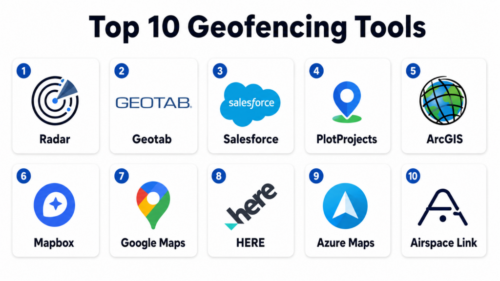
Introduction
Geofencing Tools are location-based software systems that create virtual geographic boundaries using GPS, RFID, Wi-Fi, or cellular data. When a device, user, vehicle, or asset enters or exits these boundaries, the system triggers predefined actions such as alerts, notifications, automation workflows, or access restrictions.
These tools are widely used in logistics, retail, transportation, fleet management, security, marketing, smart cities, drones, and public safety systems. They enable real-time location intelligence and automated decision-making based on spatial boundaries.
Modern geofencing platforms are no longer simple boundary alert systems. They now integrate with IoT devices, AI analytics, GIS platforms, and enterprise applications to support large-scale automation and operational intelligence.
Common real-world use cases include:
- Fleet tracking and delivery monitoring
- Drone flight boundary enforcement
- Retail location-based marketing campaigns
- Workforce attendance and field tracking
- Security perimeter monitoring
- Smart city and public safety zoning
Buyers evaluating Geofencing Tools should focus on:
- Accuracy of location detection (GPS, Wi-Fi, cellular)
- Real-time alerting and event triggers
- Scalability for large fleets or user bases
- Integration with GIS, IoT, and ERP systems
- Rule-based automation capabilities
- Battery efficiency for mobile tracking
- Multi-zone and dynamic geofence support
- API and developer ecosystem
- Data privacy and compliance controls
- Analytics and reporting features
Best for: Logistics companies, fleet operators, retail marketers, drone operators, security agencies, and smart city planners.
Not ideal for: Users who do not require location-based automation or tracking systems.
Key Trends in Geofencing Tools
- AI-powered location intelligence is improving boundary accuracy and prediction.
- Integration with IoT devices is enabling real-time automated responses.
- Geofencing is merging with GIS platforms for spatial intelligence workflows.
- Dynamic geofences (moving boundaries) are becoming more common.
- 5G is improving real-time geolocation precision and latency.
- Privacy-first geofencing is gaining importance due to regulations.
- Edge computing is enabling faster local geofence processing.
- Drone geofencing is becoming standard for airspace control.
- Marketing automation platforms are embedding geofencing triggers.
- Cross-platform APIs are enabling enterprise-scale geolocation systems.
How We Selected These Tools
The platforms listed below were selected based on location accuracy, enterprise adoption, scalability, and integration ecosystem.
- Evaluated adoption across logistics, retail, and fleet industries
- Assessed real-time geofencing accuracy and performance
- Reviewed multi-zone and dynamic geofence capabilities
- Considered integration with GIS and IoT systems
- Evaluated API and developer ecosystem strength
- Reviewed automation and event-triggering capabilities
- Assessed scalability for enterprise deployments
- Considered mobile and battery optimization efficiency
- Evaluated security, privacy, and compliance support
- Reviewed vendor maturity in location intelligence space
Top 10 Geofencing Tools
#1 — Radar
Short description: Radar is a leading geofencing and location intelligence platform used for real-time location tracking, geospatial analytics, and event-driven automation. It enables developers to build location-aware applications with precise geofencing capabilities. The platform is widely used in logistics, mobility, retail, and delivery services. It supports highly accurate GPS-based geofencing with real-time triggers. Radar is especially strong in developer-friendly location APIs and scalability.
Key Features
- Real-time geofencing engine
- Location tracking APIs
- Event-triggered automation
- Multi-zone geofencing support
- Mobile SDKs for apps
- Location analytics dashboards
- Background location tracking
Pros
- Highly accurate location detection
- Strong developer APIs
- Scalable architecture
Cons
- Requires technical integration
- Pricing scales with usage
- Not a plug-and-play tool
Platforms / Deployment
- Web / Mobile
- Cloud
Security & Compliance
Supports encryption, SOC-style controls (varies), RBAC, and privacy-compliant location tracking.
Integrations & Ecosystem
- Mobile apps
- IoT platforms
- Fleet management systems
- CRM tools
- Cloud services
- APIs
Support & Community
Strong developer documentation and enterprise support.
#2 — Geotab
Short description: Geotab is a powerful fleet management and geofencing platform that provides real-time vehicle tracking, route monitoring, and location-based alerts. It is widely used in logistics and transportation industries. The platform supports advanced geofence rules and fleet analytics. It is especially strong in enterprise fleet tracking and compliance. Geotab combines geofencing with telematics intelligence.
Key Features
- Fleet geofencing alerts
- Real-time vehicle tracking
- Route optimization tools
- Driver behavior monitoring
- Automated reporting
- Zone-based alerts
- Compliance tracking tools
Pros
- Strong fleet management capabilities
- High location accuracy
- Rich analytics dashboards
Cons
- Hardware dependency (telematics devices)
- Complex setup
- Enterprise pricing model
Platforms / Deployment
- Web / Mobile
- Cloud
Security & Compliance
Supports encryption, RBAC, and enterprise-grade compliance for fleet data.
Integrations & Ecosystem
- Fleet systems
- ERP platforms
- GPS hardware
- Logistics tools
- APIs
- Cloud systems
Support & Community
Strong enterprise transportation support ecosystem.
#3 — Salesforce Location Services (Geofencing via integrations)
Short description: Salesforce supports geofencing through location-based services and integrations, enabling businesses to trigger workflows based on customer or field agent location. It is widely used in CRM-driven geolocation automation. The platform is especially strong in sales and field service automation. It enables geofence-triggered workflows in enterprise CRM systems. Salesforce is strong in business process automation tied to location data.
Key Features
- Location-triggered workflows
- CRM geofencing automation
- Field service tracking
- Customer proximity alerts
- Mobile location services
- Event-based automation
- API-driven location integration
Pros
- Strong CRM integration
- Highly customizable workflows
- Enterprise-grade automation
Cons
- Requires configuration
- Not standalone geofencing tool
- Complex pricing structure
Platforms / Deployment
- Cloud / Web
Security & Compliance
Supports enterprise security, RBAC, encryption, and compliance frameworks.
Integrations & Ecosystem
- Salesforce CRM
- Field service tools
- Marketing automation systems
- IoT platforms
- APIs
- Cloud analytics
Support & Community
Strong enterprise CRM ecosystem support.
#4 — PlotProjects
Short description: PlotProjects is a geofencing SDK and platform designed for mobile apps, enabling developers to implement location-based triggers and notifications. It is widely used in retail, marketing, and mobile engagement applications. The platform is especially strong in mobile geofencing automation. It allows precise user engagement based on location. PlotProjects focuses on simplicity and mobile-first geofencing.
Key Features
- Mobile geofencing SDK
- Real-time location triggers
- Push notification automation
- Background tracking support
- Multi-zone geofencing
- Analytics dashboard
- Event-based triggers
Pros
- Easy mobile integration
- Strong marketing use cases
- Lightweight SDK
Cons
- Limited enterprise fleet features
- Requires app integration
- Not a standalone platform
Platforms / Deployment
- Mobile / Web
- Cloud
Security & Compliance
Supports encrypted location data and privacy-compliant tracking systems.
Integrations & Ecosystem
- Mobile apps
- Marketing tools
- CRM systems
- Analytics platforms
- Cloud services
- APIs
Support & Community
Strong developer support and documentation.
#5 — Esri ArcGIS Geofencing
Short description: Esri ArcGIS provides advanced geofencing capabilities within its GIS ecosystem, enabling spatial boundary management, real-time alerts, and location intelligence workflows. It is widely used in government, utilities, and smart city applications. The platform is especially strong in GIS-based geofencing. It integrates geofencing with spatial analytics. ArcGIS is a leader in enterprise geospatial intelligence.
Key Features
- GIS-based geofencing tools
- Spatial boundary management
- Real-time alerts and triggers
- 2D/3D map integration
- IoT location tracking
- Spatial analytics engine
- Rule-based automation
Pros
- Extremely powerful GIS integration
- High spatial accuracy
- Enterprise scalability
Cons
- High cost
- Requires GIS expertise
- Complex setup
Platforms / Deployment
- Web / Desktop / Mobile
- Cloud / Hybrid
Security & Compliance
Supports enterprise RBAC, encryption, audit logs, and government compliance standards.
Integrations & Ecosystem
- ArcGIS ecosystem
- IoT platforms
- ERP systems
- Cloud data lakes
- Remote sensing tools
- APIs
Support & Community
Strong global GIS enterprise support ecosystem.
#6 — Mapbox Geofencing APIs
Short description: Mapbox provides geofencing capabilities through APIs and SDKs that enable developers to build location-aware applications with custom boundaries and real-time triggers. It is widely used in logistics, mobility, and navigation systems. The platform is especially strong in developer-centric geofencing solutions. It enables scalable location intelligence applications. Mapbox focuses on flexible geospatial APIs.
Key Features
- Geofencing APIs and SDKs
- Real-time location tracking
- Custom boundary creation
- Event-triggered workflows
- Mobile integration tools
- Routing and navigation support
- Location analytics
Pros
- Highly customizable APIs
- Strong developer ecosystem
- Scalable architecture
Cons
- Requires coding skills
- Usage-based pricing
- Not plug-and-play
Platforms / Deployment
- Web / Mobile
- Cloud
Security & Compliance
Supports encrypted APIs, access control, and secure location handling.
Integrations & Ecosystem
- Mobile apps
- IoT systems
- Logistics platforms
- Cloud databases
- GIS tools
- APIs
Support & Community
Strong developer documentation and global usage base.
#7 — Google Maps Platform (Geofencing APIs)
Short description: Google Maps Platform offers geofencing capabilities through its location services APIs, enabling developers to build applications with location-based triggers and boundary detection. It is widely used in mobile apps and logistics systems. The platform is especially strong in global location accuracy. It supports scalable geolocation services. Google Maps is a leader in mapping and location intelligence.
Key Features
- Geofencing APIs
- Location detection services
- Real-time tracking support
- Geocoding and routing
- Mobile SDK integration
- Event-based triggers
- Location analytics
Pros
- High global accuracy
- Strong infrastructure
- Easy integration
Cons
- Usage-based pricing
- Requires development effort
- Limited enterprise geofence rules
Platforms / Deployment
- Web / Mobile
- Cloud
Security & Compliance
Supports Google Cloud security standards, encryption, and IAM controls.
Integrations & Ecosystem
- Google Cloud
- Mobile apps
- Logistics systems
- IoT platforms
- APIs
- Analytics tools
Support & Community
Strong global developer and enterprise ecosystem.
#8 — HERE Geofencing Platform
Short description: HERE Technologies provides geofencing and location intelligence APIs used for transportation, logistics, and mobility applications. It enables real-time boundary detection and fleet tracking. The platform is widely used in automotive and enterprise logistics. It is especially strong in routing and mobility geofencing. HERE provides highly accurate global mapping data.
Key Features
- Geofencing APIs
- Real-time tracking
- Fleet monitoring tools
- Route optimization
- Location-based alerts
- Traffic-aware geofencing
- Spatial analytics
Pros
- Strong routing intelligence
- High accuracy mapping
- Enterprise-ready APIs
Cons
- Requires integration effort
- Usage-based pricing
- Limited no-code tools
Platforms / Deployment
- Web / Mobile
- Cloud
Security & Compliance
Supports encryption, RBAC, and secure API access control.
Integrations & Ecosystem
- Logistics systems
- Fleet platforms
- IoT devices
- Mobile apps
- Cloud services
- APIs
Support & Community
Strong enterprise mobility ecosystem support.
#9 — Azure Maps Geofencing
Short description: Azure Maps provides geofencing capabilities as part of Microsoft’s cloud mapping and location intelligence platform. It enables developers to create geofences, track movement, and trigger location-based events. The platform is widely used in enterprise cloud applications. It is especially strong in Microsoft ecosystem integration. Azure Maps supports scalable geospatial services.
Key Features
- Cloud geofencing APIs
- Real-time tracking
- Location event triggers
- Spatial data visualization
- Routing and traffic data
- IoT integration support
- Map rendering tools
Pros
- Strong Azure ecosystem integration
- Enterprise scalability
- Reliable cloud infrastructure
Cons
- Requires cloud expertise
- Usage-based pricing
- Limited standalone features
Platforms / Deployment
- Cloud / Web
Security & Compliance
Supports Azure security framework, encryption, RBAC, and enterprise compliance standards.
Integrations & Ecosystem
- Microsoft Azure
- IoT Hub
- Power BI
- Enterprise systems
- APIs
- GIS tools
Support & Community
Strong enterprise cloud support ecosystem.
#10 — Airspace Link
Short description: Airspace Link is a geofencing and airspace management platform designed for drone operations and urban air mobility. It enables safe drone operations by managing geofences, airspace rules, and real-time restrictions. The platform is widely used in drone delivery and UAV operations. It is especially strong in drone geofencing and regulatory compliance. Airspace Link focuses on safe airspace integration.
Key Features
- Drone geofencing management
- Airspace compliance tools
- Real-time restriction updates
- UAV route planning support
- Regulatory integration systems
- Spatial safety alerts
- Flight authorization tools
Pros
- Strong drone geofencing focus
- Regulatory compliance support
- Real-time airspace updates
Cons
- Limited to aviation use cases
- Requires integration setup
- Niche industry focus
Platforms / Deployment
- Cloud / Web
Security & Compliance
Supports aviation-grade security, encryption, and regulatory compliance frameworks.
Integrations & Ecosystem
- Drone platforms
- Aviation systems
- GIS tools
- Government regulators
- Cloud systems
- APIs
Support & Community
Strong aviation and drone industry support ecosystem.
Comparison Table
| Tool Name | Best For | Platform(s) Supported | Deployment | Standout Feature | Public Rating |
|---|---|---|---|---|---|
| Radar | Developer geofencing | Web/Mobile | Cloud | Real-time location engine | N/A |
| Geotab | Fleet tracking | Web/Mobile | Cloud | Vehicle geofencing | N/A |
| Salesforce | CRM automation | Cloud | Cloud | Workflow triggers | N/A |
| PlotProjects | Mobile apps | Mobile | Cloud | Push-based geofencing | N/A |
| ArcGIS | GIS geofencing | Web/Desktop | Cloud/Hybrid | Spatial intelligence | N/A |
| Mapbox | Developer APIs | Web/Mobile | Cloud | Custom geofences | N/A |
| Google Maps | Global apps | Web/Mobile | Cloud | Location accuracy | N/A |
| HERE | Logistics | Web/Mobile | Cloud | Routing intelligence | N/A |
| Azure Maps | Enterprise cloud | Web | Cloud | Azure integration | N/A |
| Airspace Link | Drone airspace | Web | Cloud | UAV geofencing | N/A |
Evaluation & Scoring of Geofencing Tools
| Tool Name | Core 25% | Ease 15% | Integrations 15% | Security 10% | Performance 10% | Support 10% | Value 15% | Weighted Total |
|---|---|---|---|---|---|---|---|---|
| Radar | 9.0 | 8.5 | 9.0 | 8.5 | 9.0 | 8.5 | 8.5 | 8.7 |
| Geotab | 9.0 | 8.0 | 9.0 | 9.0 | 9.0 | 9.0 | 8.0 | 8.7 |
| Salesforce | 8.5 | 8.5 | 9.0 | 9.0 | 8.5 | 9.0 | 8.0 | 8.6 |
| PlotProjects | 8.5 | 9.0 | 8.5 | 8.5 | 8.5 | 8.5 | 8.5 | 8.6 |
| ArcGIS | 9.0 | 7.5 | 9.5 | 9.0 | 9.0 | 9.0 | 7.5 | 8.7 |
| Mapbox | 8.5 | 8.5 | 9.0 | 8.5 | 9.0 | 8.5 | 8.5 | 8.6 |
| Google Maps | 8.5 | 9.0 | 9.0 | 9.0 | 9.5 | 9.0 | 8.0 | 8.8 |
| HERE | 8.5 | 8.5 | 9.0 | 9.0 | 9.0 | 8.5 | 8.0 | 8.6 |
| Azure Maps | 8.5 | 8.5 | 9.0 | 9.0 | 9.0 | 9.0 | 8.0 | 8.7 |
| Airspace Link | 8.5 | 8.0 | 8.5 | 9.0 | 8.5 | 8.5 | 7.5 | 8.4 |
Which Geofencing Tool Is Right for You?
Solo / Freelancer
Google Maps APIs, Mapbox, and PlotProjects are ideal for small apps and lightweight tracking.
SMB
Radar, HERE, and Geotab work well for small fleet and logistics operations.
Mid-Market
ArcGIS, HERE, Azure Maps, and Mapbox are strong for scaling geospatial operations.
Enterprise
Geotab, ArcGIS, Salesforce, and Azure Maps are best for large-scale geofencing ecosystems.
Budget vs Premium
Budget tools focus on basic boundary tracking, while premium systems offer AI-driven automation and enterprise integration.
Feature Depth vs Ease of Use
Advanced platforms provide powerful geospatial intelligence, while simpler tools prioritize ease of deployment.
Integrations & Scalability
Geofencing systems must integrate with IoT, GIS, CRM, fleet systems, and cloud analytics platforms.
Security & Compliance Needs
Enterprise geofencing requires encryption, RBAC, audit logs, and privacy-compliant location tracking.
Frequently Asked Questions
1. What is geofencing?
Geofencing is a technology that creates virtual boundaries using GPS or location services. It triggers actions when a device enters or exits the area. It is widely used in tracking and automation. It enables location-based decision-making.
2. Who uses geofencing tools?
Logistics companies, retailers, fleet operators, drone users, and security agencies use them. They support location-based automation. They are widely used in enterprise tracking systems. Usage depends on industry needs.
3. How does geofencing work?
It uses GPS, Wi-Fi, or cellular data to detect location. A virtual boundary is created in software. When the device crosses it, an event is triggered. It enables automated workflows.
4. What industries use geofencing?
Industries include transportation, retail, logistics, agriculture, public safety, and drones. It is used for tracking and automation. Adoption is increasing rapidly. It supports operational intelligence.
5. Is geofencing accurate?
Accuracy depends on GPS quality, device type, and environment. Urban areas may reduce precision. Modern systems use multiple signals. Accuracy continues to improve.
6. Can geofencing work offline?
Some systems support limited offline tracking. However, real-time triggers require connectivity. Offline capability varies by platform. Most enterprise systems require internet.
7. What is dynamic geofencing?
Dynamic geofencing allows boundaries to move based on conditions. It is used in fleet tracking and drones. It improves flexibility. It is an advanced feature.
8. What are common challenges?
Challenges include GPS accuracy, battery usage, privacy concerns, and integration complexity. Large-scale deployments require optimization. Regulatory compliance is also important. Data security is critical.
9. Is geofencing safe?
Yes, when used with proper privacy controls and security frameworks. Enterprise tools include encryption and access control. Compliance with regulations is essential. Responsible use is important.
10. How to choose a geofencing tool?
Selection depends on accuracy, scalability, integrations, and budget. Industry requirements also matter. Real-world testing is recommended. Long-term goals should guide decisions.
Conclusion
Geofencing Tools are essential for enabling real-time location intelligence and automation across industries such as logistics, retail, drones, transportation, and public safety. These platforms allow organizations to create intelligent spatial boundaries that trigger actions, improve efficiency, and enhance operational visibility. Enterprise solutions like Geotab, ArcGIS, Google Maps Platform, and Azure Maps provide scalable and highly accurate geofencing capabilities, while Radar, Mapbox, and PlotProjects offer flexible developer-friendly options. The right tool depends on accuracy needs, integration complexity, and scale of operations. Organizations should prioritize reliability, security, and ecosystem integration to fully leverage the power of location-based automation.
