MOTOSHARE 🚗🏍️
Rent Bikes & Cars Directly from Owners
Motoshare connects vehicle owners with people who need bikes and cars on rent. Owners earn from idle vehicles, and renters get flexible ride options.
Visit Motoshare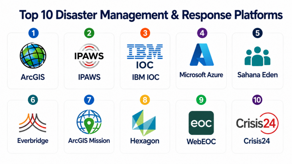
Introduction
Disaster Management & Response Platforms are digital systems used by governments, emergency agencies, NGOs, military units, and humanitarian organizations to prepare for, coordinate, and respond to natural or man-made disasters such as floods, earthquakes, cyclones, wildfires, pandemics, industrial accidents, and large-scale emergencies.These platforms centralize emergency coordination, resource allocation, field reporting, communication, evacuation planning, and real-time situational awareness. They integrate data from multiple sources such as sensors, GIS systems, emergency calls, field teams, drones, and satellite feeds to support faster decision-making during crises.
In a world where climate-related disasters and urban risk exposure are increasing, these platforms are critical for saving lives, minimizing damage, and improving coordination across multiple agencies.
Common real-world use cases include:
- Emergency response coordination during disasters
- Evacuation planning and shelter management
- Real-time incident reporting and tracking
- Resource and relief distribution management
- Crisis communication and public alerts
- Damage assessment and recovery planning
Buyers evaluating Disaster Management & Response Platforms should focus on:
- Real-time incident coordination capabilities
- GIS mapping and situational awareness dashboards
- Multi-agency communication and collaboration tools
- Mobile field response support
- Resource allocation and logistics tracking
- Alerting and emergency notification systems
- Integration with weather, sensor, and IoT data
- Scalability for national or regional emergencies
- Offline field operation capabilities
- Data security and resilience under crisis conditions
Best for: National disaster management authorities, emergency response agencies, fire departments, police departments, military coordination units, NGOs, and humanitarian relief organizations.
Not ideal for: Organizations that do not handle emergency response, crisis coordination, or large-scale operational risk management.
Key Trends in Disaster Management & Response Platforms
- AI-powered disaster prediction is improving early warning systems.
- Real-time GIS dashboards are becoming central to emergency command centers.
- Mobile-first emergency response tools are enabling faster field coordination.
- Satellite and drone data integration is improving situational awareness.
- Cloud-based emergency command systems are replacing legacy dispatch centers.
- Multi-agency interoperability is becoming a critical design requirement.
- IoT sensor integration is enabling real-time hazard detection.
- Automated alert systems are improving public warning speed.
- Digital twin technology is being used for disaster simulation and planning.
- Offline-first mobile apps are supporting responders in low-connectivity zones.
How We Selected These Tools
The platforms listed below were selected using a structured evaluation approach focused on emergency coordination, real-time response, scalability, and multi-agency disaster workflows.
- Evaluated adoption by emergency and disaster management agencies
- Assessed real-time incident coordination capabilities
- Reviewed GIS mapping and situational awareness features
- Considered communication and alerting systems
- Evaluated mobile field response capabilities
- Reviewed resource and logistics management tools
- Assessed interoperability between agencies
- Considered scalability for national disaster response
- Evaluated security and system resilience
- Reviewed vendor maturity in emergency management ecosystems
Top 10 Disaster Management & Response Platforms
#1 — Esri ArcGIS Disaster Response & Emergency Management
Short description: Esri ArcGIS is one of the most widely used geospatial platforms for disaster management, providing real-time situational awareness, mapping, and coordination tools for emergency response agencies. It enables responders to visualize disaster zones, track incidents, manage resources, and coordinate multi-agency operations. The platform integrates satellite imagery, sensor data, and field reports into unified GIS dashboards. It is widely used by governments, military units, and humanitarian organizations. ArcGIS is especially strong in real-time spatial intelligence and disaster mapping.
Key Features
- Real-time disaster mapping
- Incident tracking dashboards
- GIS-based situational awareness
- Resource allocation mapping
- Satellite and drone data integration
- Field data collection tools
- Emergency coordination layers
Pros
- Industry-leading GIS capabilities
- Strong real-time visualization
- Highly scalable for national disasters
Cons
- Requires GIS expertise
- Complex setup for small agencies
- High cost for full deployment
Platforms / Deployment
- Web / Desktop / Mobile
- Cloud / Hybrid
Security & Compliance
Supports role-based access, encrypted data handling, audit logs, and government-grade security controls.
Integrations & Ecosystem
ArcGIS integrates with emergency and government systems.
- Emergency dispatch systems
- IoT sensor networks
- Weather data platforms
- Satellite imagery systems
- Government databases
- APIs
Support & Community
Strong global emergency GIS community and enterprise support.
#2 — FEMA Integrated Public Alert & Warning System (IPAWS)
Short description: IPAWS is a national-level emergency alert and warning system used for sending public alerts during disasters such as hurricanes, floods, and emergencies. It enables government agencies to deliver real-time alerts through multiple channels including mobile phones, TV, and radio. The system is critical for mass emergency communication. IPAWS is widely used in national disaster preparedness frameworks. It is especially strong in public alert dissemination and emergency communication.
Key Features
- Emergency public alerts
- Multi-channel alert distribution
- Real-time warning system
- Geographic alert targeting
- Government coordination tools
- Emergency message templates
- Integration with emergency systems
Pros
- National-scale alert system
- Fast public communication
- Highly reliable infrastructure
Cons
- Limited operational response features
- Not a full disaster management suite
- Requires government authorization
Platforms / Deployment
- Cloud / Government network systems
Security & Compliance
Supports high-level government security protocols, encrypted messaging, and controlled access systems.
Integrations & Ecosystem
IPAWS integrates with emergency alert systems.
- Emergency dispatch systems
- Weather services
- Public safety systems
- Mobile carriers
- Broadcast systems
- APIs
Support & Community
Government-managed system with national emergency support structure.
#3 — IBM Intelligent Operations Center for Emergency Management
Short description: IBM Intelligent Operations Center is an enterprise disaster management platform designed for real-time emergency coordination, crisis monitoring, and response management. It integrates data from sensors, weather systems, IoT devices, and field reports to provide situational awareness. The platform is widely used by governments and large organizations for crisis response. It supports command center operations and multi-agency coordination. IBM is especially strong in analytics-driven disaster response.
Key Features
- Real-time crisis dashboards
- Multi-agency coordination tools
- Incident tracking system
- IoT and sensor integration
- Predictive analytics
- Resource management tools
- Emergency workflow automation
Pros
- Strong analytics capabilities
- Real-time operational insights
- Suitable for large-scale emergencies
Cons
- Complex implementation
- High cost
- Requires technical expertise
Platforms / Deployment
- Web
- Cloud / Hybrid
Security & Compliance
Supports enterprise-grade encryption, RBAC, audit logging, and government security standards.
Integrations & Ecosystem
IBM integrates with emergency systems.
- IoT platforms
- Weather data systems
- GIS platforms
- Government databases
- Sensor networks
- APIs
Support & Community
Enterprise-level global support and consulting services.
#4 — Microsoft Azure Emergency Response Platform
Short description: Microsoft Azure Emergency Response Platform is a cloud-based disaster management solution that enables real-time coordination, data sharing, and crisis analytics. It supports emergency communication, GIS mapping, and field data collection. The platform is widely used in government cloud environments. It integrates AI and cloud services for disaster prediction and response. Microsoft is especially strong in scalable cloud infrastructure for emergency operations.
Key Features
- Emergency coordination dashboards
- Cloud-based data sharing
- GIS mapping integration
- AI-driven insights
- Field reporting tools
- Communication systems
- Incident tracking workflows
Pros
- Highly scalable cloud platform
- Strong AI integration
- Fast deployment capabilities
Cons
- Requires cloud expertise
- Complex configuration
- Dependent on ecosystem setup
Platforms / Deployment
- Cloud / Web
Security & Compliance
Supports enterprise encryption, RBAC, MFA, and government compliance standards.
Integrations & Ecosystem
Microsoft integrates with emergency and cloud systems.
- GIS platforms
- IoT systems
- Government databases
- Communication tools
- Data analytics platforms
- APIs
Support & Community
Strong enterprise support and global cloud ecosystem.
#5 — Sahana Eden Disaster Management System
Short description: Sahana Eden is an open-source disaster management system designed for emergency coordination, relief management, and humanitarian response. It is widely used by NGOs and governments in disaster response scenarios. The platform supports tracking of victims, resources, shelters, and volunteers. Sahana is especially strong in humanitarian logistics and coordination. It is widely used in low-resource disaster environments.
Key Features
- Disaster relief coordination
- Shelter and resource tracking
- Volunteer management
- Incident reporting system
- GIS mapping tools
- Needs assessment tracking
- Logistics coordination
Pros
- Open-source and flexible
- Strong humanitarian focus
- Good for NGOs and relief agencies
Cons
- Requires customization
- Limited enterprise UI polish
- Needs technical setup
Platforms / Deployment
- Web
- Cloud / Self-hosted
Security & Compliance
Supports role-based access and configurable security controls depending on deployment.
Integrations & Ecosystem
Sahana integrates with humanitarian systems.
- GIS tools
- NGO databases
- Relief logistics systems
- Government systems
- Communication platforms
- APIs
Support & Community
Strong open-source humanitarian community support.
#6 — Everbridge Critical Event Management Platform
Short description: Everbridge is a leading critical event management platform used for emergency communication, disaster response coordination, and risk monitoring. It enables organizations to send alerts, coordinate response teams, and manage incidents in real time. The platform is widely used by governments and enterprises for emergency preparedness. It is especially strong in mass notification and crisis communication. Everbridge is widely adopted in public safety and enterprise resilience programs.
Key Features
- Mass emergency notifications
- Incident management system
- Real-time alerts
- Crisis communication tools
- Risk monitoring dashboards
- GIS-based alert targeting
- Workflow automation
Pros
- Strong alerting system
- Reliable crisis communication
- Good enterprise adoption
Cons
- Limited operational GIS depth
- High cost
- Complex setup for small agencies
Platforms / Deployment
- Web
- Cloud
Security & Compliance
Supports encryption, RBAC, audit logs, and enterprise compliance frameworks.
Integrations & Ecosystem
Everbridge integrates with emergency systems.
- Government alert systems
- GIS platforms
- Weather data services
- Communication systems
- IoT platforms
- APIs
Support & Community
Strong enterprise support and global emergency network.
#7 — ArcGIS Mission (Emergency Operations)
Short description: ArcGIS Mission is a real-time operational coordination tool within the Esri ecosystem designed for emergency response teams. It allows field teams and command centers to communicate, share maps, and coordinate disaster response activities. The platform supports live tracking of personnel and resources. It is widely used in public safety and emergency operations centers. ArcGIS Mission is especially strong in tactical field coordination.
Key Features
- Real-time team coordination
- Live GIS mapping
- Incident task assignment
- Field communication tools
- Resource tracking
- Situational awareness dashboards
- Mobile field integration
Pros
- Strong real-time coordination
- Excellent GIS integration
- Good for field operations
Cons
- Requires ArcGIS ecosystem
- Training required
- Limited standalone use
Platforms / Deployment
- Web / Mobile
- Cloud / Hybrid
Security & Compliance
Supports secure communication, RBAC, encryption, and government compliance controls.
Integrations & Ecosystem
ArcGIS Mission integrates with emergency systems.
- GIS databases
- Emergency dispatch systems
- IoT sensors
- Government systems
- Communication tools
- APIs
Support & Community
Strong GIS and emergency response support ecosystem.
#8 — Hexagon Safety & Infrastructure Emergency Suite
Short description: Hexagon Emergency Suite is a public safety and disaster response platform designed for emergency operations centers, police, fire departments, and disaster management agencies. It supports incident coordination, GIS mapping, and resource management. The platform is widely used in smart city emergency systems. It enables real-time situational awareness and multi-agency coordination. Hexagon is especially strong in public safety integration.
Key Features
- Incident management system
- Emergency GIS mapping
- Resource coordination tools
- Real-time dashboards
- Field response tracking
- Multi-agency communication
- Workflow automation
Pros
- Strong public safety integration
- Good GIS capabilities
- Reliable emergency workflows
Cons
- Complex setup
- Requires specialized training
- High enterprise cost
Platforms / Deployment
- Web
- Cloud / Hybrid
Security & Compliance
Supports RBAC, encryption, audit logs, and government security standards.
Integrations & Ecosystem
Hexagon integrates with public safety systems.
- CAD systems
- GIS platforms
- IoT networks
- Emergency dispatch systems
- Government databases
- APIs
Support & Community
Enterprise public safety support and consulting services.
#9 — WebEOC Emergency Management System
Short description: WebEOC is a widely used emergency operations management platform that helps governments and organizations coordinate disaster response activities. It provides incident tracking, resource management, and situational awareness dashboards. The platform is commonly used in emergency operations centers. It is especially strong in structured emergency workflows and reporting. WebEOC is widely adopted in government disaster response agencies.
Key Features
- Incident management system
- Emergency operations dashboards
- Resource tracking tools
- Situation reporting tools
- Task assignment workflows
- Communication tools
- Reporting systems
Pros
- Strong emergency operations focus
- Widely adopted in government
- Reliable coordination tools
Cons
- Interface can feel traditional
- Limited AI capabilities
- Requires training
Platforms / Deployment
- Web
- Hybrid
Security & Compliance
Supports secure access, audit logging, and emergency-grade compliance controls.
Integrations & Ecosystem
WebEOC integrates with emergency systems.
- CAD systems
- GIS platforms
- Communication tools
- Government databases
- Weather systems
- APIs
Support & Community
Strong emergency management support ecosystem.
#10 — Crisis24 Global Risk & Disaster Response Platform
Short description: Crisis24 is a global risk intelligence and disaster response platform used for crisis monitoring, emergency coordination, and threat detection. It provides real-time alerts, situational intelligence, and emergency response coordination tools. The platform is widely used by enterprises and governments for crisis preparedness. It is especially strong in global risk monitoring and intelligence. Crisis24 supports proactive disaster management strategies.
Key Features
- Global risk monitoring
- Emergency alert system
- Crisis intelligence dashboards
- Incident response coordination
- Travel and safety tracking
- Risk analytics tools
- Communication workflows
Pros
- Strong global intelligence coverage
- Good crisis monitoring tools
- Useful for enterprise risk management
Cons
- Not purely disaster operations focused
- High cost
- Limited field coordination depth
Platforms / Deployment
- Web
- Cloud
Security & Compliance
Supports enterprise encryption, RBAC, audit logs, and compliance frameworks.
Integrations & Ecosystem
Crisis24 integrates with risk and emergency systems.
- Government systems
- GIS platforms
- Communication tools
- Security platforms
- Data analytics tools
- APIs
Support & Community
Enterprise global support and risk intelligence services.
Comparison Table
| Tool Name | Best For | Platform(s) Supported | Deployment | Standout Feature | Public Rating |
|---|---|---|---|---|---|
| ArcGIS | GIS disaster mapping | Web/Desktop/Mobile | Cloud/Hybrid | Real-time spatial intelligence | N/A |
| IPAWS | National alerts | Government systems | Government network | Mass public warning system | N/A |
| IBM IOC | Crisis analytics | Web | Cloud/Hybrid | AI-driven operations center | N/A |
| Microsoft Azure | Cloud disaster ops | Web | Cloud | Scalable AI response | N/A |
| Sahana Eden | Humanitarian relief | Web | Cloud/Self-hosted | Open-source disaster coordination | N/A |
| Everbridge | Emergency alerts | Web | Cloud | Mass notification system | N/A |
| ArcGIS Mission | Field coordination | Web/Mobile | Cloud/Hybrid | Real-time team coordination | N/A |
| Hexagon | Public safety ops | Web | Cloud/Hybrid | Smart city emergency systems | N/A |
| WebEOC | Government EOC | Web | Hybrid | Incident command workflows | N/A |
| Crisis24 | Global risk intelligence | Web | Cloud | Global threat monitoring | N/A |
Evaluation & Scoring of Disaster Management & Response Platforms
| Tool Name | Core 25% | Ease 15% | Integrations 15% | Security 10% | Performance 10% | Support 10% | Value 15% | Weighted Total |
|---|---|---|---|---|---|---|---|---|
| ArcGIS | 9.5 | 7.5 | 9.5 | 9.0 | 9.5 | 9.0 | 7.5 | 8.8 |
| IPAWS | 9.0 | 7.5 | 9.0 | 9.5 | 9.5 | 9.0 | 8.0 | 8.6 |
| IBM IOC | 9.0 | 7.5 | 9.0 | 9.0 | 9.0 | 9.0 | 7.5 | 8.6 |
| Azure | 9.0 | 8.0 | 9.0 | 9.0 | 9.0 | 9.0 | 8.0 | 8.7 |
| Sahana | 8.5 | 8.5 | 8.0 | 8.0 | 8.0 | 8.0 | 9.5 | 8.4 |
| Everbridge | 8.5 | 8.5 | 8.5 | 9.0 | 8.5 | 8.5 | 8.0 | 8.5 |
| ArcGIS Mission | 8.5 | 8.0 | 9.0 | 9.0 | 9.0 | 8.5 | 7.5 | 8.5 |
| Hexagon | 8.5 | 7.5 | 8.5 | 9.0 | 8.5 | 8.5 | 7.5 | 8.3 |
| WebEOC | 8.5 | 7.5 | 8.0 | 8.5 | 8.5 | 8.5 | 8.0 | 8.3 |
| Crisis24 | 8.5 | 8.0 | 8.5 | 9.0 | 8.5 | 8.5 | 7.5 | 8.4 |
Which Disaster Management & Response Platform Is Right for You?
Solo / Freelancer
These systems are not designed for individuals. Researchers or consultants may use tools like Sahana or GIS platforms for analysis, but full systems are government-scale.
SMB
Small emergency agencies or NGOs should consider Sahana Eden, WebEOC, or Crisis24 for affordable coordination and relief workflows.
Mid-Market
Regional disaster agencies should evaluate ArcGIS Mission, Everbridge, Hexagon, and Microsoft Azure for balanced coordination and analytics.
Enterprise
National disaster management authorities should consider ArcGIS, IBM IOC, Azure, IPAWS, and Oracle-style ecosystems for large-scale resilience.
Budget vs Premium
Budget tools focus on coordination and reporting, while premium platforms provide AI analytics, GIS intelligence, and national-scale operations.
Feature Depth vs Ease of Use
Advanced systems offer powerful analytics but require training. Simpler systems improve speed of adoption in field operations.
Integrations & Scalability
Systems must integrate with GIS, weather systems, IoT sensors, emergency dispatch, and government databases. Scalability is critical for national emergencies.
Security & Compliance Needs
These systems require high resilience, encryption, RBAC, audit logs, and secure multi-agency communication during crises.
Frequently Asked Questions
1. What is a Disaster Management & Response Platform?
It is a digital system used to coordinate emergency response, disaster preparedness, and crisis management activities. It helps agencies manage incidents, resources, and communication during disasters. It improves response speed and coordination. These systems are used by governments and emergency services. They are essential for public safety operations.
2. Who uses these platforms?
Government disaster agencies, emergency responders, police, fire departments, NGOs, and military units use them. They help coordinate large-scale emergency operations. Humanitarian organizations also use them. Usage depends on crisis management responsibilities.
3. What is GIS in disaster management?
GIS is geographic mapping used to visualize disaster zones. It helps track affected areas and resources. It improves situational awareness. It is essential for emergency planning.
4. Why are these systems important?
They save lives by enabling faster response and coordination. They reduce damage during disasters. They improve communication between agencies. They help manage complex emergencies.
5. What is incident management?
Incident management is tracking and coordinating response to emergencies. It includes assigning tasks, managing resources, and monitoring progress. It ensures structured response workflows. It is a core feature of these platforms.
6. Can these systems send public alerts?
Yes, many systems integrate with emergency alert systems. They can send SMS, mobile alerts, TV warnings, and radio messages. This helps warn populations quickly. IPAWS is a key example.
7. Are these systems cloud-based?
Many modern systems are cloud-based, but hybrid and offline options exist. Cloud improves scalability and real-time coordination. Deployment depends on government infrastructure.
8. What is multi-agency coordination?
It is collaboration between multiple emergency organizations like police, fire, and health services. It ensures unified disaster response. It is critical during large-scale emergencies.
9. What are common challenges?
Challenges include integration complexity, training, data overload, and infrastructure limitations. Coordination between agencies can also be difficult. Proper planning is essential.
10. How do agencies choose a system?
They evaluate GIS capability, scalability, alerting systems, integration, and ease of coordination. Real-world testing is essential. Security and resilience are key factors. Long-term emergency readiness should guide selection.
Conclusion
Disaster Management & Response Platforms are essential for modern emergency preparedness and crisis coordination, enabling governments and organizations to respond quickly and effectively to natural and man-made disasters. These systems provide real-time situational awareness, multi-agency coordination, GIS-based mapping, and emergency communication tools that help save lives and reduce damage. Enterprise platforms like ArcGIS, IBM IOC, Azure, and Everbridge provide advanced analytics and large-scale coordination capabilities, while Sahana and WebEOC offer practical solutions for NGOs and regional agencies. The best system depends on response scale, integration needs, GIS requirements, and operational complexity. Agencies should prioritize interoperability, resilience, and real-time coordination while ensuring strong field usability and communication capabilities for effective disaster response outcomes.
