MOTOSHARE 🚗🏍️
Rent Bikes & Cars Directly from Owners
Motoshare connects vehicle owners with people who need bikes and cars on rent. Owners earn from idle vehicles, and renters get flexible ride options.
Visit Motoshare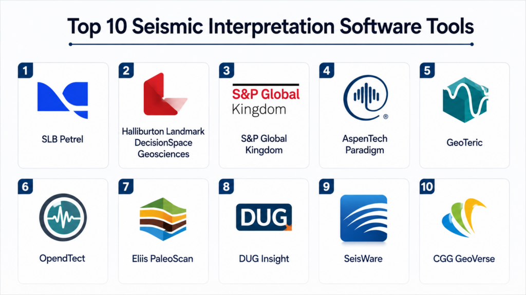
Introduction
Seismic Interpretation Software helps geoscientists, exploration teams, reservoir engineers, petroleum companies, research groups, and subsurface specialists analyze seismic data to understand what lies beneath the earth’s surface. In simple terms, it allows users to load seismic volumes, interpret horizons and faults, map structures, identify reservoirs, evaluate prospects, and connect seismic information with wells, geology, geophysics, and reservoir models.
This software matters because subsurface decisions are expensive, complex, and risk-heavy. Oil and gas exploration, carbon storage, geothermal projects, and subsurface engineering all depend on accurate interpretation of seismic data. Modern seismic interpretation platforms help teams move from static 2D sections to integrated 3D and 4D interpretation, attribute analysis, machine learning-assisted workflows, geobody detection, fault imaging, and collaborative model-building.
Common real-world use cases include:
- Interpreting faults, horizons, stratigraphy, and seismic structures
- Mapping prospects and reservoir targets
- Connecting seismic data with well logs and geological models
- Running seismic attribute analysis and geobody detection
- Supporting exploration, field development, carbon storage, and geothermal studies
What buyers should evaluate:
- 2D and 3D seismic interpretation capability
- Fault and horizon picking tools
- Seismic attribute analysis
- Well-to-seismic integration
- Geobody detection and stratigraphic interpretation
- Volume visualization and performance
- AI or assisted interpretation features
- Integration with reservoir modeling and geology tools
- Collaboration and project data management
- Scalability for large seismic datasets
Best for: Exploration and production companies, geophysicists, seismic interpreters, reservoir teams, carbon storage teams, geothermal developers, subsurface consultants, universities, research groups, and enterprise energy organizations that need advanced seismic interpretation workflows.
Not ideal for: Teams that only need basic map viewing, companies without seismic datasets, users who only need simple GIS mapping, or small projects where a lightweight visualization tool is enough.
Key Trends in Seismic Interpretation Software
- AI-assisted interpretation is becoming more practical: Modern platforms are increasingly using machine learning to support fault detection, horizon tracking, geobody extraction, seismic facies analysis, and repetitive interpretation tasks.
- Cloud and high-performance computing workflows are expanding: Large seismic volumes require strong processing power, scalable storage, and faster visualization, making cloud-enabled and HPC-supported workflows more important.
- Integrated subsurface platforms are replacing isolated tools: Buyers want seismic interpretation to connect with geological modeling, petrophysics, reservoir simulation, well planning, and production workflows.
- 4D seismic interpretation is gaining importance: Time-lapse seismic analysis helps teams monitor reservoir changes, fluid movement, production effects, and storage behavior in oil and gas, carbon storage, and other subsurface projects.
- Stratigraphic interpretation is becoming more advanced: Tools now provide better support for seismic geomorphology, depositional interpretation, sequence stratigraphy, and geobody visualization.
- Open data formats and interoperability matter more: Teams need to move data between seismic processing, interpretation, reservoir modeling, GIS, well databases, and enterprise data platforms.
- Collaboration is becoming a major buying factor: Subsurface teams often work across countries, offices, consultants, and disciplines, so project sharing, version control, and data governance are increasingly important.
- Carbon capture and geothermal use cases are growing: Seismic interpretation is no longer only about oil and gas exploration. It is also used for storage site screening, caprock evaluation, fault risk, geothermal reservoir mapping, and monitoring.
- Large-volume visualization is now expected: Users need smooth navigation through large 3D seismic cubes, attribute volumes, multi-survey datasets, and depth-converted models.
- Uncertainty-aware interpretation is becoming more valuable: Teams want better ways to evaluate confidence, alternative interpretations, structural uncertainty, and model sensitivity before making expensive decisions.
How We Selected These Tools
The tools in this list were selected using a practical buyer-focused approach:
- Market recognition in seismic interpretation, exploration, reservoir characterization, and subsurface workflows
- Geoscience-specific functionality instead of only generic 3D visualization
- Support for 2D, 3D, and advanced seismic interpretation workflows
- Fault, horizon, attribute, and geobody interpretation capabilities
- Integration with well data, geology modeling, and reservoir workflows
- Scalability for large seismic datasets and enterprise subsurface teams
- Support for collaboration, project management, and multi-disciplinary workflows
- Performance, visualization quality, and usability for interpreters
- Fit for different segments, including enterprise E&P, consultants, research teams, and smaller technical groups
- Support ecosystem, including training, documentation, professional services, and industry adoption
Top 10 Seismic Interpretation Software Tools
#1 — SLB Petrel
Short description:
SLB Petrel is one of the most widely used subsurface interpretation and modeling platforms in the energy industry. It supports seismic interpretation, geological modeling, reservoir characterization, well correlation, structural interpretation, and integrated subsurface workflows. Petrel is especially useful for large exploration and production teams that need to connect seismic interpretation with geology, petrophysics, reservoir modeling, and drilling decisions. It provides a broad environment where geoscientists and engineers can work on shared subsurface projects. Petrel is best suited for enterprise teams that need deep functionality and strong integration across the full subsurface lifecycle.
Key Features
- 2D and 3D seismic interpretation workflows
- Fault and horizon interpretation
- Seismic attribute analysis and visualization
- Well-to-seismic integration
- Geological and reservoir modeling support
- Multi-disciplinary subsurface project environment
- Integration with broader SLB digital subsurface ecosystem
Pros
- Strong enterprise subsurface workflow coverage
- Excellent fit for integrated geology, geophysics, and reservoir teams
- Mature platform with broad industry adoption
Cons
- Can be complex for new users
- Licensing and implementation may be expensive for smaller teams
- Requires training and workflow discipline for full value
Platforms / Deployment
Windows
Desktop / Enterprise / Cloud-connected options may vary
Security & Compliance
Enterprise security controls are commonly expected, but specific details such as SSO, MFA, encryption, audit logs, and certifications should be verified with the vendor.
Integrations & Ecosystem
Petrel is strongest when used as part of a broader subsurface ecosystem where seismic interpretation must connect with wells, geology, reservoir modeling, simulation, and field development workflows.
- Well data and petrophysics workflows
- Reservoir modeling and simulation tools
- Geological modeling systems
- Seismic processing and attribute workflows
- Drilling and field development workflows
- Enterprise subsurface data platforms
Support & Community
SLB provides documentation, training, implementation support, professional services, and a large global user ecosystem. Community strength is high because Petrel is widely used across enterprise subsurface teams.
#2 — Halliburton Landmark DecisionSpace Geosciences
Short description:
Halliburton Landmark DecisionSpace Geosciences is a subsurface interpretation platform designed for seismic interpretation, structural modeling, geoscience analysis, and integrated exploration workflows. It helps geoscientists interpret seismic data, connect wells, evaluate prospects, and support field development decisions. The platform is well suited for enterprise exploration and production organizations that need scalable geoscience workflows and strong data connectivity. DecisionSpace is especially valuable where seismic interpretation must connect with reservoir characterization, drilling, and enterprise data management. It is best for larger technical teams with multi-disciplinary subsurface workflows.
Key Features
- Seismic interpretation and visualization
- Fault and horizon interpretation
- Well and seismic integration
- Structural modeling workflows
- Prospect evaluation support
- Connection with Landmark subsurface ecosystem
- Collaboration and enterprise workflow support
Pros
- Strong fit for enterprise geoscience teams
- Useful for integrated exploration and field development workflows
- Supports large technical datasets and multi-disciplinary use cases
Cons
- May be too complex for small interpretation teams
- Full value often depends on broader Landmark ecosystem adoption
- Requires implementation planning and user training
Platforms / Deployment
Windows / Web capabilities may vary by module
Desktop / Enterprise / Cloud-connected options may vary
Security & Compliance
Not publicly stated in full detail. Buyers should validate access controls, SSO, MFA, encryption, audit logs, and enterprise deployment security.
Integrations & Ecosystem
DecisionSpace Geosciences fits well in enterprise subsurface environments where seismic interpretation must connect with wells, data management, modeling, and engineering systems.
- Well databases
- Landmark ecosystem tools
- Seismic interpretation projects
- Reservoir characterization workflows
- Drilling and development planning
- Enterprise subsurface data systems
Support & Community
Halliburton Landmark provides enterprise support, training, implementation services, documentation, and professional services. Community strength is strong within large E&P and geoscience organizations.
#3 — S&P Global Kingdom
Short description:
S&P Global Kingdom is a well-known seismic interpretation and geoscience platform used by exploration companies, independent operators, consultants, and subsurface teams. It supports seismic interpretation, fault and horizon picking, well correlation, mapping, attribute analysis, and geological evaluation. Kingdom is valued for practical interpretation workflows and accessibility compared with some larger enterprise platforms. It is a strong choice for teams that need solid seismic interpretation without necessarily adopting a very large integrated subsurface environment. Kingdom is especially useful for independent E&P companies and consultants managing exploration and development projects.
Key Features
- 2D and 3D seismic interpretation
- Fault and horizon picking
- Well-to-seismic correlation
- Mapping and prospect evaluation
- Seismic attribute visualization
- Geological and geophysical project workflows
- Integration with common subsurface data formats
Pros
- Practical and widely recognized seismic interpretation platform
- Good fit for independents, consultants, and mid-sized teams
- Easier to adopt than some larger enterprise systems
Cons
- May not offer the same enterprise breadth as full subsurface suites
- Advanced modeling workflows may require other tools
- Collaboration and governance needs should be validated
Platforms / Deployment
Windows
Desktop / Enterprise deployment options may vary
Security & Compliance
Not publicly stated in full detail. Buyers should validate license governance, access controls, encryption, data sharing, and enterprise security requirements.
Integrations & Ecosystem
Kingdom is commonly used with well data, seismic volumes, mapping workflows, interpretation exports, and reservoir evaluation processes.
- Well logs and well databases
- Seismic interpretation datasets
- Mapping and contouring workflows
- Reservoir evaluation tools
- Data exchange formats
- Reporting and presentation workflows
Support & Community
S&P Global provides documentation, support resources, and training options. Kingdom has a strong user base among independent operators, consultants, and exploration geoscientists.
#4 — AspenTech Paradigm
Short description:
AspenTech Paradigm is a subsurface interpretation and reservoir characterization platform used for seismic interpretation, structural modeling, stratigraphic analysis, geostatistics, and reservoir workflows. It is designed for teams that need advanced geoscience interpretation and strong connection between seismic, geology, and reservoir characterization. Paradigm is especially useful for technical teams working on complex structural settings, stratigraphic interpretation, and integrated reservoir studies. It provides depth for advanced users who need interpretation quality, modeling capability, and technical flexibility. It is best suited for enterprise and specialist geoscience teams.
Key Features
- Seismic interpretation and visualization
- Structural and stratigraphic interpretation workflows
- Seismic attribute and volume analysis
- Well and reservoir data integration
- Geostatistical and reservoir characterization support
- Advanced subsurface modeling workflows
- Integration with AspenTech subsurface and energy workflows
Pros
- Strong technical depth for advanced geoscience workflows
- Useful for complex reservoirs and integrated interpretation
- Good fit for specialist teams needing advanced interpretation flexibility
Cons
- May require experienced users and formal training
- Can be more complex than lightweight interpretation tools
- Deployment and product scope should be validated carefully
Platforms / Deployment
Windows / Linux availability may vary by module
Desktop / Enterprise deployment options may vary
Security & Compliance
Not publicly stated in full detail. Buyers should validate enterprise access controls, encryption, license management, auditability, and data governance requirements.
Integrations & Ecosystem
AspenTech Paradigm fits workflows where seismic interpretation must connect with geostatistics, reservoir characterization, and advanced technical studies.
- Well and petrophysical data
- Reservoir characterization workflows
- Seismic attribute analysis
- Structural modeling tools
- Data management systems
- AspenTech energy software ecosystem
Support & Community
AspenTech provides enterprise support, documentation, training, and professional services. Community strength is strongest among advanced geoscience and reservoir characterization users.
#5 — GeoTeric
Short description:
GeoTeric is a seismic interpretation and cognitive interpretation platform focused on helping geoscientists identify geological features, geobodies, faults, channels, stratigraphy, and reservoir patterns from seismic data. It is known for advanced seismic attribute analysis, visual interpretation, and machine learning-assisted workflows. GeoTeric is especially useful for teams that need to quickly extract geological meaning from complex seismic volumes. It works well alongside broader interpretation platforms and can add value where detailed seismic geomorphology and geobody detection are important. It is best suited for interpreters focused on advanced seismic analysis and visual insight.
Key Features
- Advanced seismic attribute analysis
- Geobody detection and extraction
- Fault and channel interpretation support
- Machine learning-assisted interpretation workflows
- Seismic facies and geomorphology interpretation
- 3D visualization of geological features
- Integration with broader interpretation workflows
Pros
- Strong visual and attribute-driven interpretation capabilities
- Useful for identifying complex geological features
- Good fit for advanced seismic geomorphology workflows
Cons
- May not replace a full enterprise interpretation platform
- Best used with skilled seismic interpreters
- Workflow integration should be validated with existing systems
Platforms / Deployment
Windows
Desktop / Enterprise deployment options may vary
Security & Compliance
Not publicly stated in full detail. Buyers should verify access controls, encryption, license governance, and enterprise deployment requirements.
Integrations & Ecosystem
GeoTeric is commonly used with seismic interpretation platforms, seismic processing outputs, and geological modeling workflows.
- Seismic volumes and attributes
- Interpretation platforms
- Geological modeling workflows
- Reservoir characterization tools
- Export workflows for interpreted geobodies
- Reporting and visualization outputs
Support & Community
GeoTeric provides technical support, training, documentation, and specialist guidance. Community strength is concentrated among seismic interpreters, geophysicists, and advanced visualization users.
#6 — OpendTect
Short description:
OpendTect is a seismic interpretation platform used for visualization, fault interpretation, horizon picking, seismic attribute analysis, machine learning workflows, and research-oriented geoscience projects. It is especially recognized for its flexible interpretation environment and plugin-based ecosystem. OpendTect is useful for universities, research groups, consultants, and companies that need seismic interpretation with strong customization potential. It can support both standard interpretation tasks and more advanced workflows such as neural network-based seismic analysis. It is best suited for users who want flexibility, extensibility, and technical control.
Key Features
- 2D and 3D seismic interpretation
- Fault and horizon interpretation
- Seismic attribute generation and analysis
- Plugin-based extensibility
- Machine learning and neural network workflow options
- Well-to-seismic integration
- Research and advanced interpretation support
Pros
- Flexible and extensible interpretation environment
- Strong fit for research, education, and advanced users
- Useful plugin ecosystem for specialized workflows
Cons
- May require technical skill for advanced workflows
- Enterprise support and governance should be reviewed
- User experience may be less polished than some commercial suites
Platforms / Deployment
Windows / Linux / macOS availability may vary
Desktop
Security & Compliance
Not publicly stated in full detail. Buyers should validate deployment security, access management, data handling, and enterprise requirements.
Integrations & Ecosystem
OpendTect is commonly used with seismic datasets, plugins, research tools, and machine learning workflows.
- Seismic data formats
- Well data
- Attribute and plugin workflows
- Machine learning tools
- Research workflows
- Export formats for interpretation results
Support & Community
OpendTect has documentation, training resources, commercial support options, and a technical user community. It is especially strong among research and specialist geoscience users.
#7 — Eliis PaleoScan
Short description:
Eliis PaleoScan is a seismic interpretation platform focused on stratigraphic interpretation, horizon tracking, fault interpretation, relative geological time modeling, and high-resolution seismic analysis. It is especially useful for interpreters who need to understand depositional systems, stratigraphy, channels, and geological layering from seismic volumes. PaleoScan is known for fast horizon interpretation and stratigraphic modeling workflows. It can help teams build detailed geological frameworks from seismic data and support reservoir characterization. It is best suited for geoscientists working on stratigraphically complex reservoirs and depositional interpretation.
Key Features
- Stratigraphic seismic interpretation
- Automated and assisted horizon tracking
- Fault interpretation support
- Relative geological time modeling
- Seismic geomorphology workflows
- High-resolution volume interpretation
- Reservoir characterization support
Pros
- Strong fit for stratigraphic and depositional interpretation
- Useful for fast horizon and layer-based workflows
- Helps build detailed seismic stratigraphic frameworks
Cons
- May not replace a full enterprise subsurface platform
- Best value depends on seismic data quality and interpretation goals
- Users may need training for advanced stratigraphic workflows
Platforms / Deployment
Windows / Linux availability may vary
Desktop / Enterprise deployment options may vary
Security & Compliance
Not publicly stated in full detail. Buyers should confirm access controls, encryption, license management, and enterprise security needs.
Integrations & Ecosystem
PaleoScan is often used alongside broader seismic interpretation and reservoir characterization platforms.
- Seismic volumes
- Well data
- Reservoir characterization workflows
- Geological modeling tools
- Stratigraphic interpretation outputs
- Data exchange formats
Support & Community
Eliis provides technical support, training, and specialist documentation. Community strength is focused on stratigraphic interpretation and advanced seismic analysis users.
#8 — DUG Insight
Short description:
DUG Insight is a seismic interpretation and visualization platform designed for geoscientists working with 2D and 3D seismic data. It supports interpretation workflows, seismic visualization, attribute analysis, well integration, and large dataset handling. DUG Insight is known for performance-focused workflows and is useful for interpreters who need strong visualization and efficient navigation through seismic volumes. It can support exploration, development, and research-oriented seismic workflows. It is best suited for teams looking for powerful seismic interpretation with strong performance and practical geoscience usability.
Key Features
- 2D and 3D seismic interpretation
- Fault and horizon interpretation
- Seismic attribute visualization
- Well data integration
- Large seismic volume handling
- Mapping and interpretation workflows
- Performance-focused data visualization
Pros
- Strong seismic visualization and performance
- Useful for exploration and interpretation teams
- Practical for large seismic datasets
Cons
- May not provide the same broad ecosystem as larger enterprise suites
- Advanced enterprise integrations should be validated
- Best fit depends on interpretation workflow requirements
Platforms / Deployment
Windows / Linux availability may vary
Desktop / Enterprise deployment options may vary
Security & Compliance
Not publicly stated in full detail. Buyers should validate access controls, encryption, auditability, and data governance requirements.
Integrations & Ecosystem
DUG Insight works well with seismic datasets, well information, interpretation exports, and geoscience analysis workflows.
- 2D and 3D seismic data
- Well data
- Seismic attribute workflows
- Interpretation exports
- Mapping workflows
- Geoscience reporting outputs
Support & Community
DUG provides vendor-led support, documentation, training, and technical assistance. Community strength is strongest among seismic processing and interpretation professionals.
#9 — SeisWare
Short description:
SeisWare is a seismic interpretation platform designed for exploration and production teams, independent operators, and geoscience professionals who need practical seismic interpretation workflows. It supports 2D and 3D interpretation, horizon and fault picking, mapping, well correlation, and prospect evaluation. SeisWare is often valued for usability and practical interpretation workflows. It can be a good fit for teams that need a focused seismic interpretation system without the complexity of very large enterprise platforms. It is best suited for independent operators and interpretation teams looking for efficient day-to-day seismic workflows.
Key Features
- 2D and 3D seismic interpretation
- Fault and horizon interpretation
- Well-to-seismic correlation
- Mapping and prospect evaluation
- Attribute visualization
- Project data management
- Practical interpretation workflows
Pros
- Good usability for day-to-day interpretation
- Practical fit for independent operators and consultants
- Focused seismic interpretation capabilities
Cons
- May not match the full breadth of enterprise subsurface suites
- Advanced modeling and reservoir workflows may require other tools
- Integration depth should be validated for larger organizations
Platforms / Deployment
Windows
Desktop / Enterprise deployment options may vary
Security & Compliance
Not publicly stated in full detail. Buyers should verify access controls, license management, encryption, and enterprise security requirements.
Integrations & Ecosystem
SeisWare is commonly used with seismic volumes, well data, mapping workflows, and exploration project datasets.
- Seismic interpretation data
- Well logs and well databases
- Mapping workflows
- Prospect evaluation workflows
- Reporting outputs
- Data exchange formats
Support & Community
SeisWare provides vendor support, documentation, training, and customer assistance. Community strength is practical and focused on seismic interpreters and independent E&P users.
#10 — CGG GeoVerse
Short description:
CGG GeoVerse is a subsurface digital platform that supports geoscience workflows, data access, visualization, and interpretation-related capabilities. It is relevant for companies that need to work with large geoscience datasets and connect seismic interpretation with broader subsurface data environments. GeoVerse is especially useful where data access, visualization, collaboration, and subsurface information management are important. It may be used alongside specialist interpretation workflows and broader geoscience services. It is best suited for organizations that need subsurface data intelligence, interpretation support, and scalable geoscience data environments.
Key Features
- Subsurface data access and visualization
- Seismic and geoscience data workflows
- Data management and collaboration support
- Integration with geoscience interpretation processes
- Large dataset handling
- Cloud-oriented subsurface workflows
- Support for enterprise geoscience data environments
Pros
- Strong fit for subsurface data-rich organizations
- Useful for connecting seismic data with broader geoscience workflows
- Good alignment with enterprise data access and collaboration needs
Cons
- May not replace a dedicated desktop seismic interpretation tool for all users
- Product scope should be validated against specific interpretation needs
- Best value depends on data management and enterprise workflow priorities
Platforms / Deployment
Web / Desktop capabilities may vary
Cloud / Enterprise deployment options may vary
Security & Compliance
Not publicly stated in full detail. Buyers should verify SSO, MFA, encryption, audit logs, data governance, and compliance requirements.
Integrations & Ecosystem
CGG GeoVerse is useful where seismic interpretation sits within a broader subsurface data and geoscience workflow environment.
- Seismic data repositories
- Geoscience data platforms
- Interpretation workflows
- Visualization tools
- Cloud data environments
- Enterprise subsurface systems
Support & Community
CGG provides technical support, geoscience services, documentation, and specialist expertise. Community strength is tied to enterprise subsurface users and CGG’s broader geoscience services ecosystem.
Comparison Table
| Tool Name | Best For | Platform Supported | Deployment | Standout Feature | Public Rating |
|---|---|---|---|---|---|
| SLB Petrel | Enterprise subsurface interpretation | Windows | Desktop / Enterprise / Cloud-connected varies | Integrated seismic-to-reservoir workflows | N/A |
| Halliburton Landmark DecisionSpace Geosciences | Large geoscience and E&P teams | Windows / Web varies | Desktop / Enterprise / Cloud-connected varies | Enterprise geoscience interpretation environment | N/A |
| S&P Global Kingdom | Independent operators and consultants | Windows | Desktop / Enterprise varies | Practical seismic interpretation and mapping | N/A |
| AspenTech Paradigm | Advanced geoscience and reservoir teams | Windows / Linux varies | Desktop / Enterprise varies | Advanced interpretation and reservoir characterization | N/A |
| GeoTeric | Attribute-driven and geobody interpretation | Windows | Desktop / Enterprise varies | Cognitive seismic interpretation and geobody detection | N/A |
| OpendTect | Research, education, and flexible interpretation | Windows / Linux / macOS varies | Desktop | Plugin-based seismic interpretation | N/A |
| Eliis PaleoScan | Stratigraphic seismic interpretation | Windows / Linux varies | Desktop / Enterprise varies | Relative geological time and stratigraphic modeling | N/A |
| DUG Insight | High-performance seismic visualization | Windows / Linux varies | Desktop / Enterprise varies | Large-volume seismic visualization | N/A |
| SeisWare | Practical seismic interpretation teams | Windows | Desktop / Enterprise varies | User-friendly interpretation workflows | N/A |
| CGG GeoVerse | Enterprise subsurface data environments | Web / Desktop varies | Cloud / Enterprise varies | Subsurface data access and visualization | N/A |
Evaluation & Scoring of Seismic Interpretation Software
| Tool Name | Core 25% | Ease 15% | Integrations 15% | Security 10% | Performance 10% | Support 10% | Value 15% | Weighted Total 0–10 |
|---|---|---|---|---|---|---|---|---|
| SLB Petrel | 9.6 | 7.5 | 9.3 | 8.5 | 9.0 | 9.0 | 7.8 | 8.74 |
| Halliburton Landmark DecisionSpace Geosciences | 9.1 | 7.4 | 9.0 | 8.3 | 8.8 | 8.8 | 7.8 | 8.50 |
| S&P Global Kingdom | 8.5 | 8.3 | 8.0 | 7.8 | 8.4 | 8.2 | 8.5 | 8.32 |
| AspenTech Paradigm | 9.0 | 7.3 | 8.7 | 8.0 | 8.8 | 8.5 | 7.8 | 8.38 |
| GeoTeric | 8.6 | 8.0 | 8.0 | 7.6 | 8.7 | 8.2 | 8.1 | 8.23 |
| OpendTect | 8.2 | 7.8 | 8.1 | 7.2 | 8.2 | 7.8 | 8.8 | 8.06 |
| Eliis PaleoScan | 8.5 | 7.9 | 7.9 | 7.5 | 8.5 | 8.0 | 8.0 | 8.11 |
| DUG Insight | 8.4 | 8.0 | 7.8 | 7.5 | 8.8 | 8.0 | 8.2 | 8.17 |
| SeisWare | 8.2 | 8.4 | 7.7 | 7.5 | 8.2 | 8.0 | 8.5 | 8.14 |
| CGG GeoVerse | 8.0 | 7.8 | 8.4 | 8.0 | 8.5 | 8.4 | 7.8 | 8.13 |
These scores are comparative and based on interpretation depth, usability, integration potential, performance, support strength, enterprise fit, and practical value. They are not public ratings. A higher weighted score does not automatically mean the tool is the best option for every team. Enterprise E&P companies may prioritize integration and data governance, while consultants may prioritize usability, cost, and fast interpretation. Research teams may value flexibility and extensibility more than enterprise packaging.
Which Seismic Interpretation Software Tool Is Right for You?
Solo / Freelancer
Independent geophysicists, consultants, and small interpretation specialists should focus on usability, cost control, format compatibility, and practical interpretation speed. S&P Global Kingdom, SeisWare, DUG Insight, and OpendTect can be useful depending on the type of projects handled. OpendTect may appeal to technical users who want flexibility and plugin options, while Kingdom and SeisWare are practical for day-to-day seismic interpretation. Solo users should avoid very large enterprise platforms unless client requirements or data workflows demand them.
SMB
Small and mid-sized exploration companies should prioritize tools that help them interpret prospects, connect seismic with wells, create maps, evaluate structures, and prepare technical presentations without excessive complexity. Kingdom, SeisWare, DUG Insight, GeoTeric, and OpendTect can be strong options depending on budget and project needs. If the company plans to move into broader reservoir modeling, Petrel or Paradigm may become more relevant. SMB buyers should test tools using real seismic volumes, well data, and interpretation deliverables.
Mid-Market
Mid-market E&P companies usually need stronger integration between seismic interpretation, geology, reservoir characterization, and prospect evaluation. SLB Petrel, Halliburton Landmark DecisionSpace Geosciences, AspenTech Paradigm, Kingdom, and GeoTeric are strong candidates. If stratigraphic interpretation is a major requirement, Eliis PaleoScan should also be considered. Mid-market buyers should evaluate not only interpretation features but also collaboration, project governance, data exchange, and long-term scalability.
Enterprise
Large energy companies and global subsurface teams need scalable platforms with strong data management, security, collaboration, integration, and support. SLB Petrel, Halliburton Landmark DecisionSpace Geosciences, AspenTech Paradigm, CGG GeoVerse, and enterprise-supported specialist tools such as GeoTeric or PaleoScan can be strong candidates. Enterprises should evaluate how each system connects with corporate data platforms, reservoir modeling tools, petrophysics systems, cloud environments, and interpretation governance. Security, access control, auditability, and global support should be reviewed early.
Budget vs Premium
Budget-focused buyers should not choose only by license cost. Seismic interpretation directly affects drilling decisions, prospect ranking, reservoir understanding, and subsurface risk. A lower-cost or flexible tool may work well for smaller studies, research, or consulting projects. Premium platforms are often justified when teams need integrated workflows, enterprise collaboration, large dataset performance, and direct connection to reservoir modeling or field development. Buyers should compare software cost with the financial impact of better subsurface decisions.
Feature Depth vs Ease of Use
Feature-rich platforms such as Petrel, DecisionSpace, and Paradigm provide broad subsurface workflows but often require training and strong data management. Focused tools such as Kingdom, SeisWare, DUG Insight, GeoTeric, and PaleoScan can be easier to apply for specific interpretation needs. The best tool depends on whether the main goal is general interpretation, advanced attributes, stratigraphy, enterprise integration, research flexibility, or reservoir modeling. Buyers should prioritize workflows that users will apply every week, not just impressive features in a demo.
Integrations & Scalability
Seismic interpretation software becomes more valuable when it connects with well data, petrophysics, geology modeling, reservoir simulation, seismic processing, GIS, cloud storage, and enterprise subsurface databases. Buyers should validate data import, export, project migration, format compatibility, API availability, and performance with large seismic volumes. Scalability also means supporting multiple users, multiple basins, large surveys, interpretation versioning, and long project histories. Integration planning should be done before the tool is rolled out widely.
Security & Compliance Needs
Seismic data can be highly sensitive because it may reveal exploration targets, reservoir potential, field development strategy, and major investment decisions. Buyers should validate user permissions, access control, encryption, project sharing rules, cloud governance, backups, audit logs, and data retention. Enterprise teams should involve IT, security, legal, and data governance teams early in the selection process. For cloud or collaborative workflows, access control and data residency should be reviewed carefully.
Frequently Asked Questions
1. What is Seismic Interpretation Software?
Seismic Interpretation Software is used to analyze 2D and 3D seismic data so geoscientists can understand subsurface structures, faults, horizons, stratigraphy, reservoirs, and potential drilling targets. It helps users visualize seismic volumes, pick geological features, integrate well data, generate maps, and support exploration or development decisions. These platforms are commonly used in oil and gas, carbon storage, geothermal, academic research, and subsurface consulting. The goal is to turn seismic data into geological insight.
2. Why is Seismic Interpretation Software important?
Seismic interpretation software is important because subsurface decisions are expensive and uncertain. Drilling a well, developing a field, choosing a reservoir target, or evaluating a storage site requires strong geological understanding. The software helps reduce uncertainty by allowing teams to analyze seismic structures, connect them with wells, and build stronger subsurface interpretations. It also improves communication across geophysics, geology, reservoir engineering, and management teams. While it does not eliminate risk, it helps teams make more informed decisions.
3. How much does Seismic Interpretation Software cost?
Pricing varies widely depending on vendor, modules, license type, number of users, deployment model, support level, and enterprise requirements. Some platforms are premium enterprise systems, while others are more accessible for consultants, universities, or smaller teams. Buyers should also consider training, hardware, data storage, project migration, and support costs. The best approach is to request pricing based on real workflows, expected users, data volume, and required modules. Public pricing is often not enough to evaluate total cost.
4. What features should buyers prioritize first?
Buyers should prioritize features based on their main subsurface workflow. For general seismic interpretation, horizon picking, fault interpretation, well correlation, mapping, and attribute analysis are essential. For advanced studies, geobody extraction, stratigraphic interpretation, machine learning support, 4D workflows, and reservoir integration may matter more. Enterprise buyers should prioritize scalability, security, data governance, collaboration, and integration. The best feature set depends on whether the team is focused on exploration, development, reservoir characterization, carbon storage, or research.
5. What is the difference between seismic processing and seismic interpretation?
Seismic processing prepares raw seismic data by applying corrections, filtering, migration, velocity analysis, and imaging techniques to create usable seismic volumes. Seismic interpretation uses those processed volumes to identify geological meaning, such as faults, horizons, structures, stratigraphy, reservoirs, and prospects. Processing focuses on signal quality and imaging, while interpretation focuses on geological understanding and decision-making. Some companies use separate tools for each workflow, although interpretation platforms may include attribute and analysis features. Both steps are important for reliable subsurface decisions.
6. Can Seismic Interpretation Software integrate with well data?
Yes, well integration is one of the core requirements for seismic interpretation. Interpreters commonly load well logs, deviation surveys, formation tops, checkshots, synthetic seismograms, markers, and production-related information. This helps connect seismic reflections with real geological and petrophysical information from wells. Good integration improves confidence in horizon picking, depth conversion, reservoir mapping, and prospect evaluation. Buyers should test how each platform handles well formats, coordinate systems, depth-time relationships, and well-to-seismic calibration.
7. Can AI help with seismic interpretation?
AI can help with repetitive and pattern-based interpretation tasks such as fault detection, horizon tracking, seismic facies classification, geobody identification, and attribute-based pattern recognition. It can improve speed and consistency, especially on large seismic volumes. However, AI does not replace expert geological judgment. Seismic data can be noisy, ambiguous, and structurally complex, so interpreters must validate AI-assisted results. The best use of AI is as a decision-support tool that accelerates interpretation while keeping geoscientists in control.
8. Is cloud deployment useful for seismic interpretation?
Cloud deployment can be useful for collaboration, large dataset access, scalable compute, remote teams, and enterprise data governance. It can help geoscientists work across offices and access shared projects more easily. However, seismic datasets are often very large, so performance, data transfer, security, and storage cost must be evaluated carefully. Some companies prefer hybrid workflows where data is stored centrally but interpretation is performed on high-performance workstations. The best deployment model depends on data size, team location, security policy, and IT infrastructure.
9. What are common mistakes when choosing seismic interpretation tools?
A common mistake is choosing a tool based only on brand recognition without testing real data and workflows. Another mistake is ignoring interpreter usability, data loading speed, and integration with existing subsurface systems. Some teams buy advanced features but do not train users properly, which leads to poor adoption. Others focus only on interpretation and forget collaboration, project governance, and data security. Buyers should test candidate tools using real seismic volumes, well data, maps, and expected deliverables before making a final decision.
10. Which tool is best for small seismic interpretation teams?
Small teams often benefit from practical tools that are easier to adopt and do not require heavy enterprise implementation. S&P Global Kingdom, SeisWare, DUG Insight, and OpendTect can be good options depending on workflow and budget. GeoTeric or PaleoScan may be useful when the project requires advanced attribute-driven or stratigraphic interpretation. The best tool for a small team is usually the one that supports required data formats, performs well on available hardware, and helps users deliver interpretations quickly without unnecessary complexity.
Conclusion
Seismic Interpretation Software helps geoscience teams turn complex seismic datasets into meaningful subsurface insight for exploration, development, reservoir characterization, carbon storage, geothermal evaluation, and technical decision-making. The best tool depends on team size, data volume, interpretation goals, integration needs, budget, and technical maturity. SLB Petrel, Halliburton Landmark DecisionSpace Geosciences, and AspenTech Paradigm are strong choices for enterprise subsurface teams that need broad integrated workflows. S&P Global Kingdom, SeisWare, DUG Insight, and OpendTect are practical options for consultants, independents, research users, and focused interpretation teams. GeoTeric and Eliis PaleoScan are valuable for advanced attribute-driven, geobody, and stratigraphic interpretation, while CGG GeoVerse supports broader subsurface data and collaboration workflows. Buyers should avoid looking for one universal winner and instead shortlist tools based on real seismic volumes, well data, interpretation deliverables, security needs, and integration requirements.
