MOTOSHARE 🚗🏍️
Rent Bikes & Cars Directly from Owners
Motoshare connects vehicle owners with people who need bikes and cars on rent. Owners earn from idle vehicles, and renters get flexible ride options.
Visit Motoshare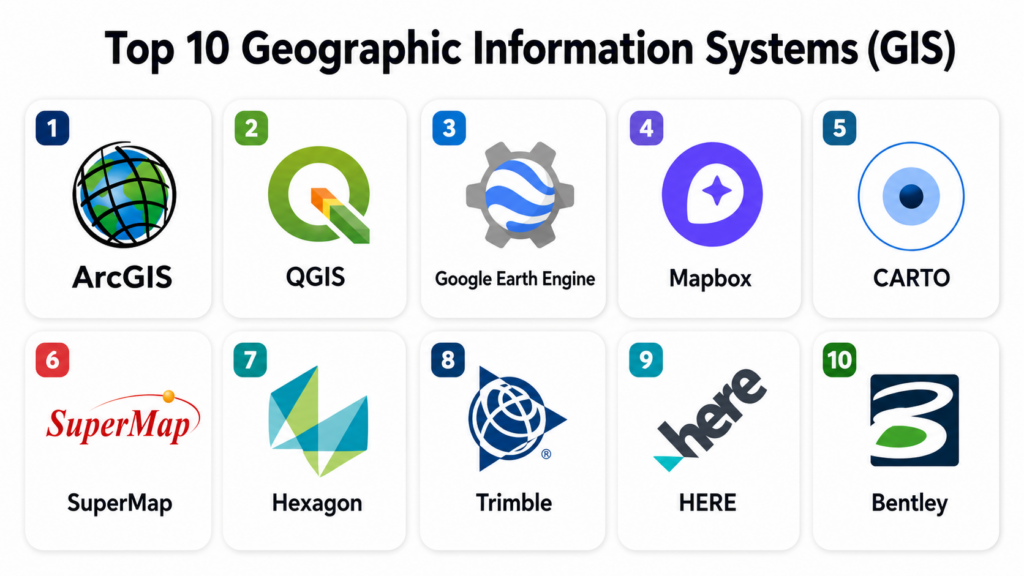
Introduction
Geographic Information Systems (GIS) are software platforms used to capture, store, analyze, manage, and visualize spatial or geographic data. GIS connects data with location, allowing users to understand patterns, relationships, and trends through maps and spatial analytics.These systems are widely used in urban planning, transportation, utilities, defense, agriculture, disaster management, environmental monitoring, and logistics. GIS transforms raw data into map-based insights that support smarter, location-driven decision-making.
Modern GIS platforms combine satellite imagery, IoT sensor data, GPS inputs, AI analytics, and cloud computing to deliver real-time geospatial intelligence.
Common real-world use cases include:
- Urban planning and smart city development
- Disaster response and emergency management
- Utility and infrastructure mapping
- Transportation and route optimization
- Environmental and climate monitoring
- Land use and cadastral mapping
Buyers evaluating GIS platforms should focus on:
- Spatial analysis and geoprocessing capabilities
- 2D/3D visualization and mapping tools
- Real-time data processing and updates
- Integration with IoT, ERP, and databases
- Support for raster, vector, and satellite data
- Scalability for large geospatial datasets
- API and developer ecosystem strength
- Cloud vs desktop deployment options
- Security and access control mechanisms
- Ease of use for analysts and field teams
Best for: Governments, smart cities, defense agencies, utilities, logistics companies, environmental organizations, and research institutions.
Not ideal for: Organizations that do not work with spatial or location-based data.
Key Trends in Geographic Information Systems (GIS)
- AI-powered spatial analytics is improving predictive mapping accuracy.
- Cloud-native GIS platforms are replacing traditional desktop systems.
- Real-time geospatial data from IoT devices is becoming standard.
- 3D GIS and digital twins are transforming urban planning workflows.
- Integration with big data platforms is enabling large-scale spatial analysis.
- Mobile GIS apps are improving field data collection efficiency.
- Open-source GIS ecosystems are rapidly expanding.
- API-first GIS platforms are driving developer adoption.
- Satellite and remote sensing integration is becoming standard.
- Location intelligence is now central to enterprise decision-making.
How We Selected These Tools
The platforms below were selected based on GIS capability, industry adoption, scalability, spatial analysis depth, and ecosystem maturity.
- Evaluated global adoption in government and enterprise GIS
- Assessed spatial analysis and mapping capabilities
- Reviewed 2D/3D visualization and digital twin support
- Considered real-time data processing features
- Evaluated integration with IoT, ERP, and databases
- Reviewed support for raster, vector, and satellite data
- Assessed API and developer ecosystem strength
- Considered scalability for large geospatial datasets
- Evaluated security and governance capabilities
- Reviewed vendor maturity in GIS industry
Top 10 Geographic Information Systems (GIS)
#1 — Esri ArcGIS Platform
Short description: Esri ArcGIS is the global leader in GIS platforms, offering advanced spatial analysis, mapping, and geospatial intelligence capabilities. It is widely used by governments, utilities, defense, and enterprises for complex geospatial workflows. The platform supports 2D/3D mapping, real-time data integration, and predictive spatial analytics. ArcGIS is especially strong in enterprise GIS and smart city applications. It provides one of the most complete geospatial ecosystems in the industry.
Key Features
- Advanced spatial analysis tools
- 2D and 3D mapping capabilities
- Real-time GIS dashboards
- Remote sensing integration
- Digital twin modeling
- Geoprocessing automation
- AI-based spatial analytics
Pros
- Industry-leading GIS ecosystem
- Extremely powerful analytics tools
- Strong enterprise scalability
Cons
- High licensing cost
- Requires GIS expertise
- Complex deployment
Platforms / Deployment
- Web / Desktop / Mobile
- Cloud / Hybrid
Security & Compliance
Supports enterprise-grade encryption, RBAC, audit logs, and government compliance standards.
Integrations & Ecosystem
- IoT platforms
- ERP systems
- Cloud data lakes
- AI/ML platforms
- Remote sensing tools
- APIs
Support & Community
Strong global GIS community and enterprise support ecosystem.
#2 — QGIS (Open Source GIS)
Short description: QGIS is a free and open-source GIS platform used for mapping, spatial analysis, and geospatial visualization. It is widely adopted in academia, government, and research institutions. QGIS supports a wide range of plugins that extend its functionality. It is highly flexible and customizable for GIS workflows. QGIS is especially strong in cost-effective GIS implementations.
Key Features
- Spatial data visualization
- Vector and raster analysis
- Map creation and styling
- Plugin-based architecture
- Geoprocessing tools
- GPS data integration
- Remote sensing support
Pros
- Free and open-source
- Highly customizable
- Strong global community
Cons
- Requires technical knowledge
- Limited enterprise support
- Performance depends on setup
Platforms / Deployment
- Desktop / Web (via extensions)
- Cloud / Self-hosted
Security & Compliance
Depends on deployment configuration and system-level security setup.
Integrations & Ecosystem
- PostGIS databases
- Remote sensing tools
- Cloud storage systems
- Python libraries
- GIS formats
- APIs
Support & Community
Strong global open-source GIS community.
#3 — Google Earth Engine
Short description: Google Earth Engine is a cloud-based geospatial processing platform designed for large-scale satellite and spatial data analysis. It is widely used in environmental monitoring, climate research, and land-use studies. The platform provides access to global satellite datasets and powerful computation tools. It is especially strong in planetary-scale spatial analysis. Google Earth Engine is widely used in scientific and research applications.
Key Features
- Global satellite data access
- Time-series spatial analysis
- Cloud-based processing engine
- Machine learning integration
- Environmental monitoring tools
- Raster data analysis
- Large-scale geospatial computation
Pros
- Massive global dataset access
- Extremely powerful processing engine
- Ideal for research and climate analysis
Cons
- Requires coding skills
- Limited traditional GIS interface
- Not beginner-friendly
Platforms / Deployment
- Cloud / Web
Security & Compliance
Supports Google Cloud security framework, encryption, and IAM controls.
Integrations & Ecosystem
- Google Cloud Platform
- BigQuery
- Python APIs
- AI/ML tools
- Remote sensing platforms
- Data science tools
Support & Community
Strong global research and academic community.
#4 — Mapbox
Short description: Mapbox is a developer-focused GIS and mapping platform used to build interactive maps and location-based applications. It is widely used in logistics, mobility, and transportation industries. The platform provides APIs and SDKs for custom map design and real-time mapping. It is especially strong in web and mobile mapping applications. Mapbox is popular for building modern location intelligence systems.
Key Features
- Custom map styling tools
- Vector tile rendering engine
- Location APIs and SDKs
- Real-time map visualization
- Geocoding and routing services
- Mobile mapping support
- Data visualization tools
Pros
- Highly customizable maps
- Strong developer ecosystem
- Excellent mobile support
Cons
- Requires programming knowledge
- Limited GIS analysis tools
- Pricing depends on usage
Platforms / Deployment
- Web / Mobile
- Cloud
Security & Compliance
Supports encryption, API security, and access control mechanisms.
Integrations & Ecosystem
- Mobile applications
- IoT systems
- Cloud databases
- Logistics platforms
- Web apps
- APIs
Support & Community
Strong developer documentation and global community.
#5 — CARTO
Short description: CARTO is a cloud-native GIS and spatial analytics platform used for location intelligence, mapping, and data visualization. It allows users to analyze spatial data without deep GIS expertise. The platform is widely used in business intelligence, retail, and urban planning. It is especially strong in cloud-based spatial analytics. CARTO simplifies geospatial decision-making for enterprises.
Key Features
- Cloud GIS analytics
- Spatial data visualization
- Location intelligence dashboards
- Predictive spatial modeling
- Data enrichment tools
- Interactive mapping
- API-based workflows
Pros
- Easy-to-use interface
- Strong analytics capabilities
- Cloud-native architecture
Cons
- Limited deep GIS editing
- Subscription-based pricing
- Not ideal for complex engineering GIS
Platforms / Deployment
- Web
- Cloud
Security & Compliance
Supports encryption, RBAC, and enterprise security controls.
Integrations & Ecosystem
- Data warehouses
- BI tools
- Cloud platforms
- CRM systems
- GIS databases
- APIs
Support & Community
Strong enterprise analytics support ecosystem.
#6 — SuperMap GIS
Short description: SuperMap is a high-performance GIS platform used for large-scale geospatial data processing, mapping, and spatial analysis. It is widely used in national GIS systems and smart city projects. The platform supports 2D/3D GIS and digital twin applications. It is especially strong in high-performance geospatial computing. SuperMap is widely adopted in government GIS modernization programs.
Key Features
- 2D/3D GIS visualization
- Spatial analysis engine
- Digital twin support
- Big data GIS processing
- Remote sensing integration
- Mobile GIS tools
- Cloud GIS services
Pros
- High-performance GIS engine
- Strong 3D capabilities
- Suitable for national systems
Cons
- Complex setup
- Requires training
- Smaller ecosystem than Esri
Platforms / Deployment
- Web / Desktop / Mobile
- Cloud / Hybrid
Security & Compliance
Supports encryption, RBAC, and enterprise security frameworks.
Integrations & Ecosystem
- Government systems
- IoT platforms
- Remote sensing tools
- ERP systems
- Data warehouses
- APIs
Support & Community
Enterprise GIS support and training ecosystem.
#7 — Hexagon Geospatial
Short description: Hexagon Geospatial provides advanced GIS and spatial intelligence tools used in defense, urban planning, and environmental monitoring. It supports remote sensing, 3D mapping, and geospatial analytics. The platform is widely used in enterprise GIS environments. It is especially strong in geospatial intelligence and imagery processing. Hexagon is known for high-end GIS solutions.
Key Features
- Remote sensing analysis
- 3D GIS visualization
- Spatial intelligence tools
- Image processing capabilities
- Geospatial modeling
- Data fusion engine
- Mapping dashboards
Pros
- Advanced spatial analytics
- Strong defense applications
- High-precision tools
Cons
- Complex interface
- High cost
- Requires expertise
Platforms / Deployment
- Desktop / Web
- Cloud / Hybrid
Security & Compliance
Supports enterprise encryption, RBAC, and secure geospatial data handling.
Integrations & Ecosystem
- Defense systems
- GIS databases
- Satellite imagery tools
- Cloud platforms
- AI/ML systems
- APIs
Support & Community
Enterprise-grade GIS support ecosystem.
#8 — Trimble GIS
Short description: Trimble GIS is a geospatial platform focused on field data collection, surveying, and infrastructure mapping. It integrates GPS technology with GIS workflows for accurate spatial data capture. The platform is widely used in construction, utilities, and agriculture. It is especially strong in field-based GIS operations. Trimble is known for high-precision geospatial data collection.
Key Features
- GPS-based data collection
- Field mapping tools
- Survey-grade accuracy
- Asset tracking systems
- Mobile GIS apps
- Cloud data synchronization
- Spatial data management
Pros
- High accuracy field data
- Strong mobile capabilities
- Excellent for infrastructure
Cons
- Hardware dependency
- Complex setup
- Cost varies by modules
Platforms / Deployment
- Web / Mobile
- Cloud / Hybrid
Security & Compliance
Supports encrypted data transfer, RBAC, and enterprise security standards.
Integrations & Ecosystem
- GPS devices
- ERP systems
- GIS databases
- IoT systems
- Cloud storage
- APIs
Support & Community
Strong enterprise field GIS support.
#9 — HERE Technologies GIS Platform
Short description: HERE Technologies is a location intelligence platform providing mapping, routing, and spatial analytics services. It is widely used in transportation, logistics, and automotive industries. The platform offers APIs for real-time mapping and navigation. It is especially strong in routing and mobility intelligence. HERE is a major provider of global location data services.
Key Features
- Location APIs
- Real-time routing engine
- Traffic data analytics
- Geocoding services
- Fleet tracking tools
- Spatial visualization
- Navigation systems
Pros
- Strong global mapping data
- Excellent routing accuracy
- Developer-friendly APIs
Cons
- Limited advanced GIS analysis
- Requires integration effort
- Usage-based pricing
Platforms / Deployment
- Web / Mobile
- Cloud
Security & Compliance
Supports encryption, API security, and enterprise access controls.
Integrations & Ecosystem
- Logistics systems
- Fleet management tools
- Mobile apps
- IoT devices
- Cloud platforms
- APIs
Support & Community
Strong enterprise and developer ecosystem support.
#10 — Bentley OpenCities Map
Short description: Bentley OpenCities Map is a GIS platform designed for infrastructure modeling, urban planning, and digital twin applications. It combines GIS with engineering design tools for smart city development. The platform is widely used in government infrastructure projects. It is especially strong in 3D modeling and infrastructure GIS workflows. Bentley is known for engineering-grade geospatial solutions.
Key Features
- 3D GIS modeling
- Infrastructure mapping
- Digital twin capabilities
- Urban planning tools
- Survey data integration
- Asset management
- Engineering GIS workflows
Pros
- Strong infrastructure integration
- Advanced 3D modeling
- Ideal for smart cities
Cons
- Complex learning curve
- High cost
- Requires expertise
Platforms / Deployment
- Desktop / Web
- Cloud / Hybrid
Security & Compliance
Supports enterprise security, RBAC, encryption, and audit logging.
Integrations & Ecosystem
- CAD systems
- IoT platforms
- Government databases
- GIS systems
- Data warehouses
- APIs
Support & Community
Enterprise GIS and infrastructure support ecosystem.
Comparison Table
| Tool Name | Best For | Platform(s) Supported | Deployment | Standout Feature | Public Rating |
|---|---|---|---|---|---|
| ArcGIS | Enterprise GIS | Web/Desktop/Mobile | Cloud/Hybrid | Advanced spatial intelligence | N/A |
| QGIS | Open-source GIS | Desktop | Self-hosted | Free customization | N/A |
| Google Earth Engine | Satellite analytics | Cloud | Cloud | Planet-scale processing | N/A |
| Mapbox | Developer mapping | Web/Mobile | Cloud | Custom map APIs | N/A |
| CARTO | Spatial analytics | Web | Cloud | Location intelligence | N/A |
| SuperMap | National GIS systems | Web/Desktop/Mobile | Cloud/Hybrid | High-performance GIS engine | N/A |
| Hexagon | Defense GIS | Web/Desktop | Cloud/Hybrid | Remote sensing analytics | N/A |
| Trimble | Field GIS | Web/Mobile | Cloud/Hybrid | GPS precision mapping | N/A |
| HERE | Location intelligence | Web/Mobile | Cloud | Routing and navigation | N/A |
| Bentley | Infrastructure GIS | Desktop/Web | Cloud/Hybrid | Digital twin modeling | N/A |
Evaluation & Scoring of GIS Platforms
| Tool Name | Core 25% | Ease 15% | Integrations 15% | Security 10% | Performance 10% | Support 10% | Value 15% | Weighted Total |
|---|---|---|---|---|---|---|---|---|
| ArcGIS | 9.5 | 7.5 | 9.5 | 9.0 | 9.5 | 9.0 | 7.5 | 8.8 |
| QGIS | 8.5 | 8.5 | 8.5 | 8.0 | 8.5 | 8.5 | 9.5 | 8.6 |
| Google Earth Engine | 9.0 | 7.5 | 9.0 | 9.0 | 9.5 | 8.5 | 7.5 | 8.6 |
| Mapbox | 8.5 | 8.5 | 8.5 | 8.5 | 8.5 | 8.5 | 8.5 | 8.5 |
| CARTO | 8.5 | 8.5 | 8.5 | 8.5 | 8.5 | 8.5 | 8.5 | 8.5 |
| SuperMap | 8.5 | 7.5 | 8.5 | 8.5 | 9.0 | 8.5 | 8.0 | 8.3 |
| Hexagon | 8.5 | 7.5 | 8.5 | 9.0 | 8.5 | 8.5 | 7.5 | 8.3 |
| Trimble | 8.5 | 8.0 | 8.5 | 8.5 | 8.5 | 8.5 | 8.0 | 8.4 |
| HERE | 8.5 | 8.5 | 8.5 | 8.5 | 9.0 | 8.5 | 8.0 | 8.5 |
| Bentley | 8.5 | 7.5 | 8.5 | 9.0 | 8.5 | 8.5 | 7.5 | 8.2 |
Which GIS Platform Is Right for You?
Solo / Freelancer
QGIS, Mapbox, and CARTO are ideal for individuals and analysts working on mapping and spatial visualization.
SMB
Small organizations should consider QGIS, CARTO, HERE, and Trimble for cost-effective GIS capabilities.
Mid-Market
Mid-sized enterprises should evaluate ArcGIS, CARTO, SuperMap, and Hexagon for balanced GIS workflows.
Enterprise
Large governments and enterprises should consider ArcGIS, Google Earth Engine, Hexagon, and Bentley for advanced geospatial intelligence.
Budget vs Premium
Budget tools focus on accessibility and open-source flexibility, while premium tools provide advanced analytics, scalability, and enterprise GIS integration.
Feature Depth vs Ease of Use
Advanced GIS platforms offer deep spatial analysis but require expertise. Simpler tools improve usability and adoption speed.
Integrations & Scalability
GIS systems must integrate with IoT, ERP, cloud platforms, and big data systems for full spatial intelligence workflows.
Security & Compliance Needs
Enterprise GIS platforms must support encryption, RBAC, audit logs, and secure handling of sensitive geospatial data.
Frequently Asked Questions
1. What is GIS?
GIS (Geographic Information Systems) are tools used to capture, analyze, and visualize spatial data. They help connect data with geographic locations. GIS is used for mapping and decision-making. It is widely used across industries.
2. Who uses GIS platforms?
Governments, urban planners, utilities, defense agencies, and logistics companies use GIS. Researchers and environmental scientists also use it. It is used wherever spatial analysis is required. Usage depends on location-based needs.
3. What is spatial analysis in GIS?
Spatial analysis involves studying geographic patterns and relationships in data. It helps identify trends based on location. It is used in planning and forecasting. It is a core GIS capability.
4. Why is GIS important?
GIS helps visualize complex data geographically. It improves decision-making in planning and operations. It supports smart cities and infrastructure. It enables location intelligence.
5. What is 3D GIS?
3D GIS allows visualization of geographic data in three dimensions. It is used in urban planning and engineering. It helps simulate real-world environments. It improves spatial understanding.
6. Are GIS platforms cloud-based?
Many modern GIS platforms are cloud-based, but desktop and hybrid systems still exist. Cloud improves scalability and collaboration. Deployment depends on use case. Cloud adoption is increasing.
7. What is remote sensing in GIS?
Remote sensing is the collection of geospatial data using satellites or drones. It is used for environmental and land monitoring. It is integrated into GIS workflows. It enhances spatial analysis.
8. What industries use GIS?
Industries include government, transportation, agriculture, utilities, defense, and environmental science. It is widely used in smart cities. GIS is expanding across sectors. It supports location intelligence.
9. What are common GIS challenges?
Challenges include data complexity, integration issues, and high technical expertise requirements. Large datasets can be difficult to manage. Real-time processing can be complex. Proper infrastructure is needed.
10. How should GIS platforms be selected?
They should be selected based on scalability, integration, usability, and analytical needs. Budget and expertise also matter. Real-world testing is important. Long-term GIS strategy should guide decisions.
Conclusion
Geographic Information Systems (GIS) are essential tools for modern spatial intelligence, enabling organizations to visualize, analyze, and interpret geographic data for better decision-making. These platforms support applications across urban planning, transportation, defense, utilities, and environmental management. Enterprise solutions like ArcGIS, Google Earth Engine, Hexagon, and Bentley provide advanced geospatial intelligence and large-scale analytics, while QGIS, CARTO, and Mapbox offer flexible and cost-effective alternatives. The right GIS platform depends on analytical depth, scalability, integration needs, and technical expertise. Organizations should prioritize interoperability, real-time data handling, and usability to fully leverage location intelligence in modern digital ecosystems.
