Pythal Mala Trekking And Camping
By road Kannur is 155 KMs south of Mangalore and 535 KMs north of Thiruvananthapuram.
Summary
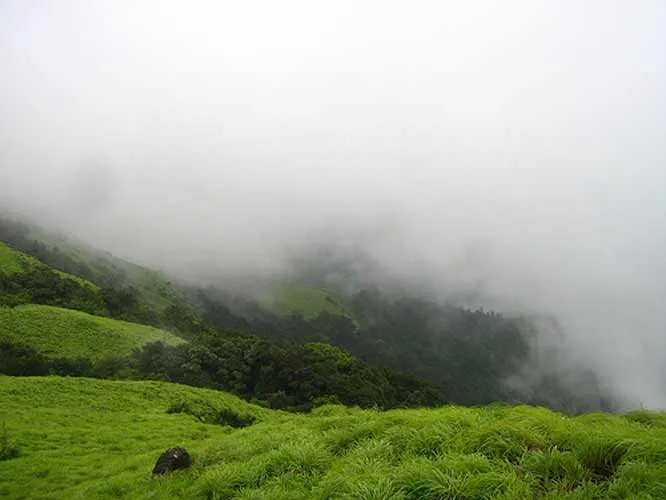
Pythal Mala is located near the Sreekandapuram, Kerala-Karnataka border, 65Km from Kannur district, Kerala.It is a 6 kms trek to the top of the hills. This beautiful, calm hill station, is at an altitude of 4500 ft. above sea level.Abundant in flora and fauna, this place is now being developed as a hill resort. There is a proposal to set up a zoo at the top of the hill.The enchanting hill station offers a challenging trek to those inclined to stretch their legs. Trekkers are rewarded by a profusion of exotic flora and fauna and an exhilirating view from the top. The enchanting hill station offers a challenging trek to those inclined to stretch their legs. For the advantage of tourists, there is a base reception centre and a watchtower a top the cliff.
Things To Look for
St Angelo Fort:
The Portuguese built St Angelo Fort in 1505 on the promontory northwest of town. It’s a peaceful place, and the tourist police here are happy to give you a guided tour. There is a good view of Kannur town and the ocean from the top.
Ezhimala:
At an altitude of 286 m Ezhimala has fascinating scultured stone pillars scattered all over the beach. There is also an ancient mosque on a hill nearby.
Ranipuram :
Situated 750 m above sea level, Ranipuram is famous for its trekking trails and varied vegetation - evergreen shoal woods, monsoon forests grasslands.
Pazhassi Dam:
Pazhassi Dam is located 37 km east of Kannur and It is an ideal retreat for tourists; the damsite is famous for its scenic beauty. the Pazhassi Dam is nestled amidst an idyllic and picturesque setting. The Pazhassi Dam is a popular tourist hangout.With an abundant water body present amidst ample greenery, Pazhassi quickly emerged to become one of the most favored tourist attractions cum picnic spot in the region.
Location info
-
Distances: 65Km from Kannur district, Kerala
-
Camping Sites: 6 kms trek to the top of the hills
-
Trek Length: Altitude of 4500 ft.
Mobile network coverage
Airtel, Jio, BSNL, and Vi all provide coverage across Kerala. 4G is reliable in Kochi, Thiruvananthapuram, Kozhikode, and along the coastal belt. Coverage may be weaker in remote sections of the Western Ghats, deep forest reserves, and certain backwater stretches. Most hotels, houseboats, and cafes in tourist areas offer free Wi-Fi.
Food & restaurants nearby
Food options are available in the nearest town. Kerala cuisine — fish curry, appam with stew, puttu, and Kerala sadhya — is widely available and famously delicious.
Hotels & accommodation nearby
Accommodation is available in the nearest town or city. Options range from homestays to luxury resorts. Kerala’s homestay network is excellent and offers authentic local experiences.
Climate & weather
Kerala has a tropical monsoon climate with warm, humid conditions year-round. The best time to visit is November to February, when temperatures are a pleasant 22°C–30°C with low humidity and clear skies. March–May is hot and humid (up to 36°C). The southwest monsoon (June–September) brings heavy rainfall — the landscape transforms into lush green and this is the best time for Ayurvedic treatments. The northeast monsoon (October–November) brings shorter showers. Hill stations (Munnar, Wayanad) remain cooler year-round.
Helpline & emergency contacts
Tourist Helpline: 1364 (toll-free, 24×7). Police: 112 (all-India emergency). Ambulance: 108. Women’s Helpline: 1091. Kerala Police Tourist Helpline: +91-471-2722255.
Nearest petrol pump
Petrol pumps are available in the nearest town or on the approach road — check locally for the closest option.
Accessibility
Accessibility information is not currently available for this site. Contact the venue directly or check with your accommodation for the latest accessibility details.
Rules & restrictions
Standard visitor rules apply. Check locally for any specific restrictions at this site.
Best photography spots
The best photography spots are typically during the golden hours (early morning and late afternoon). Scout the location first to identify the best angles, and consider the direction of light at different times of day.
Best time to visit Pythal Mala Trekking And Camping
The best time for trekking at Pythal Mala Trekking A Camping is from November to February when the weather is cool and dry with clear skies. Post-monsoon (September–November) offers lush green landscapes. Monsoon trekking is not recommended due to slippery trails and leeches. Summer treks are possible in early mornings but afternoons can be hot.
How to reach Pythal Mala Trekking And Camping
Nearest Airport: Cochin International Airport (COK) (approximately 0 km). Nearest Railway Station: Ernakulam Junction / Ernakulam Town Railway Station. The destination is well-connected by Kerala State Road Transport Corporation (KSRTC) buses and private taxis from major towns.
Timings & opening hours
Trekking routes are accessible from 6:00 AM to 5:00 PM. All trekkers must start their trek before 10:00 AM and must complete it before sunset. Night trekking is not permitted without special permission.
Entry fee & tickets
Trekking permit fees: INR 100–500 per person for day treks. Guide charges: INR 500–1,500 per day. Forest entry fee: INR 25–50 per person. Some restricted areas (like Agasthyakoodam) require special permits from the Forest Department months in advance.
Duration needed
Half day (3–5 hours) for short treks. Full day (6–8 hours) for moderate treks. Multi-day treks require camping arrangements and advance booking.
Safety tips
Always hire a local guide for trekking routes — especially in forested and hilly areas. Carry sufficient water (at least 2 litres per person) and snacks. Start your trek early in the morning (before 7:00 AM) and aim to finish before 3:00 PM. Wear sturdy trekking shoes with good grip. Inform someone about your trekking route and expected return time. Check weather conditions before heading out.
Things to carry
Trekking shoes with good grip and ankle support (essential), rucksack/backpack (30–40 litre capacity), 2–3 litres of drinking water, high-energy snacks (nuts, dry fruits, energy bars), a first-aid kit (bandages, antiseptic, pain relievers, blister plasters), insect repellent, sunscreen, hat, raincoat/poncho, whistle (emergency), torch/headlamp with extra batteries, a map or GPS-enabled phone, and a small towel. Hire a local guide for unfamiliar routes.
Nearby visiting places
Fort Kochi, Mattancherry Palace, Cherai Beach, Bolghatty Island, Marine Drive, Chinese Fishing Nets, Hill Palace Museum, Kerala Kathakali Centre, St. Francis Church
Nearest airport, railway & bus
Nearest Airport: Cochin International Airport (COK) (approximately 0 km). Nearest Railway Station: Ernakulam Junction / Ernakulam Town Railway Station. The destination is well-connected by Kerala State Road Transport Corporation (KSRTC) buses and private taxis from major towns.
History of Pythal Mala Trekking And Camping
The trekking trails at Pythal Mala Trekking A Camping traverse the beautiful terrain of the Western Ghats, a mountain range that runs parallel to Kerala’s coast and is recognised as a UNESCO World Heritage Site. The Ghats are one of the most biologically diverse regions on Earth, with trekking routes passing through shola forests, grasslands, tea plantations, and spice gardens. These trails have been used by local communities for centuries for travel and trade between the coast and the interior.
Things to do at Pythal Mala Trekking And Camping
Trek through scenic trails passing through shola forests and grasslands, spot wildlife and birds along the trail, photograph the panoramic mountain views, enjoy a packed lunch at a scenic viewpoint, identify unique flora including medicinal plants and orchids, camp overnight (on multi-day treks), learn about the ecosystem from your guide, and challenge yourself physically while connecting with nature.
Things to visit & highlights
The scenic trekking trails through forests, grasslands, and plantations, panoramic viewpoints offering stunning valley views, diverse flora including endemic species and orchids, wildlife sightings along the trail, and the sense of adventure and connection with nature.
Frequently asked questions
Do I need a guide for trekking? — Yes, a local guide is strongly recommended and mandatory in some areas. Guides know the terrain, can point out wildlife, and ensure your safety. What fitness level is required? — Most treks in Kerala range from easy to moderate. Some treks (like Agasthyakoodam and Chembra Peak) require good physical fitness and stamina. Check difficulty levels before booking. What should I carry? — Sturdy trekking shoes, 2–3 litres of water, snacks, sunscreen, hat, raincoat, insect repellent, first-aid kit, and a camera. Do I need a permit? — Some treks require permits from the Kerala Forest Department. Agasthyakoodam treks require advance permits (limited to 100 per day) during the season.
Quick facts
- Type: Tourist Attraction
- State: Kerala
- Category: Trekking Camping
Visitor information
Please check locally for current visitor information.
Map & location view
This section is being updated and will be available shortly.
Photo gallery of Pythal Mala Trekking And Camping
Video gallery
Related destinations
Agasthyakoodam Trekking And Camping
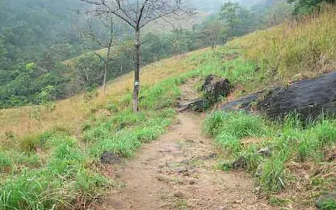
NH7 to Tirumangalam via Salem, Dindigul and Madurai. NH208 to Thenmala via Tenkasi and Shencottai; state road to Ponmudi.
Anamudi Trekking And Camping
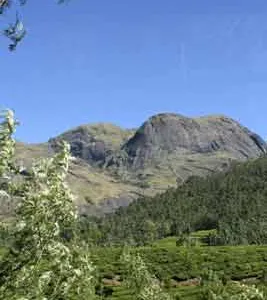
Marayoor is approximately 40 kilometers away from Munnar region.There many bus tranport system from government of kerala.
Chembra Peak Trekking And Camping
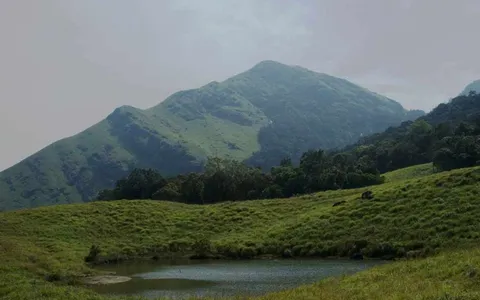
This 344 km² from trivendrum city and is about 16 km east of Sultan Battery, kerala.Mysore - Nanjangod - Gundlupet - Muthanga WLS - Sulthan bathery (140 kms) and…