Visapur
It is 3500 feet high and situated between Lohagad and Bedse Caves. A huge cannon (almost 10 feet long) on Visapur is very vital as it has an impression of royal crown. One can see Purandar on south-east. Sinhagad as well as Tung and Tikona can also be clearly seen. Both these forts are of Satwahan Era and of great importance in Shivaji's period as to keep watch on Konkan and Bor Ghat. These two forts are historically very crucial and must be visited by trek lovers and history lovers.
About Visapur
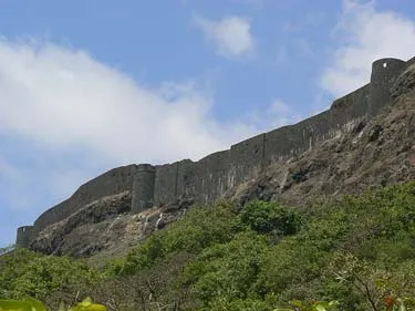
Visapur is fort adjacent to Lohagad. Visapur fort can be easily identified by its “tat-bandhi”(fort walls) which can be seen prominently from the foot hills.Visapur is famous for the white stocking bisons and wild boars. On the way there are Bhaje caves which are worth seeing.
These two roofless buildings surrounded by outer or veranda walls said to have once been Government offices. The ruins of a large stone-built house are known as the Peshwa’s palace. In addition to a huge carving of Hanuman, there are also several temple dedicated to him scattered all over the place. Hanuman (or Maruti) was likely the patron deity of Visapur fort.
There is a well which local legend says was built by the Pandavas. In 1885, near the north wall there was an iron gun ten feet long and of four-inch bore, marked with the Tudor Rose and Crown, flanked by the letters E. R. This is probably a gun of Queen Elizabeth’s reign probably taken as bounty from an English ship and presented to the Peshwa by Kanhoji Angre or some other commander of the Maratha navy. Like other guns on the fort it has been disabled by breaking off its trunnions. Close to it are the remains of an old Mahadev shrine.
Unlike the inner structure, majority of its wall is still intact. At a moderate pace, it takes two hours to walk along the winding Visapoor walls. It is high and strengthened by towers along the west face. In other parts, the wall varies from 3 feet thick fortification, backed by masonry platforms where the slope of the hill is easy, to a mere parapet of dry stone where the plateau ends in a precipice. Two massive bastions still flank the ruined central gate.
History
The adjoining fort, Visapur, is larger and at a greater elevation than Lohagad.Visapur fort was built to guard Lohgad and has impressive fortification and plateau at its top. The way to reach Visapur fort top is interesting.
The height advantage was used and British troops in 1818 AD set up their canons on Visapur and bombarded Lohagarh, forcing the Marathas to leave the fort. Lohagarh has a long history. It was occupied by many dynasties: Satavahanas, Chalukyas, Rashtrakutas, Yadavas, Bahamanis, Nizamshahis, Mughals and Maarathas. Lohagarh was captured by Shivaji in 1648 AD. but by the Treaty of Purandar he had to surrender it to the Mughals in 1665 AD. It was recaptured by Shivaji in 1670 AD and was used for keeping the treasury. Then on, the fort remained with the Marathas. Ultimately Lohagarh-Visapur was taken over by the British in 1818.
Interesting things to Visit
- The Bhaja caves , situated in Bhaja village, are nearby and it is a 4 kilometer walk from Lohagad to these caves and so also from Lohagad to the main road. The nearest railhead is Malvali, 10 kilometers away.
- Caves at Lohagad
- Tikona Fort
- Visapur Fort
- Well at Lohagad Fort
- Extension of Lohagad Fort
- Water tank at Lohagad Fort
- Karle Caves near Lohagad- Visapur
Nearest Visiting places
- Malawali railway station
- Mumbai-Pune Expressway (10 km)
- Bhaja Caves (2 km from Malawali), once home to Buddhist monks
- Karla Caves
- Lonavala hill station (20 km)
- Bushi Dam from Lonavala Market.
- Ambey Valley Around 22 km from Bushi Dam.
Help Line/Phone Number
Nearest Hospital:
Rajiv Ratan Hospital Wlc at Chandrapur
DR.MUNJE at Wani, Yavatmal, Maharashtra
Pavana Lake is essentially an artificial lake brought into existence due to the Pavana Dam. A picturesque sight, the Pavana Lake, along with the Pavana Dam, is located around 14 kilometres away from Lonavla.Offering much-needed solitude and some peace and quiet, the Pavana Lake is not a crowded place like Lonavala. Tucked away around 19 kilometres somewhere inside Kamshet, the Pavana Lake offers a soothing outing for the tired city soul…..more
Lohagad (literally “Iron fort” in Marathi) is one of the many hill forts of Chatrapati Shivaji. It is situated 52 km from Pune in western India. Lohagad is at an elevation of 3,450 feet (1,052 m).Lohagad and Visapur are excellent forts near Lonavla more than ten century…..more
Copyright 2016 HolidayLandmark All rights reserved
Location info
-
Address:52 km from Pune
-
District: Lonavala
-
Nearest City: Pune
-
Best time to visit: Any Time.July and December.
Things to do at Visapur
Can capture the beauty of the place in your camera.
How to reach Visapur
-
Nearest Railway Station:Mumbai, you can take a train to Lonavla/malavli station
-
Nearest Airport:Pune Airport
Road Transport:Cross the mumbai pune express highway via overhead bridge and turn walking towards mumbai direction to bhaje village which is approx 2 Kms. From bhaje walk towards lohagad.
Hotels & accommodation nearby
Hotel Chanakya at Ahmednagar
Suraj Hotel at Surajnagar,Old Pune-Nagar Road
Things to carry
Mineral water bottles, food, first aid kit,camera and so on
Best time to visit Visapur
October to March: cool and pleasant weather ideal for trekking. Avoid monsoon (June–September) as trails become slippery and dangerous.
Timings & opening hours
Typically open from 6:00 AM to 6:00 PM daily. Some forts may close earlier during monsoon or for maintenance.
Entry fee & tickets
Free entry for most hill forts. ASI-protected forts may charge INR 25 for Indians and INR 300 for foreign nationals.
Duration needed
3–4 hours including trek to the top and exploration. Larger forts may require a full day.
Safety tips
Wear sturdy footwear with good grip. Carry sufficient water — many forts have no water sources on top. Do not climb on unstable walls or edges. Start the trek early in the morning to avoid afternoon heat. Inform someone about your trek plan.
Nearest airport, railway & bus
Nearest airport: Pune International Airport (PNQ) or Mumbai International Airport (BOM). Nearest railway station: Pune Railway Station or nearest station on the Central Railway. Well-connected by road from Pune and Mumbai.
Mobile network coverage
Airtel, Jio, and Vi all provide excellent coverage across Maharashtra’s cities (Mumbai, Pune, Nagpur) and major tourist areas. 4G is reliable along highways and in most towns. Coverage may be weaker in deep forest areas of Tadoba, Melghat, and certain ghat sections. Free Wi-Fi is widely available in hotels and cafes.
Food & restaurants nearby
Most hill forts in Maharashtra have local snack stalls at the base serving pithla bhakri, vada pav, and tea. Carry food for longer treks — many forts on hilltops have no facilities. The nearest village or town offers Maharashtrian thali meals.
Climate & weather
Maharashtra has a diverse climate spanning coastal Konkan, the Western Ghats, and the interior Deccan plateau. Winter (November–February) is the best time to visit: temperatures range from 12°C to 30°C depending on region. Summer (March–June) is hot, with interior areas reaching 40°C+ while hill stations (Mahabaleshwar, Lonavala) remain pleasant. The monsoon (June–September) brings heavy rainfall to the coast and ghats but transforms the landscape into lush green. October–November is pleasant post-monsoon.
Nearest petrol pump
Petrol pumps are available in the nearest town or on the approach road to Visapur. It is advisable to fill fuel before heading to remote areas, especially hill forts and wildlife sanctuaries.
Frequently asked questions
How long does it take to trek to the top? The trek to most forts takes 1–3 hours depending on the fort’s height and the trail condition. Some forts have road access up to the entrance.
Is there food and water available on the fort? Most forts have no facilities on top. Carry at least 2 litres of water per person and some snacks. Local stalls at the base village sell refreshments.
Can I visit during monsoon? Many forts are open year-round but trails become extremely slippery during monsoon. November to February offers the best trekking conditions.
Quick facts
- Location: Maharashtra
- Best time to visit: October to March for comfortable exploration
- Ideal duration: 1-2 hours to explore the site
- Entry: Nominal entry fee at most ASI-protected sites
- Photography: Allowed at most sites; videography may require permit
Map & location view
- Destination: Visapur
- State: Maharashtra, India
- Region: historical region of Maharashtra
- How to reach: Accessible by road from nearby towns and cities. Local transport options include buses and taxis.
- Google Maps: Search for “Visapur, Maharashtra” on Google Maps for precise directions and navigation.
Photo gallery of Visapur
Video gallery
Related destinations
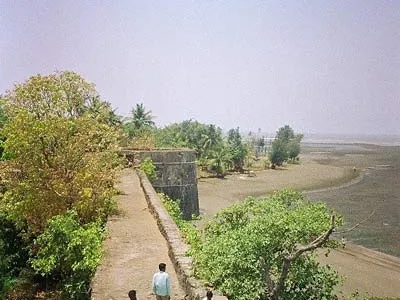
Arnala
In 1516, a local chieftain in Gujarat, Sultan Mahmud Begda originally constructed the fort on the island, strategically located at the mouth of the Vaitarna river…
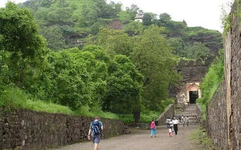
Daulatabad
The fortress of Daulatabad is surrounded by 5 km of sturdy walls. The central bastion tops a 200m high hill, originally known as Devagiri, the Hill of the Gods. It…
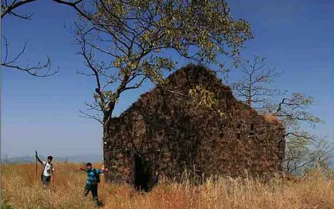
Karnala
Karnala is 120 km from Pune and 13 km from Panvel. Between Pune and Panvel lies the Fort Karnala.