Daulatabad
The fortress of Daulatabad is surrounded by 5 km of sturdy walls. The central bastion tops a 200m high hill, originally known as Devagiri, the Hill of the Gods. It was named Daulatabad, the City of Fortune, in the 14th century by Mohammed Tughlaq, who conceived the crazy plan of not only building himself a new capital here, but marching the entire population of Delhi 1100 km south to populate it.The fort has been considered as the most powerful, puissant fort that offered robust resistance to…
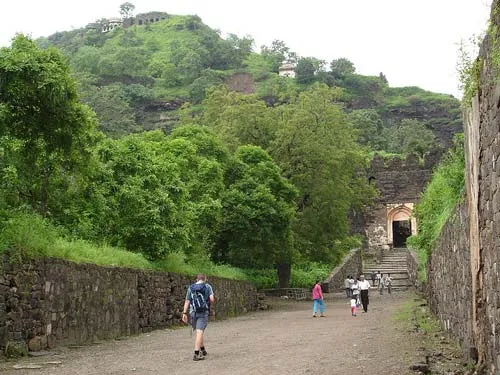
About Daulatabad
The fortress of Daulatabad is surrounded by 5 km of sturdy walls. The central bastion tops a 200m high hill, originally known as Devagiri, the Hill of the Gods. It was named Daulatabad, the City of Fortune, in the 14th century by Mohammed Tughlaq, who conceived the crazy plan of not only building himself a new capital here, but marching the entire population of Delhi 1100 km south to populate it.The fort has been considered as the most powerful, puissant fort that offered robust resistance to the enemies. An invincible fort, one of the best preserved in comparison to other forts in the vicinity of the same period. Its sound and sturdy quality exists due to the powerful wall about three miles in perimeter and defended by a moat and gacis that runs round the hill at its foot and between this outer curtain and the citadel, also known as Dharagir and Duwagir.
Daulatabad is just 16 km from Aurangabad and is easily accessible by road. Visit to the Daulatabad fort is a half day affair. One can book a taxi cab from Aurangabad from near the central bus stand. Its advisable to go for taxis through the authorized taxi union which has its office just adjacent to the ‘out gate’ of the central bus stand. Alternatively, single tourist can also go by the state transport buses or many private buses which ply from Aurangabad.
Have some nice guavas at the entrance (Daulatabad is famous for those) and start off inside the fort. It opens at 7 AM.
After a brief hike, you will reach the magnificent ‘Mendha Tof’ (A cannon with its head resembling like a sheep) pointing out towards the enemy.
Further up, you will encounter a great moat which separates the fort from the outer boundaries. The moat used to be filled with water and hungry crocodiles once upon a time.
The marvellous ‘bhul bhullaiya’ (Maze) follows the trench and is a dark corridor maze which anyone has to pass to climb further up. The bhul bhullaiya has some perfect traps for the enemy where he could slip and slide down directly into the trench ! The ‘bhul bhullaiya guides’ present there would explain many things and show you around using a flame torch for a price. For the non-enthusiast, you can always take the outer stairs constructed later by the government.
Many tourists back off after this but for the committed and enthusiastic, you would like to climb further up and in the end, you reach the Moghul Pavilion (the white colored structure at the top) which seems to be the top of the fort but wait ! Climb up all the way to the flagpole which offers a panoramic view of the place around.
The descent is comparatively easy, but dangerous due to the huge speed one can attain if over-enthusiastic.
It would be a nice idea to club the visit to Daulatabad with Aurangzeb’s tomb at Khultabad, Bhadra Maruti Mandir, Ellora Caves (11 km ahead) and the Grisneshwar Temple of Lord Shiva (One of the 12 jyotirlinga’s)
History
Daulatabad Fort – Devagiri (Deogiri).
The city is said to have been founded c. 1187 by Bhillama V, a prince who renounced his allegiance to the Chalukyas and established the power of the Yadava dynasty in the west. In 1294 the fort was captured by Ala-ud-din Khilji, and the rajas, so powerful that they were held by the Sultans of Delhi to be the rulers of all the Deccan, were reduced to pay tribute. The tribute falling into arrear, Devagiri was again occupied by the Muslims under Malik Kafur, in 1307 and 1310, and in 1318 the last raja, Harpal, was flayed alive.
Devagiri now became an important base for the operations of the Delhi Sultanate’s conquering expeditions southwards. In 1327 Muhammad bin Tughluq determined to make it his capital, changed its name to Daulatabad , and tried to march the whole population of Delhi to it.
The project was interrupted by troubles which summoned him to the north; during his absence the Muslim governors of the Deccan revolted; and Daulatabad itself fell into the hands of Zafar Khan, the governor of Gulbarga. It remained in the hands of the Bahmanis till 1526, when it was taken by the Nizam Shahis. It was captured by the Mughal emperor Akbar, but in 1595 it again surrendered to Ahmad Nizam Shah of Ahmednagar, on the fall of whose dynasty in 1607 it passed into the hands of the usurper, the Nizam Shahi minister Malik Amber, originally an Abyssinian slave, who was the founder of Kharki (the present Aurangabad).
His successors held it until they were overthrown by Shah Jahan, the Mughal emperor, in 1633; after which it remained in the possession of the Delhi emperors until, after the death of Aurangzeb, it fell to the first Nizam of Hyderabad. Its glory, however, had already decayed owing to the removal of the seat of government by the emperors to Aurangabad.
Interesting things to Visit
Besides the fortifications Daulatabad contains several notable monuments, of which the chief are the Chand Minar and the Chini Mahal. The Chand Minar is a tower 210 ft (64 m). high and 70 ft (21 m). in circumference at the base, and was originally covered with beautiful Persian glazed tiles. It was erected in 1445 by Ala-ud-din Bahmani to commemorate his capture of the fort. The Chini Mahal, or China Palace, is the ruin of a building once of great beauty. In it Abul Hasan Tana Shah, the last of the Qutb Shahi kings of Golconda, was imprisoned by Aurangzeb in 1687.
The moat, 40 ft. deep and carved into solid rock with mechanical drawbridges teemed with crocodiles. A 5-kilometer sturdy wall, artificial scarping and a complicated series of defenses made Daulatabad impregnable.
Jami Masjid
The mosque situated inside the Daulatabad Fort complex is known as Jami Masjid. It was constructed in 1318 by Qutub-ud-din Mubarak, the Khilji ruler of Delhi. It stands adorned with 106 splendid pillars, which were looted from several Hindu and Jain temples that stood on the site initially. Some time back, the mosque was converted into a Bharatmata Temple.
Nearest Visiting places
- Aurangabad, Ellora Caves
- Evincesis Info Solutions
- Panchakki
- Jami Masjid (Daulatabad Fort)
- Chini Mahal (Daulatabad Fort)
- Daulatabad Fort
- Bibi Ka Maqbara
- Ajanta & Ellora Caves
Hotels/Lodge/Accommodation
- Quality Inn The Meadows
- President Park
Help Line/Phone Number
Nearest Hospital:
- **Kodlikeri Momorail Hospital
** - **Kamalnayan Bajaj Hospital
** - Zavar Hospital
The Ellora caves, locally known as ‘Verul Leni’ is located on the Aurangabad-Chalisgaon road at a distance of 30 km north-northwest of Aurangabad, the district headquarters. The Ellora caves is one of the World Heritage Sites in India. The Elora caves are one of the wonders of the time and speak volumes about the excellent craftsmanship of the Ellora artists, sculptors and painters. The structures at Ellora caves are not creation of a particular period but were built over a long period of time from the 6th century AD to 10th century. The structures at Ellora comprise of Buddhist, Hindu and Jain cave temples and monasteries……more
Jaikwadi dam, also known as Nath Sagar is located near Paithan.It is about 50 km from Aurangabad, built on river Godavari and about 110 km from Ahmednagar. Its area is 1300 km². It supplies water to Aurangabad City and generates power.The power station is at the foot of dam and is generating 12 MW power with reversible type generator.The Jaikwadi Dam supplies water to Aurangabad City and generates ample hydroelectric power……more
Copyright 2016 HolidayLandmark All rights reserved
Location info
-
Address:16 km from Aurangabad
-
District: Aurangabad
-
Nearest City: Aurangabad
-
Best time to visit: Any Time.
Things to do at Daulatabad
Can take lots of photos of different monuments at Daulatabad.Its an exciting place to
How to reach Daulatabad
-
Nearest Railway Station:Daulatabad Station.
-
Nearest Airport:Aurangabad Airport
Road Transport:Daulatabad Fort is a part of the MTDC tour to Ellora from Aurangabad. It can also be reached by private taxi or by the local bus that runs between Aurangabad and Ellora.
Nearest petrol pump
Nearest petrol bunk at Aurangabad .
Things to carry
Mineral water bottles, food, first aid kit, camers and so on.
Best time to visit Daulatabad
October to March: cool and pleasant weather ideal for trekking. Avoid monsoon (June–September) as trails become slippery and dangerous.
Timings & opening hours
Typically open from 6:00 AM to 6:00 PM daily. Some forts may close earlier during monsoon or for maintenance.
Entry fee & tickets
Free entry for most hill forts. ASI-protected forts may charge INR 25 for Indians and INR 300 for foreign nationals.
Duration needed
3–4 hours including trek to the top and exploration. Larger forts may require a full day.
Safety tips
Wear sturdy footwear with good grip. Carry sufficient water — many forts have no water sources on top. Do not climb on unstable walls or edges. Start the trek early in the morning to avoid afternoon heat. Inform someone about your trek plan.
Nearest airport, railway & bus
Nearest airport: Pune International Airport (PNQ) or Mumbai International Airport (BOM). Nearest railway station: Pune Railway Station or nearest station on the Central Railway. Well-connected by road from Pune and Mumbai.
Mobile network coverage
Airtel, Jio, and Vi all provide excellent coverage across Maharashtra’s cities (Mumbai, Pune, Nagpur) and major tourist areas. 4G is reliable along highways and in most towns. Coverage may be weaker in deep forest areas of Tadoba, Melghat, and certain ghat sections. Free Wi-Fi is widely available in hotels and cafes.
Food & restaurants nearby
Most hill forts in Maharashtra have local snack stalls at the base serving pithla bhakri, vada pav, and tea. Carry food for longer treks — many forts on hilltops have no facilities. The nearest village or town offers Maharashtrian thali meals.
Climate & weather
Maharashtra has a diverse climate spanning coastal Konkan, the Western Ghats, and the interior Deccan plateau. Winter (November–February) is the best time to visit: temperatures range from 12°C to 30°C depending on region. Summer (March–June) is hot, with interior areas reaching 40°C+ while hill stations (Mahabaleshwar, Lonavala) remain pleasant. The monsoon (June–September) brings heavy rainfall to the coast and ghats but transforms the landscape into lush green. October–November is pleasant post-monsoon.
Frequently asked questions
How long does it take to trek to the top? The trek to most forts takes 1–3 hours depending on the fort’s height and the trail condition. Some forts have road access up to the entrance.
Is there food and water available on the fort? Most forts have no facilities on top. Carry at least 2 litres of water per person and some snacks. Local stalls at the base village sell refreshments.
Can I visit during monsoon? Many forts are open year-round but trails become extremely slippery during monsoon. November to February offers the best trekking conditions.
Quick facts
- Location: Maharashtra
- Best time to visit: October to March for comfortable exploration
- Ideal duration: 1-2 hours to explore the site
- Entry: Nominal entry fee at most ASI-protected sites
- Photography: Allowed at most sites; videography may require permit
Map & location view
- Destination: Daulatabad
- State: Maharashtra, India
- Region: historical region of Maharashtra
- How to reach: Accessible by road from nearby towns and cities. Local transport options include buses and taxis.
- Google Maps: Search for “Daulatabad, Maharashtra” on Google Maps for precise directions and navigation.
Photo gallery of Daulatabad
Video gallery
Related destinations
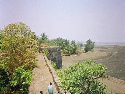
Arnala
In 1516, a local chieftain in Gujarat, Sultan Mahmud Begda originally constructed the fort on the island, strategically located at the mouth of the Vaitarna river…
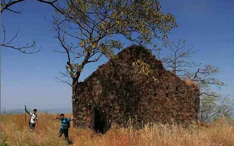
Karnala
Karnala is 120 km from Pune and 13 km from Panvel. Between Pune and Panvel lies the Fort Karnala.
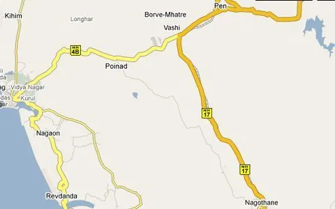
Kolaba Fort
Kolaba Fort (sometimes Kulaba Fort) is an old military fortification in India. It is situated in the sea at a distance of 1–2 km from the shores of Alibag, 35 km…