Kolaba Fort
Kolaba Fort (sometimes Kulaba Fort) is an old military fortification in India. It is situated in the sea at a distance of 1–2 km from the shores of Alibag, 35 km south of Mumbai, in the Konkan region of Maharashtra, India. The fort was built by Chatrapati Shivaji Maharaj in 1652 to keep a check on the activities of the foreign naval powers of English, Portuguese and the Siddhi of Janjira.
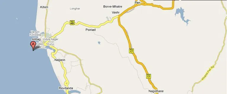
About Kolaba Fort
The average height of the fort walls is 25 feet. It has two main entrances, one on the sea side and the other towards Alibag. An interesting feature of this fort is that it has freshwater wells in its premises even though it is a seaside fort. In the monsoons, the fort can be reached by wading through waist-deep water at low tide. However, at high tide, boats must be used to reach it.
Visitors can visit the fort only during low tide.The fort consists of sweet water well in the middle. There are many temples and fortifications along guns which face the sea. The fort is 300 years old.
Carvings of tigers, peacocks, and elephants on the entrance arch can be seen. Near the gate there are shrines of Mahishasura and Padmavathi and other gods along with fort deity. A Ganesha temple was built in front of the sweet water tank in 1759.
A token entry fee for the visitors is charged by the Archaeological Survey of India.
Interesting things to Visit
- You can also visit Kanakeshwar temple perched on a hill near Mapgaon village, about 12 km away from Alibag and falls on the way to Mandawa.
- If you love the smell of historic towns then you won’t regret a visit to Chaul, situated about 15 km away from Alibag. It is famous for its Portuguese ruins, an old church, a synagogue, Buddhist caves, the Hamam Khana and a temple.
- About 20 km away from Alibag is Vikram Vinayak Temple or Birla Temple, Salav, you will also enjoy Janjira, the legendary fort situated not very far from Alibagh.
- Kanakeshwar forest:
Adventure lovers and nature lovers can set out for an excursion in this forest. Even though the forest is lush green in nature, due to its depth, it remains dark even during bright sunny days. Leopards, wild boars and poisonous snakes are the rightful owners of the forest. Guides are not available here and visitors can tour this forest at their own risk. - Khanderi fort:
Built in 1678, the fort was captured by the British in 1750 after many attempts. The fort stands on a small island out to sea. The lighthouse here was constructed later. The Bombay Port Trust takes care of the fort currently. With prior permission from the Port Trust, tourists can visit the fort. - Kihim beach:
This beach is not much explored. This secluded beach is a haven for nature lovers and bird watchers. The thick clumps of green coconut trees, rare floras, butterflies and birds are the inhabitants of the beach. Kihim beach is 12 km away from Alibaug beach. - Vrindavan farm:
Sprawling over 28 acres of area, this farm has a huge collection of plants. The count says 70,000 and more plants. Crotons, cacti, mango, guava, and custard apple are some of the plants grown here. It is located near the Kanakeshwar forest. - Kanoji Angre Samadhi
Just 5 minutes walk from S.T. stand this samadhi is next to market. Kanoji Angre had established Alibag city in Shivaji’s time - Murud & JanjiraMurud
Murud & JanjiraMurud lies 50kms from Alibag.Janjira, near Murud, is amongst the more hardy forts that the Konkan coast is gilded with. The Arabian Sea crashes relentlessly all around the fort, which lies 2 km into the ocean . Murud was the 15-16th century capital of the Siddis of Janjira. This indomitable fortress inspired the Maratha chieftain Shivaji to launch several attacks, but the fort remained unconquerable to the last. - Agarkot
Near Revdanda, Approx. 18 Km away from Alibag. - Khanderi-Underi
Small Sea forts, 5 km. away from Alibag. - Sagargad
Near Tinvira - Approx. 10 km away from east Alibag.
Nearest Visiting places
- Kihim Beach
- Nagaon Beach
- Akshi Beach
Hotels/Lodge/Accommodation
- Shree Holiday Resorts
- Resorts In Alibagh
Help Line/Phone Number
Nearest Hospital:
- **RCF Hospital
** - **Saroj Tamboli Memorial Hospital
** - **Dhamankar Hospital
** - KESCH Keluskar Hom Medical College & Hospital
Copyright 2016 HolidayLandmark All rights reserved
Location info
-
Address:35 km south of Mumbai
-
District: Kolaba
-
Nearest City: Mumbai
-
Best time to visit: Off Monsoon.
History of Kolaba Fort
The fort was built by Chatrapati Shivaji Maharaj in 1652 to keep a check on the activities of the foreign naval powers of English, Portuguese and the Siddhi of Janjira.n 1771 Raghuji Angre was living on the island fort of Kolaba while his palace, treasury, stables, and gardens were on the mainland, in Alibag. It became the headquarters of the Kolaba agency in 1840.
Things to do at Kolaba Fort
The Siddhivinayak temple inside the fort was built by Raghoji Angre in 1759
How to reach Kolaba Fort
-
Nearest Railway Station:Pen
-
Nearest Airport:Mumbai International Airport.
Road Transport:45 minute bumpy ferry ride from Mumbai’s Gateway of India to the Mandawa jetty.The alternate is a roundabout road trip that will take you about 3 hours.
Nearest petrol pump
At the nearest city or the way Bombay to Pune.
Things to carry
Mineral water bottles, food, first aid kit,camera and so on
Best time to visit Kolaba Fort
October to March: cool and pleasant weather ideal for trekking. Avoid monsoon (June–September) as trails become slippery and dangerous.
Timings & opening hours
Typically open from 6:00 AM to 6:00 PM daily. Some forts may close earlier during monsoon or for maintenance.
Entry fee & tickets
Free entry for most hill forts. ASI-protected forts may charge INR 25 for Indians and INR 300 for foreign nationals.
Duration needed
3–4 hours including trek to the top and exploration. Larger forts may require a full day.
Safety tips
Wear sturdy footwear with good grip. Carry sufficient water — many forts have no water sources on top. Do not climb on unstable walls or edges. Start the trek early in the morning to avoid afternoon heat. Inform someone about your trek plan.
Nearest airport, railway & bus
Nearest airport: Pune International Airport (PNQ) or Mumbai International Airport (BOM). Nearest railway station: Pune Railway Station or nearest station on the Central Railway. Well-connected by road from Pune and Mumbai.
Mobile network coverage
Airtel, Jio, and Vi all provide excellent coverage across Maharashtra’s cities (Mumbai, Pune, Nagpur) and major tourist areas. 4G is reliable along highways and in most towns. Coverage may be weaker in deep forest areas of Tadoba, Melghat, and certain ghat sections. Free Wi-Fi is widely available in hotels and cafes.
Food & restaurants nearby
Most hill forts in Maharashtra have local snack stalls at the base serving pithla bhakri, vada pav, and tea. Carry food for longer treks — many forts on hilltops have no facilities. The nearest village or town offers Maharashtrian thali meals.
Climate & weather
Maharashtra has a diverse climate spanning coastal Konkan, the Western Ghats, and the interior Deccan plateau. Winter (November–February) is the best time to visit: temperatures range from 12°C to 30°C depending on region. Summer (March–June) is hot, with interior areas reaching 40°C+ while hill stations (Mahabaleshwar, Lonavala) remain pleasant. The monsoon (June–September) brings heavy rainfall to the coast and ghats but transforms the landscape into lush green. October–November is pleasant post-monsoon.
Frequently asked questions
How long does it take to trek to the top? The trek to most forts takes 1–3 hours depending on the fort’s height and the trail condition. Some forts have road access up to the entrance.
Is there food and water available on the fort? Most forts have no facilities on top. Carry at least 2 litres of water per person and some snacks. Local stalls at the base village sell refreshments.
Can I visit during monsoon? Many forts are open year-round but trails become extremely slippery during monsoon. November to February offers the best trekking conditions.
Accessibility
Historic forts typically have uneven stone pathways, steep staircases, and no ramps. Forts are built on elevated ground — reaching them requires a climb on foot or by vehicle to the base followed by stairs. Visitors with mobility issues may find the outer grounds and lower levels more accessible than the upper ramparts. Wear sturdy footwear and allow extra time.
Rules & restrictions
Do not climb on unstable walls or beyond marked boundaries. Some bastion platforms are partially collapsed. Graffiti and defacement are illegal. Alcohol and smoking are not permitted inside most historic sites. Drones may require permission. Large bags may be checked at the entrance. Photography is permitted but tripods may need special permission. Respect heritage rules — these monuments are protected under the Ancient Monuments and Archaeological Sites and Remains Act.
Best photography spots
The ramparts offer the best panoramic views — arrive early morning or late afternoon for golden light across the landscape. The bastions and arched windows make excellent natural frames. Wide-angle lenses capture the scale of the fortifications; telephoto lenses isolate details of the stonework and distant views. Sunset silhouettes of the fort walls against the sky are iconic.
Quick facts
- Location: Maharashtra
- Best time to visit: October to March for comfortable exploration
- Ideal duration: 1-2 hours to explore the site
- Entry: Nominal entry fee at most ASI-protected sites
- Photography: Allowed at most sites; videography may require permit
Visitor information
- Timings: Generally open from sunrise to sunset. Verify local timings before planning your visit.
- Entry fee: Nominal entry fee applies at most sites. Check with local authorities for current rates.
- Best time to visit: October to March for the most comfortable weather conditions.
- Duration needed: 1 to 2 hours recommended for a comfortable visit.
Map & location view
- Destination: Kolaba Fort
- State: Maharashtra, India
- Region: historical region of Maharashtra
- How to reach: Accessible by road from nearby towns and cities. Local transport options include buses and taxis.
- Google Maps: Search for “Kolaba Fort, Maharashtra” on Google Maps for precise directions and navigation.
Photo gallery of Kolaba Fort
Photos coming soon. In the meantime, you can find images of Kolaba Fort on popular travel photography sites and social media.
Photo gallery of Kolaba Fort
Video gallery
Related destinations
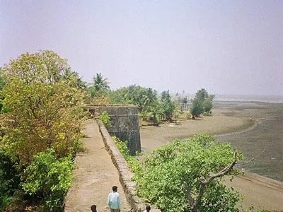
Arnala
In 1516, a local chieftain in Gujarat, Sultan Mahmud Begda originally constructed the fort on the island, strategically located at the mouth of the Vaitarna river…
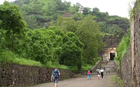
Daulatabad
The fortress of Daulatabad is surrounded by 5 km of sturdy walls. The central bastion tops a 200m high hill, originally known as Devagiri, the Hill of the Gods. It…
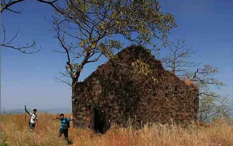
Karnala
Karnala is 120 km from Pune and 13 km from Panvel. Between Pune and Panvel lies the Fort Karnala.