Karnala
Karnala is 120 km from Pune and 13 km from Panvel. Between Pune and Panvel lies the Fort Karnala.
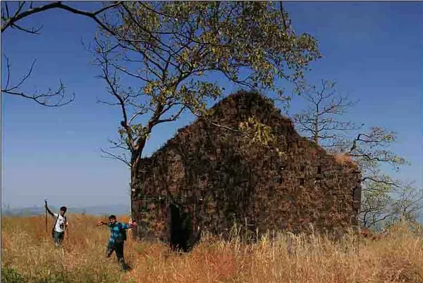
About Karnala
Just 10 km off the busy Mumbai-Pune highway a sign welcomes visitors to the Karnala Bird Sanctuary. As the road winds up a little ghat on Mumbai-Goa highway, travel-weary visitors feel a sudden freshness in the air as they enter this pocket-sized Eden.
Karnala is dominated by a fort, which rises up from the sanctuary at its base. The sanctuary is around 82 ft high from the sea level. On a clear day, the Mumbai coastline, 30 km away is absolutely visible from the peak of the fort. To the east of the fort, on the bank of the River Patalganga, is village Apte, on the west is Ransai while on the north is Vichwan. The whole area is lush green and rich with natural habitation of various birds like Red Vented, Bulbul, Horn Bill, Myna, Owl, Robin McPie and many others.
The fort of Karnala and its steep rocks have always been a challenge for trekkers. Its close proximity to Mumbai makes Karnala an ideal spot for a one-day picnic. During the monsoons, the pathway leading to the pinnacle of the fort is almost permanently wreathed in wisps of cloud and mist, giving you an absolutely exhilarating feeling.
Karnala fort actually consists of two forts one at a higher level and other lower. At the centre of the higher level is a 125 feet high basalt pillar. It is also called Pandu’s tower. This structure was used as watchtower when the fort was occupied however now it is a ruined condition.
The fort has two inscriptions one in Marathi and the other in Persian. The Marathi inscription which has no date is seen on the lower gate on the inner side. Its words are indecipherable. The Persian writing is on upper gate reads “Syed Nuruddin Muhammad Khan, Hijri, 1147 AH (1735 CE) and probably dates from the Mughal occupation of the fort.
History
Its exact date of formation is not known but likely it predates 1400 CE as under the Devagiri Yadavs(1248- 1318) and under the Tughlaq rulers(1318-1347), Karnala was the capital of the north Konkan districts of their respective empires. It later fell under the command of the Gujarat Sultanate but in 1540 was taken over by Nizam Shah of Ahmednagar. The Gujarat sultans then requested the help of the Dom Francisco de Menenzes the commanding officer of the Portuguese at Bassien(modern day Vasai) to win it back. He ordered 500 of his solidiers to Karnala fort and they were able to capture it. The fort was left in charge of the Gujarat Sultanate but with Portuguese garrisons.
The loss of Karnala enraged the Nizam Shah and he took back the fort and the surrounding countryside by sending 5,000 of his men. The Gujarat sultans fled to Vasai in panic and gave up any claims of the fort to the Portuguese. In the subsequent battle between the Nizam Shah and the Portuguese, the latter were victorious in repulsing further attacks of the Nizam Shahi army and the fort remained with the Portuguese. However the Portuguese Viceroy determined that the forts of Sangli and Karnala were of little value to them and decided to give them to the Nizam Shah for an annual payment of Rs. 17,500(or 5,000 gold pardoas) to further their friendship.
Shivaji conquered it from the Portuguese in 1670 by building breastworks as he advanced. After his death in 1680 it was taken over by Aurangzeb. After this the Mughals occupied it for some time after which it in 1740 with the rise of the Peshwas of Pune it went to them. It remained under the command of killedar(garrison commander) Anantrao until a colonel Prother won the fort and established the rule of the British East India Company there in 1818.
Interesting things to do
- Karnala is a bird watcher’s paradise and even the casual picnicker is rewarded with sights of colourful bird species.
- The fort of Karnala and its steep rocks have always been a challenge for trekkers so u can trek the place.
Interesting things to Visit
- Karnala bird sanctuary.
- Karnala Fort
Nearest Visiting places
- Alibag.
- Murud-Janjira.
Hotels/Lodge/Accommodation
- Nil Kamal Hotel
- Utsav Hotel
- Mamta Hotel
- Woods Resort
Things to carry
- Better to carry binoculars.
- Ideal for adventure sports at Karnala fort.
- Ideal for one day Picnic.
Help Line/Phone Number
Nearest Hospital:
- **Rege Hospital
** - **Dhirubhai Ambani Hospital
** - Shreyas Hospital
Karla Caves is an complex of ancient Buddhist Indian rock-cut architecture cave shrines built over the period of 3rd to 2nd century B.C. Even though the caves were constructed over a period of time and the oldest one is believed to date back to 160 BC. Located in Karli near Lonavala, Maharashtra, the caves are on an major ancient trade route, running eastward from the Arabian Sea into the Deccan. Karli’s location in Maharashtra places it in a region that is the division between North India and South India……more
Mulshi is the name of a major dam on the Mula river located in the Taluka Mulshi administrative division of the Pune district of Maharashtra State, India.Water from the dam is used for irrigation as well as for producing electricity at the Bhira hydroelectric power plant, operated by Tata Power Company LTD. The station operates six 25MW Pelton turbines and was established in 1927. It mostly supplies power to Mumbai……more
Rajmachi consists of two beautiful peaks namely ‘Shrivardhan’ and ‘Manaranjan’. Rajmachi is very famous fort near twin hill stations in Maharashtra - Lonavala and Khanadala. Rajmachi fort is nearby 18/20 Kms from Lonavala but a nice way to reach the fort is from Tungarli Lake. This trek is very good for the beginners.Shrivardhan and Manaranjan can also be considered as two separate forts. There is one small platue in between them…..more
Situated 32 km south west of Pune, and standing at an imposing 1215 m above msl overlooking Pune city, Sinhagad, even today stands testimony to the grand Maratha Regime.On top of the fort, the trekkers must try the traditional breakfast of Kanda Bhaji, a delicacy enjoyed by most. Check out Tanaji Kada, Kalyan Darwaza, Tanajis memorial…Perched on an isolated cliff of the Bhuleswar range of the Sahyadri Mountains, its height above sea-level is 1350 metres. Given natural protection by its very steep slopes, the walls and bastions were constructed at only key places; it has two gates – the Kalyan Darwaza in the south-east and the Pune Darwaza in the north-east…..more
Tikona (also known as Vitandgad) is the dominant hill fort in Maval in western India. It is located near Kamshet around 60 km from Pune The village nearest the fort is called Tikona-Peth. The 3500 ft high hill is pyramidal in shape and the name Tikona means “triangle”.The fort is a trekking destination noted for the large doors, the temple of ‘Trimbakeshwar Mahadev’, a water tank and some Satvahan caves. Trek organisers also commend the views of Pawna dam and the nearby forts of Tung, Lohagad and Visapur. There is a lake at the summit…..more
Copyright 2016 HolidayLandmark All rights reserved
Location info
-
Address:120 km from Pune and 13 km from Panvel
-
District: Raigad
-
Nearest City: Panvel
-
Best time to visit: November to February
How to reach Karnala
-
Nearest Railway Station:Panvel (13 km)
-
Nearest Airport:Mumbai (49 km)
-
Road Transport:49 km Mumbai.Mumbai-Pune highway
Best time to visit Karnala
October to March: cool and pleasant weather ideal for trekking. Avoid monsoon (June–September) as trails become slippery and dangerous.
Timings & opening hours
Typically open from 6:00 AM to 6:00 PM daily. Some forts may close earlier during monsoon or for maintenance.
Entry fee & tickets
Free entry for most hill forts. ASI-protected forts may charge INR 25 for Indians and INR 300 for foreign nationals.
Duration needed
3–4 hours including trek to the top and exploration. Larger forts may require a full day.
Safety tips
Wear sturdy footwear with good grip. Carry sufficient water — many forts have no water sources on top. Do not climb on unstable walls or edges. Start the trek early in the morning to avoid afternoon heat. Inform someone about your trek plan.
Nearest airport, railway & bus
Nearest airport: Pune International Airport (PNQ) or Mumbai International Airport (BOM). Nearest railway station: Pune Railway Station or nearest station on the Central Railway. Well-connected by road from Pune and Mumbai.
Mobile network coverage
Airtel, Jio, and Vi all provide excellent coverage across Maharashtra’s cities (Mumbai, Pune, Nagpur) and major tourist areas. 4G is reliable along highways and in most towns. Coverage may be weaker in deep forest areas of Tadoba, Melghat, and certain ghat sections. Free Wi-Fi is widely available in hotels and cafes.
Food & restaurants nearby
Most hill forts in Maharashtra have local snack stalls at the base serving pithla bhakri, vada pav, and tea. Carry food for longer treks — many forts on hilltops have no facilities. The nearest village or town offers Maharashtrian thali meals.
Climate & weather
Maharashtra has a diverse climate spanning coastal Konkan, the Western Ghats, and the interior Deccan plateau. Winter (November–February) is the best time to visit: temperatures range from 12°C to 30°C depending on region. Summer (March–June) is hot, with interior areas reaching 40°C+ while hill stations (Mahabaleshwar, Lonavala) remain pleasant. The monsoon (June–September) brings heavy rainfall to the coast and ghats but transforms the landscape into lush green. October–November is pleasant post-monsoon.
Nearest petrol pump
Petrol pumps are available in the nearest town or on the approach road to Karnala. It is advisable to fill fuel before heading to remote areas, especially hill forts and wildlife sanctuaries.
Frequently asked questions
How long does it take to trek to the top? The trek to most forts takes 1–3 hours depending on the fort’s height and the trail condition. Some forts have road access up to the entrance.
Is there food and water available on the fort? Most forts have no facilities on top. Carry at least 2 litres of water per person and some snacks. Local stalls at the base village sell refreshments.
Can I visit during monsoon? Many forts are open year-round but trails become extremely slippery during monsoon. November to February offers the best trekking conditions.
Quick facts
- Location: Maharashtra
- Best time to visit: October to March for comfortable exploration
- Ideal duration: 1-2 hours to explore the site
- Entry: Nominal entry fee at most ASI-protected sites
- Photography: Allowed at most sites; videography may require permit
Map & location view
- Destination: Karnala
- State: Maharashtra, India
- Region: historical region of Maharashtra
- How to reach: Accessible by road from nearby towns and cities. Local transport options include buses and taxis.
- Google Maps: Search for “Karnala, Maharashtra” on Google Maps for precise directions and navigation.
Photo gallery of Karnala
Video gallery
Related destinations
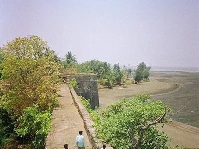
Arnala
In 1516, a local chieftain in Gujarat, Sultan Mahmud Begda originally constructed the fort on the island, strategically located at the mouth of the Vaitarna river…
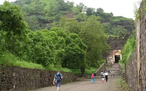
Daulatabad
The fortress of Daulatabad is surrounded by 5 km of sturdy walls. The central bastion tops a 200m high hill, originally known as Devagiri, the Hill of the Gods. It…
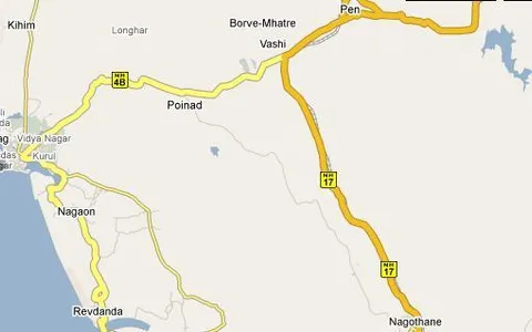
Kolaba Fort
Kolaba Fort (sometimes Kulaba Fort) is an old military fortification in India. It is situated in the sea at a distance of 1–2 km from the shores of Alibag, 35 km…