Vijayadurg
Vijaydurg (formerly also known as Gheriah) is a seaport 485 km from Bombay on India's West Coast. It boasts a safe harbour with average depths in excess of 100 feet.From Vijaydurg, Goa is a 200km drive South along the National Highway 17. The beach facing the Arabian Sea has a historic fort ( 800 years old) from which the town/seaport derives its name. The region offers a very panoramic view of the creek and the fort. A number of virgin beaches abound near Vijaydurg.
About Vijayadurg
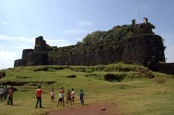
’Vijaydurg, which literally means “Victory Fort”, is a fort built by Shivaji in the Sindhudurg district in Maharashtra, India. The main purpose of building this fort was to defend the shoreline on the Arabian Sea. This fort is a complex in itself, having a commander’s house and three lines of defences. The three fortified walls stand proud and tested by time and the unforgiving sea.
The Vijaydurg fort was built by Shivaji at the mouth of Vaghotane creek. The fort is on a peninsula into the sea and is spread in an area of six hectares. The fort has 27 bastions and is still in a very good condition. The huge stones used for the fort walls and the strength of the walls are still visible, and it is quite interesting to think how these huge walls were built in the open sea.
Vijaydurg Located in Devgad taluka, Vijaydurg is famous all over the world for its delicious Alphonso mangoes, and this becomes quite evident on the approach to Devgad.
Vijaydurg, is situated 48kms south of Ratnagiri, is one of the strongest marine forts on the west coast of India. It is also an excellent harbour. Built on a hill on the mouth of Vaghotan River, the fort was protected on three sides by the sea and on the east side by ditch, now filled up. After crossing the front gate on the east, the path, skirting round the massive middle wall, enters the hidden inner gateway. The strong triple line of fortifications had 27 bastions, some of them two-storeyed. Within the citadel there were many buildings and storehouses, now all in ruins except a structure called Rest House. For the supply of water there were several wells and large tanks
History
At the beginning of the 18th century the pirate chief Angria made Viziadrug the capital of a territory stretching for 150 M. along the coast and from 30 to 60 m. inland . The fort was taken by Admiral Watson and Colonel Clive in 1756
The oldest fort on Sindhudurg coast constructed in the regime of Raja Bhoj of shilahar dynasty in 1205 (construction period 1193-1205). The fort was earlier known as “Gheria” as it is situated in the village “Girye”. Shivaji Maharaj won this fort from Adilshaha of Bijapur in 1653 and renamed it as “Vijay Durg” as the then Hindu solar ear’s name was “Vijay”. Vijay means Victory.
Chatrapati Shivaji extended the area of fort by constructing three fort walls on the eastern side. These three fortifications are of 36 m height and he also constructed 20 bastions of the fortwall. This is only one of the two forts of the Maratha kingdom, where King Shivaji personally hoisted the saffron flag. The other fort is “Torana”. This fort was also known as “Eastern Gibraltar” as this fort was impregnable for a long time like the fort “Gibraltar” in Europe. This impregnable fort has some locational advantages. One such advantage is 40 km long waghotan/kharepatan Creek. The big ships can’t enter the shallow water of this creek and hence Maratha warships were anchored in this creek. These ships were invisible from deep sea.
A historic place with serene, coastal beauty, Vijaya durg fort testifies the martial supremacy of the Marathas during the reign of Sivaji. Numerous towers, the triple line of huge walls, and the spacious interior buildings of this impressive monument are added by Sivaji.
Interesting things to Visit
- Visit the twin forts of Vijaydurg and Sindhudurg on a low rocky 48acre island of Malvan coast. With a serene coastal beauty, the remnants of history prevail here on every brick of the Vijaydurg-Sindhudurg forts.
- Bhavani Temple
- Mahadeo Temple
- Jarimai Temple
- Mahapurush Temple
- Shivaji Temple
- Kunkeshwar Temple is not only a beautiful temple but the setting of this temple is absolutely marvellous.
- Devgarh fort is a small fort, not really worth a visit, but it has a small beach tucked away inside it
Nearest Visiting places
The palatial house of Dhulap in ‘Vijaydurg’ village has some beautiful wall paintings of natural colours. These paintings are of Maratha style.
The Rameshwar Temple at Girye is 3 Km from the fort. This stone archway and pathway leading to the temple is a sight and behold. This temple also has beautiful wall paintings and wooden engravings on the columns.
Wind mills, Devgad Fort (30 kms) and Kunkeswar Temple ( 40 kms.)
Hotels/Lodge/Accommodation
- Hotel Krishna Sea View at Ratnagir
- Mamacha Gaon at Ratnagir
Help Line/Phone Number
Nearest Hospital:
Varavade Rural Hospital at Sindhudurg
Sushrut Surgical and Maternity Hospital at Ratnagir
Tarkarli can be referred to as an undiscovered paradise on Earth! Undiscovered because many people don’t know about this lovely holiday destination, even those who live in Mumbai, Maharashtra.Tarkarli situated 6 Kms. south of Malvan and 546 kms. away from Mumbai on the west coast of India, is Tarkarli. The major attraction here is the long and narrow stretch of beach, with its pristine waters. It lies on the western coast of India, at the meeting of Arabian Sea and Karli River……more
Sindhudurg district is located in between the Sahyadri mountain ranges and the Arabian Sea. This district is rich in natural beauty; the beaches and the Forts here are an added attraction. Vijaydurg-Sindhudurg forts are located in this district. Vijaydurg-Sindhudurg beaches offer a tranquil and striking coastal view of the Konkan coastline.Vijaydurg Located in Devgad taluka, Vijaydurg is famous all over the world for its delicious Alphonso mangoes, and this becomes quite evident on the approach to Devgad……more
Copyright 2016 HolidayLandmark All rights reserved
Location info
-
Address: 48kms south of Ratnagiri
-
District: Sindhudurg district
-
Nearest City: Devgad/Ratnagiri.
-
Best time to visit: Any Time
Things to do at Vijayadurg
Can Take Lots Of Photos of the Fort.
How to reach Vijayadurg
-
Nearest Railway Station:The nearest rail-head is Kankavli on Konakan Rly Route (80 kms.) / Kolhapur Station.
-
Nearest Airport:Mumbai International Airport
-
Road Transport:Vijaydurg is 52 kms from Kasarde off Mumbai –Goa NH 17.
Things to carry
Mineral water bottles, food, first aid kit,camera and so on
Best time to visit Vijayadurg
October to March: cool and pleasant weather ideal for trekking. Avoid monsoon (June–September) as trails become slippery and dangerous.
Timings & opening hours
Typically open from 6:00 AM to 6:00 PM daily. Some forts may close earlier during monsoon or for maintenance.
Entry fee & tickets
Free entry for most hill forts. ASI-protected forts may charge INR 25 for Indians and INR 300 for foreign nationals.
Duration needed
3–4 hours including trek to the top and exploration. Larger forts may require a full day.
Safety tips
Wear sturdy footwear with good grip. Carry sufficient water — many forts have no water sources on top. Do not climb on unstable walls or edges. Start the trek early in the morning to avoid afternoon heat. Inform someone about your trek plan.
Nearest airport, railway & bus
Nearest airport: Pune International Airport (PNQ) or Mumbai International Airport (BOM). Nearest railway station: Pune Railway Station or nearest station on the Central Railway. Well-connected by road from Pune and Mumbai.
Mobile network coverage
Airtel, Jio, and Vi all provide excellent coverage across Maharashtra’s cities (Mumbai, Pune, Nagpur) and major tourist areas. 4G is reliable along highways and in most towns. Coverage may be weaker in deep forest areas of Tadoba, Melghat, and certain ghat sections. Free Wi-Fi is widely available in hotels and cafes.
Food & restaurants nearby
Most hill forts in Maharashtra have local snack stalls at the base serving pithla bhakri, vada pav, and tea. Carry food for longer treks — many forts on hilltops have no facilities. The nearest village or town offers Maharashtrian thali meals.
Climate & weather
Maharashtra has a diverse climate spanning coastal Konkan, the Western Ghats, and the interior Deccan plateau. Winter (November–February) is the best time to visit: temperatures range from 12°C to 30°C depending on region. Summer (March–June) is hot, with interior areas reaching 40°C+ while hill stations (Mahabaleshwar, Lonavala) remain pleasant. The monsoon (June–September) brings heavy rainfall to the coast and ghats but transforms the landscape into lush green. October–November is pleasant post-monsoon.
Nearest petrol pump
Petrol pumps are available in the nearest town or on the approach road to Vijayadurg. It is advisable to fill fuel before heading to remote areas, especially hill forts and wildlife sanctuaries.
Frequently asked questions
How long does it take to trek to the top? The trek to most forts takes 1–3 hours depending on the fort’s height and the trail condition. Some forts have road access up to the entrance.
Is there food and water available on the fort? Most forts have no facilities on top. Carry at least 2 litres of water per person and some snacks. Local stalls at the base village sell refreshments.
Can I visit during monsoon? Many forts are open year-round but trails become extremely slippery during monsoon. November to February offers the best trekking conditions.
Quick facts
- Location: Maharashtra
- Best time to visit: October to March for comfortable exploration
- Ideal duration: 1-2 hours to explore the site
- Entry: Nominal entry fee at most ASI-protected sites
- Photography: Allowed at most sites; videography may require permit
Map & location view
- Destination: Vijayadurg
- State: Maharashtra, India
- Region: historical region of Maharashtra
- How to reach: Accessible by road from nearby towns and cities. Local transport options include buses and taxis.
- Google Maps: Search for “Vijayadurg, Maharashtra” on Google Maps for precise directions and navigation.
Photo gallery of Vijayadurg
Video gallery
Related destinations
Arnala
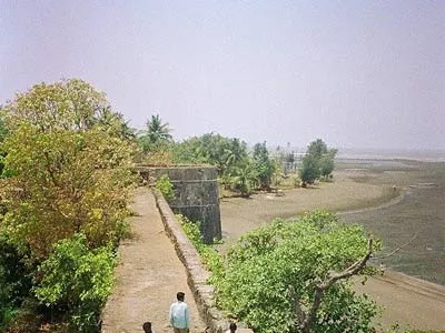
In 1516, a local chieftain in Gujarat, Sultan Mahmud Begda originally constructed the fort on the island, strategically located at the mouth of the Vaitarna river…
Daulatabad
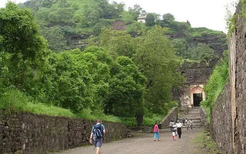
The fortress of Daulatabad is surrounded by 5 km of sturdy walls. The central bastion tops a 200m high hill, originally known as Devagiri, the Hill of the Gods. It…
Karnala
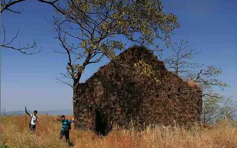
Karnala is 120 km from Pune and 13 km from Panvel. Between Pune and Panvel lies the Fort Karnala.