Naldurg
Naldurg is a city and a municipal council in Osmanabad district in the Indian state of Maharashtra.
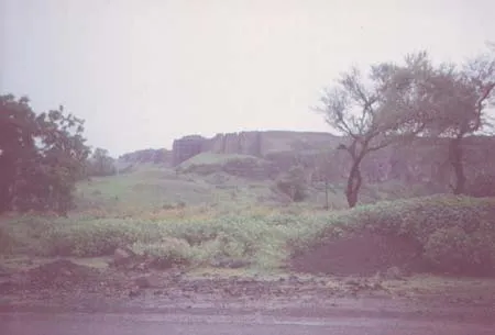
About Naldurg
King Nal built a fort. This is famous for the Two chanal of Overflow Units of the dam Known As NAR(MALE) And MADI(FEMALE)beautiful sean when the dam get overflowed in rainy season and the water flows through these units.Sardar Vallabh patel attacks to free this place from cluthces of Nizam.
Tulja Bhavani, revered deity of Maharashtra, at whose feet Chhatrapati Shivaji Maharaj received inspiration to establish Hindvi Swaraj, is at Tuljapur is in this district in which Shree Sant Goroba was born. Naldurg fort is an architectural marvel and its palace below water attracts tourists and researchers alike, even after five centuries. The Osmanabad goat is a tough breed, always in demand by farmers across the country. Umarga and Sastoor were uprooted in the massive earthquake of 1993. They have risen again from the ruins, just like Phoenix, highlighting the courage the people of the district
It was under the Nizam rule bordering the state of Hyderabad until 1948.
Naldurg which was formerly a district headquarter is situated about 50 Kms south-east of Osmanabad. The fort which is an interesting place has enclosed a surface of a knoll or plantain of basalt rock which is jutted out into the valley or raving of the small river Bori. Along the rest of the cliff on three sides ran fortifications. bastion firmly built out have deseed basalt and are large enough to carry heavy guns. The entire circumference is about a mile and a half. The interior portion is covered with ruined walls and a half, the interior portion is covered with ruined walls and a vide road running up to the center. The fort has many bastions amongst which are Upli Buruj, which is the height point in the fort Paranda Buruj , Nagar Buruj, Sangam Buruj, Sangram Buruj, Bands Buruj, Pune Buruj, etc.
Inside the fort there are remains of the walls and some of the building such a Barood kotha, Baradari, Ambarkhana, Rangaan mahal, Jali etc. Though the buildings are in ruins the remains give a impression that there night have been at one time the specious buildings, There are two tanks in the fort known as Machali guns amongst which important are the “Hathi Toph” and Magar Toph”, The Hathi Darwaza and the Hurmukh and the Hurmukh Darwaza are the main gates of the fort.
The most interesting building which connects the fort and the Ranmandala is the dam constructed across the Bori river, the dam and the” Pani Mahal, which is built in the middle of the dam were constructed during the reign of Ibrahim Adil shah II. The fort is said to have been originally built by a Hindu Raja who was a vassal of the Chalukya kings of Kalyani. It was latter included in the dominions of the Bahamanis and was subsequently taken over by the Adil Shahi kings of Bijapur, from whom it passed in the hands of Mughalain the year 1686.A.D.
History
The Naldurg fort is one of the important ground fort in Marathawada region. It represents a fine example of the medieval architectural style.
The local tradition believes that the fort was built by Nalaraja (The King Nala). The fort and the city is named after him. The fort is said to have been built in the period of the CHALUKYA kings of Kalyani. Later from A.D.1351 to A.D.1480 in the period of BAHAMANI kings and in A.D. 1558 Adil shahi rulers constructed the massive fortification wall of the fort. In A.D. 1613 IBRAHIM ADILSHAH II built the wier on the river BORI and constructed PANI MAHAL.
The main entrance gate of the fort is known as HULMUKH DARWAZA. The protective walls have massive 114 BASTIONS the chief bastion are named as PARANDA, UPLI, SANGRAM & NAV BURUJ. UPLI BURUG is the highest place in the fort. Cannons are also placed on these bastions till today.
These canons have figures of elephant and crocodile and are therefore called HATHI THOP & MAGAR THOP. There are some old buildings still standing in good condition.
Nearest Visiting places
- Tuljapur
- Naldurg fort
Help Line/Phone Number
Naldurg is a city and a municipal council in Osmanabad district in the Indian state of Maharashtra.King Nal built a fort. This is famous for the Two chanal of Overflow Units of the dam Known As NAR(MALE) And MADI(FEMALE)beautiful sean when the dam get overflowed in rainy season and the water flows through these units.Sardar Vallabh patel attacks to free this place from cluthces of Nizam…..more
Copyright 2016 HolidayLandmark All rights reserved
Location info
-
Address:Osmanabad district in the Indian state of Maharashtra.
-
District: Osmanabad district
-
Nearest City: Mumbai/Pune.
-
Best time to visit: Any Time
Things to do at Naldurg
Can take lots of photos of the beautiful place.
Things to visit & highlights
The interior portion of the fort is enclosed within ruined walls. There are many bastions in the fort. The Upli Buruj is the highest point in the fort. There are several buildings in the fort which are now in ruins. The dam constructed across the Boru River which connects the fort and the Ranamandala, is worth visiting. The dam and the Pani Mahal were constructed during the reign of Ibrahim Adil Shah II.
How to reach Naldurg
-
Nearest Railway Station:From Bombay to Naldurg
-
Nearest Airport:Osmanabad Airport /Sholapur Airport
-
Road Transport:Pune to Hyderabad
Nearest petrol pump
At the nearest city or the way Bombay or Pune.
Things to carry
Mineral water bottles, food, first aid kit,camera and so on
Best time to visit Naldurg
October to March: cool and pleasant weather ideal for trekking. Avoid monsoon (June–September) as trails become slippery and dangerous.
Timings & opening hours
Typically open from 6:00 AM to 6:00 PM daily. Some forts may close earlier during monsoon or for maintenance.
Entry fee & tickets
Free entry for most hill forts. ASI-protected forts may charge INR 25 for Indians and INR 300 for foreign nationals.
Duration needed
3–4 hours including trek to the top and exploration. Larger forts may require a full day.
Safety tips
Wear sturdy footwear with good grip. Carry sufficient water — many forts have no water sources on top. Do not climb on unstable walls or edges. Start the trek early in the morning to avoid afternoon heat. Inform someone about your trek plan.
Nearest airport, railway & bus
Nearest airport: Pune International Airport (PNQ) or Mumbai International Airport (BOM). Nearest railway station: Pune Railway Station or nearest station on the Central Railway. Well-connected by road from Pune and Mumbai.
Mobile network coverage
Airtel, Jio, and Vi all provide excellent coverage across Maharashtra’s cities (Mumbai, Pune, Nagpur) and major tourist areas. 4G is reliable along highways and in most towns. Coverage may be weaker in deep forest areas of Tadoba, Melghat, and certain ghat sections. Free Wi-Fi is widely available in hotels and cafes.
Food & restaurants nearby
Most hill forts in Maharashtra have local snack stalls at the base serving pithla bhakri, vada pav, and tea. Carry food for longer treks — many forts on hilltops have no facilities. The nearest village or town offers Maharashtrian thali meals.
Hotels & accommodation nearby
Accommodation is available in the nearest town or base village. Hill fort areas have simple lodges and MTDC guesthouses. Pune and Nashik have the widest range of options for fort circuit explorers.
Climate & weather
Maharashtra has a diverse climate spanning coastal Konkan, the Western Ghats, and the interior Deccan plateau. Winter (November–February) is the best time to visit: temperatures range from 12°C to 30°C depending on region. Summer (March–June) is hot, with interior areas reaching 40°C+ while hill stations (Mahabaleshwar, Lonavala) remain pleasant. The monsoon (June–September) brings heavy rainfall to the coast and ghats but transforms the landscape into lush green. October–November is pleasant post-monsoon.
Frequently asked questions
How long does it take to trek to the top? The trek to most forts takes 1–3 hours depending on the fort’s height and the trail condition. Some forts have road access up to the entrance.
Is there food and water available on the fort? Most forts have no facilities on top. Carry at least 2 litres of water per person and some snacks. Local stalls at the base village sell refreshments.
Can I visit during monsoon? Many forts are open year-round but trails become extremely slippery during monsoon. November to February offers the best trekking conditions.
Quick facts
- Location: Maharashtra
- Best time to visit: October to March for comfortable exploration
- Ideal duration: 1-2 hours to explore the site
- Entry: Nominal entry fee at most ASI-protected sites
- Photography: Allowed at most sites; videography may require permit
Map & location view
- Destination: Naldurg
- State: Maharashtra, India
- Region: historical region of Maharashtra
- How to reach: Accessible by road from nearby towns and cities. Local transport options include buses and taxis.
- Google Maps: Search for “Naldurg, Maharashtra” on Google Maps for precise directions and navigation.
Photo gallery of Naldurg
Video gallery
Related destinations
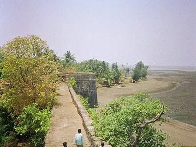
Arnala
In 1516, a local chieftain in Gujarat, Sultan Mahmud Begda originally constructed the fort on the island, strategically located at the mouth of the Vaitarna river…
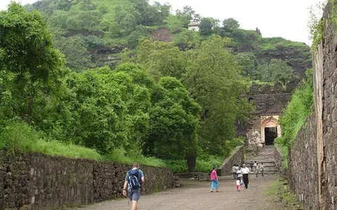
Daulatabad
The fortress of Daulatabad is surrounded by 5 km of sturdy walls. The central bastion tops a 200m high hill, originally known as Devagiri, the Hill of the Gods. It…
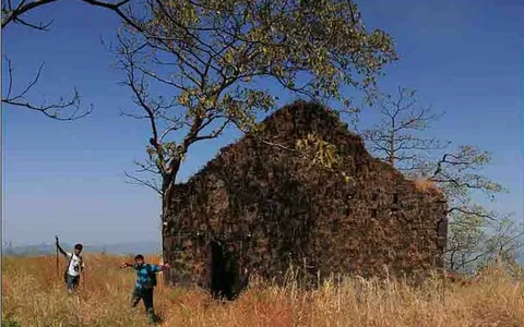
Karnala
Karnala is 120 km from Pune and 13 km from Panvel. Between Pune and Panvel lies the Fort Karnala.