Gingee Fort
Gingee Fort counts amongst the few forts that are still in existence in Tamil Nadu. It is situated in the Villupuram district, which is situated at a distance of approximately 160 km from the Chennai city of India. The district also lies close to the union territory of Pondicherry. One of the most unassailable citadels of India, the fort was given the name of 'Troy of the East' by the British. The place where the Gingi fort today stands, was once the site of a small fort built by the Chola…
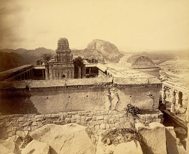
About Gingee Fort
Gingee Fort counts amongst the few forts that are still in existence in Tamil Nadu. It is situated in the Villupuram district, which is situated at a distance of approximately 160 km from the Chennai city of India. The district also lies close to the union territory of Pondicherry. One of the most unassailable citadels of India, the fort was given the name of ‘Troy of the East’ by the British. The place where the Gingi fort today stands, was once the site of a small fort built by the Chola dynasty in 9th century. Shivaji ranked it as the “most impregnable fortress in India” and it was called the “Troy of the East” by the British.
.
Interesting things to Visit
Fortification Walls : The massive fortification walls of Gingee interconnect the three inaccessible hills-krishnaglri, chakkilidrug and Rajagiri. The three hills are disported in the form of triangle, while the main wall connecting them is 20 meters thick. The tops of the three hills form impregnable citadels, while the inner fort contains many fortifications and gates. The Rajagiri citadel is the highest, about 800 ft. in height, and the most inaccessible. The 20 meters deep chasm is now connected by a bridge.
Venugopala swamy Temple : Located to the west of the inner gate of the lower citadel, the temple contains a remarkable sculpture depicting Lord krishna playing on the flute with is two consorts. Another interesting feature in this temple is a finely polished, broadsmooth slab found in front of the temple
Kalyana Mahal: Built in the indo-Islamic style, the kalyana Mahal is one of the most attractive ruins in the fort. It consists of a square court, surrounded by rooms for the ladies of the Governors household. In the middle of this court, is a 27 meter high square tower, built of stone. The tower has a pyramidal roof. The rooms in this tower are very similar to other Vijayanagar Nayaka buildings elsewhere.
The Ponds: The way to the Hanuman Temple, outside the lower fort, abounds in temple ponds and many impressive structures. Chakkarakulam and chettikulam are the two famous ponds in this fort.Chettikulam was built by Raja shetty during the Maratha occupation of the place, towards the end of the 18****th century. To the north of this pond is a platform believed to be Raja Desingh funeral pyre, where his young wife committed sati.
The famous Ranganatha temple. Built in typical Indo-Islamic style, the Audience hall is a damaged roof supported by a series of graceful little pointed arches. The Magazine building is also a noteworthy structure. Built in typical Vijayanagar style, is the famous Rangantha Temple. To the south of the watch-tower, is a big iron cannon, roughly 4 meters long, and 2 meters in circumference. In style and form, this cannon is very similar to the Malik-1-Maidan of Bijapur.
Kamalakkanni Amman Temple : This small shrine dedicated to Kamalakkani Amman (Goddess Durga), a local delty, is found on the way to the citadel on Rajagiri Hill. It contains a sacrificial altar and well-preserved mural paintings belonging to the Nayak period.
Thumpoor : The Temple of lord Nagamman. This temple is 1450 years old
Esalam : Built by Rajendra Cholan I (1012) lord sri Ramanatha Eswarar. The legend found in Sanskrit language and in grantha character. Written on the periphery of the seal is as follows, Rajad-Rajanya Makuta sreni-ratnesu sasanam Etad Rajendra Cholasya parakesari varmanah.
Nearest Visiting places
Kalrayan Hills- It is one part of the Eastern ghats, lies on the western side of the Kallakurichi Taluk. This area spread over an area of 600 sq. kms. approximately with the height ranging from 1000 ft to 3800 ft from the sea level. The History of Kalrayan hills with its Jagirdars run back to the time of Krishna Deverayar the Emperor of ‘Vijaya Nagar Kingdom’. The emperor Krishna Deverayar given the rights to the tribes to enjoy this land but imposed many taxes on them. About the hill tribes it is said that warriors belonging to ‘KARALAR’ community had come from Kanchipuram and settled in kalrayan hills. after sometimes they over ride the tribal people called ‘Vedar’ (hunter) and married their wives. The communities of karalar and vedar who at present are called ‘Malayali’ and they call themselves as ‘Goundars’. Kalrayan hills Possesses innumerable tourism Potentialities like water falls, jungle streams, rivers and rivulets and lovely jungle walks. The place is a veritable paradise for trekkers. It is also called as ‘Poor man’s hill station’ of Tamil Nadu. Every year the District Administration is conducting the Summer Festival to create the awareness among the tribes.
Mayilam - Arulmigu Subramaniya Swami Temple located on small hillock at Mailam is a famous place for of pilgrimage. It is about 32 kms from Viluppuram on the Puducherry - Thindivanam road. The Panguni Uthiram festival held in March - April fascinates a large crowd of devotes from all over Tamil Nadu.
Thiruvakkarai - A Geological park is about 40 kms from Viluppuram and 25 kms from Puducherry. A national geological park with large number of petrified tree trunks known as fossil are found here. There is a temple for Lord Siva constructed by the famous Chola queen Sembiyan Madheviyar. Arulmigu Chandramoulisvarar and Tenambikai are the presiding deities here. Arulmigu Vakkaralingam and Arulmigu Vakkrakali for whom every full moon day and night of the year special prayers are conducted and thronged by pious devotees throughout the night. The Temple was sung by the Thirugnana Sambandar. Excellent sculptures and car/chariot like Mandapam is also existing here with huge Nandhi and Ganesha. It was connected by Thindivanam and Puducherry by regular buses.
Thiruvennainallur - It is 20 kms from Viluppuram on the Thirukkoilur road which is the birth place of Sadayappar, the patron of Kambar (The greatest Tamil poet and author of the Tamil Epic Kambaramayanam) There is also an ancient temple dedicated to Lord Siva.
Marakanam Beach - It is 22 kms from Puducherry across East Coast Road in Vanur Taluk. The salt field is very famous in this beach.
Hotels/Lodge/Accommodation
For accommodation near Gingee Fort, nearby towns offer budget lodges, guesthouses, and mid-range hotels. Book ahead during peak season (December-March).
Help Line/Phone Number
Villupuram West Police Station
NH 45A, Villupuram, Villupuram, Tamil Nadu
Pudupet Police Station
SH 68, Puthupet, Panruti, Cuddalore, Tamil Nadu
Villianur Police Station
Pondicherry, Pondicherry?
NELLIKUPPAM POLICE STATION
Nellikkuppam, Cuddalore, Tamil Nadu
CLINIC NALLAM
86, EASWARAN KOIL STREET, PUDUCHERRY, Puducherry 605001 - 0413 2335463
Dr.Ramadoss Hospital
Dr.Ramadoss Hospital Tindivanam-604001
GPHOSPITAL
104/40, Ramalinganar Main Street,, Tiruvannamalai, Tamil Nadu 606601 - 04175 224851
Shankara Global Marketing Services
64/1, Bazaar Street, chidambaram, Tamil Nadu 608001- 041 44224787
Location info
-
**Address:**Gingee,Villupuram district tamil Nadu
-
District: Villupuram
-
Nearest City: Thindivanam.
-
Best time to visit: December To February
Climate & weather
The district witnesses pleasant sea breeze all around the year. The temperature in these parts are quite warm although the real problem is posted by the humidity in the air. The best time to visit Cuddalore is between the months of October to March.
History of Gingee Fort
Originally the site of a small fort built by the Chola dynasty in 9th century AD, it was later modified by the Vijayanagar empire in the 13th century to elevate it to the status of an unbreachable citadel to protect the small town of Gingee. It was also the head quarters of the Gingee Nayakas, during the Nayaka domination in Tamil Nadu. The fort was built as a strategic place of fending off any invading armies. The fort was further strengthened by the Marathas under the leadership of Shivaji in 1677 AD, who recaptured it from the Bijapur sultans who had originally taken control of the fort from the Marathas. During Aurangzeb’s campaign in the Deccan, Shivaji’s second son who had assumed the throne,Chhatrapati Rajaram escaped to Ginjee in the distant South and continued the fight with Moghuls from Ginjee. The Moghuls could not capture the fort for seven years in spite of laying siege. The fort was finally captured in 1698, but not before Chhatrapati Rajaram escaped. It was later passed on to the Carnatic Nawabs who lost it to the French in 1750 before the British finally took control in 1761 despite losing it to Hyder Ali for a brief period. Raja Desinghu ruled Chenji an he was one of the famous kings to be known when it came to Chenji. He also worshipped Singavaram Sri Ranganatha Temple located in between Chenji and Melmalayanur. The temple is full of rock sculptures.
How to reach Gingee Fort
-
**Nearest Railway Station:**Tindivanam
-
Nearest Airport: Chennai 150kms
**Road Transport:**To reach the Gingee fort from Chennai, one has to take NH45 and proceed till Tindivanam from where there is a road going towards the right which connects to NH66. The Gingee fort is located about 25km from Tindivanam.
Best time to visit Gingee Fort
November to February when the weather is cool and pleasant. Early morning (8–10 AM) or late afternoon (3–5 PM) are the best times to explore, avoiding the midday heat. Forts are particularly photogenic during golden hour (4–5:30 PM).
Timings & opening hours
Open from 9:00 AM to 5:00 PM on all days. Some forts remain closed on national holidays (Republic Day, Independence Day, Gandhi Jayanti). Last entry is usually 30–45 minutes before closing.
Entry fee & tickets
Entry fee for Indian nationals: INR 10–25. Foreign nationals: INR 100–250. Camera fee: INR 20–50 (still), INR 100 (video). Children under 15 years generally enter free. Maintained by the Archaeological Survey of India at most locations.
Duration needed
2–3 hours to explore the fort thoroughly. Allow extra time if you plan to climb the ramparts or visit any museum within the fort complex. Photography enthusiasts may need more time.
Safety tips
Wear sturdy walking shoes — fort floors can be uneven with loose stones and steps. Carry water as the climb can be strenuous, especially in summer. Some unguarded edges may be dangerous — stay within visitor areas. Watch for monkeys near eating areas.
Things to carry
- Comfortable Walking Shoes: Uneven terrain.
- Water Bottle: Limited facilities inside forts.
- Hat and Sunglasses: Sun protection.
- Camera: Capture architecture and views.
- First-Aid Kit: For minor injuries.
Nearest airport, railway & bus
Nearest airport: Chennai International Airport (MAA), approximately 150 km from Gingee.
Nearest railway station: Tindivanam Station, about 30 km away, or Villupuram Junction (VM), about 40 km away.
By road: Gingee Fort is on the Chennai-Villupuram highway (NH 77), with regular bus services from Chennai, Villupuram, and Pondicherry.
Mobile network coverage
Airtel, Jio, BSNL, and Vi all provide coverage across Tamil Nadu. 4G is reliable in Chennai, Coimbatore, Madurai, and along major highways. Coverage may be weaker in remote sections of the Western Ghats, deep forest reserves, and certain rural interior areas. Free Wi-Fi is widely available in hotels and cafes in urban areas.
Food & restaurants nearby
Forts in Tamil Nadu typically have limited food options on-site. The nearest town offers traditional Tamil meals, idli-dosa shops, and vegetarian restaurants. Carry water and snacks.
Things to do at Gingee Fort
Explore the fort’s massive ramparts, bastions, and gateways that showcase military architecture from a bygone era. Climb to the highest point for panoramic views of the surrounding landscape. Visit the small museum inside (if present) to see artefacts and historical exhibits.
Nearest petrol pump
Petrol pumps are available on the approach road and in the nearest town. Indian Oil, Bharat Petroleum, and HPCL outlets are within 3–8 km of the fort.
Frequently asked questions
What is the best time to visit Gingee Fort? Early morning (8–10 AM) or late afternoon (3–5 PM) between November and February for comfortable weather.
How much time is needed to explore Gingee Fort? 2–3 hours is adequate for a full exploration. History enthusiasts and photographers may need an additional hour.
Is there a guided tour available at Gingee Fort? Local guides are available at the entrance. Audio guides may be available at major forts. Information boards in English and Tamil are present.
Accessibility
Historic forts typically have uneven stone pathways, steep staircases, and no ramps. Forts are built on elevated ground — reaching them requires a climb on foot or by vehicle to the base followed by stairs. Visitors with mobility issues may find the outer grounds and lower levels more accessible than the upper ramparts. Wear sturdy footwear and allow extra time.
Rules & restrictions
Do not climb on unstable walls or beyond marked boundaries. Some bastion platforms are partially collapsed. Graffiti and defacement are illegal. Alcohol and smoking are not permitted inside most historic sites. Drones may require permission. Large bags may be checked at the entrance. Photography is permitted but tripods may need special permission. Respect heritage rules — these monuments are protected under the Ancient Monuments and Archaeological Sites and Remains Act.
Best photography spots
The ramparts offer the best panoramic views — arrive early morning or late afternoon for golden light across the landscape. The bastions and arched windows make excellent natural frames. Wide-angle lenses capture the scale of the fortifications; telephoto lenses isolate details of the stonework and distant views. Sunset silhouettes of the fort walls against the sky are iconic.
Quick facts
- Type: Tourist Attraction
- State: Tamilnadu
- Category: Forts
Visitor information
Please check locally for current visitor information.
Map & location view
This section is being updated and will be available shortly.
Photo gallery of Gingee Fort
Video gallery
Related destinations
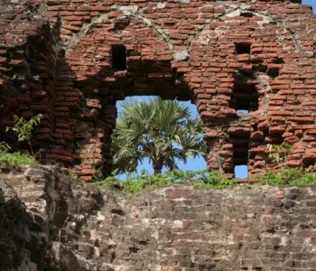
Alamparai Fort
Backwaters is very scenic- Good and safe for a swim. Local fisherman offer to take you for a ride on the boat-charges will be in the range of Rs. 200-500 for 30…
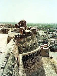
Dindigul Fort
Dindigul Fort is situated in Dindigul, Tamil Nadu, India and was built by the Madurai Nayak kings in 1605 and was later passed on to Kingdom of Mysore. In 1799 it…
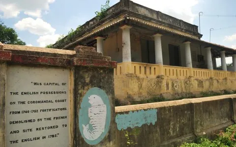
Fort St. David
Fort St. David, located near the town of Cuddalore, approximately 100 miles south of Chennai on the Coromandel Coast of India, has a significant history tied to…