Umaria District
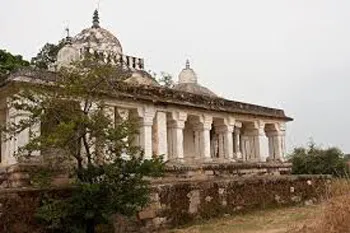
Umaria is one of the 48 administrative districts of Madhya Pradesh located towards the northeastern side of the state. It was formerly the headquarter of the South Rewa District and thereafter the headquarter town of the Bandhavgarh tehsil. The district forms a part of Rewa division.
About Umaria District
Umaria is one of the 48 administrative districts of Madhya Pradesh located towards the northeastern side of the state. It was formerly the headquarter of the South Rewa District and thereafter the headquarter town of the Bandhavgarh tehsil. The district forms a part of Rewa division.
Umaria is famous for the Bandhavgarh National Park (Tala) and Sanjay Gandhi Thermal Power Station Mangthar (Pali). The district is rich in natural resources namely forests and minerals. The most important mineral found in the district is coal and as a result eight mines are being operated by South Eastern Coalfield Limited in the district.
Umaria is enriched with its vast resources of forests and minerals. The coal mines are a steady source of revenue for the district.
Umaria has many places of interest for the tourists and the Bandhavgarh National Park will definitely head the list. The total geographical area of the district sums up to 4548 square kilometers and has a population of 5,15,963. Out of which about 83% population resides in rural areas.
The district has extensive forests. About 42% of the total area is covered by forests only. The District is rich in minerals. The most important mineral found in the district is coal and as a result 8 mines are being operated by South Eastern Coalfield Limited in the district.
The famous Bandhavgarh National Park (Tala) and Sanjay Gandhi Thermal Power Station Mangthar (Pali) are located in the district.
Umaria was formerly the headquarters of the South Rewa District and thereafter the headquarters town of the Bandhavgarh tehsil. It is situated at a distance of about 69 Km. from Shahdol, the parent district. Metalled roads connect the town with Katni, Rewa Shahdol etc., on which regular buses ply.
Climate/Weather
Average Rainfall : 1093 m.m.
Average Max. Temperature :46.2°C
Average Min. Temperature : 1.8°C
History of Umaria
Umaria was a part of Shahdol district. This was separated in 1998. Umariya is ruled by **Lodhi Rajputs (**Malgujars). This Lodhi Rajput Family has built the famous and important temple of Lakshmi Narayan on southern bank of Narbada Barman ghat. They also built on the steps of the northern bank of Barman ghat Kareli a great gateway called the Hathi Darwaza, as their elephants can pass through it.
Educational Institutions in Umaria
Jawahar Navodaya Vidyalaya School
Kendriya Vidyalaya School
Maharishi Vidya Mandir School.
Langauges
Hindi and other regional languages
Tourist Attraction of Umaria
Bandhavgarh (The ancient Name is Bandhogarh) National park Village-TALA, Taluka-Bandhavgarh, District-Umaria, (Madhya Pradesh), INDIA -Although Bandhavgarh is a relatively small park in the last few years this former game reserve has become one of India’s most prominent National Parks. The major reason for all the interest is Bandhogarh’s high density of tigers (The Bagh), which roam the mixed forests of sal ,bamboo and ambilica officinale in search of an easy kill. The tigers (The Bagh) have not only bolstered the local population by breeding success fully, they have also brought international media attention to the park and the plight of the Royal Bengal Tiger.BANDHAVGARH NATIONAL PARK Compact, yet full of game. The density of tiger population at Bandhavgarh is the highest known in India. 60 Tigers at 450 Sq. k.m. area in Bandhavgarh National Park. This is also “WHITE TIGER” country. The last known as captured by Maharaja Martand Singh in 1951. This White Tiger “Mohan”, is now stuffed and display in the place of Maharajah of Rewa.To reach Bandhavgarh from Umaria there are so many buses ply. To stay, there is so many lodges, like GTV Resort, Phone No. +91 7627 265 314, there is some Dhaba’s to get food, like Bansi Dhaba, cell No. 9424 973 602.
Bandhavgarh Fort
Bandhavgarh is the name of tehsil in Umaria District. Formerly it was the capital of the Bandhavgarh Kingdom of the Magha dynasty, then the head-quarters of the tehsil. At present its headquarters is Umaria.
The fort of Bandhavgarh is a place of considerable archaeological and historical importance.
It is a natural impregnable fort and stands on a hill, at an attitude of about 2430 metres above sea-level. The Bamnia hill is also a part of the fort, because it is enclosed by a rampart. The fort is on the Rewa-Umaria road, at a distance of about 41Km from Umaria Town.
Chandia Khas
Chandia is situated on the Umaria-Katni road, at a distance of about 21 km. from Umaria. The railway station of Chandia Khas, known as Chandia railway station.
The most important spot of Chandia Khas is a small temple, enshrining Goddess Kalika. Her mouth is wide open, but her out-stretched tongue is broken. There is also a old temple of god Rama and his consort Janaki. It was the seat of Thakur of Chandia. A small fair meets at Suraswahi Chandia for 3 days in February/March, on the occasion of Shivaratri.
Pali Birsinghpur
Pali is situated on the Umaria-Shahdol road, at a distnace of about 36km. from Umaria. Another road goes from Pali to Mandla via Dindori. Pali is also a railway station, and there is a rest house for the tourists to stay. The Station is known as the Pali-Birsinghpur station. Near the railway station there is a temple, enshrining Birasinidevi. By popular belief she is Goddess Kali, represented here as skeleton Goddess, but with her mouth closed. Many remains of old jain idols kept here in some Hindu temples. The annual fairs are held both in October and March, on the occasion of Navaratri, Near the temple of Goddess.
Umaria Town
The headquarters town of the Umaria district and Bandhavgarh tehsil, formerly umaria was the headquarters of the South Rewa District. It is situated at a distance of about 69 km from Shahdol.
Near the railway station stands a Siva temple, known as the Sagara temple. It was an old shrine, recently remodeled. Its main gates are still intact with beautiful stone statues, carved in Khajuraho models. Near about is Jwalamukhi temple. abut 6.5km away from the town, there is another temple,. with similar carvings of the Khajuraho pattern. It is known as the Mariwal temple.
Umaria is famous for its coal-mines, which were opened in 1881 by the Government of India and transferred to the Rewa Darbar in the same year, mainly to meet the requirement of railway at Katni
Hotels/Lodge/Accommodation in Umaria
Treehouse Hideaway
Jungle Lodge Hotel:
Address: P.O Tala., District - Umaria - 484 661 - India
Phone: 07627 - 265317
Copyright 2016 HolidayLandmark All rights reserved
Location info
Umaria district is located to the North East of Madhya Pradesh. Mathematically the coordinates of the District extend from 23o38’ to 24o20’ North and 80o28’ to 82o12’ East. It has geographical area of 4548 sq.km. The greatest length of the district is about 150 km. from north to south and the greatest width is about 60km from east to west.
Best time to visit Umaria District
Average Rainfall : 1093 m.m.
Average Max. Temperature :46.2°C
Average Min. Temperature : 1.8°C
Timings & opening hours
Always accessible; district offices open 10:00 AM to 5:00 PM weekdays
Entry fee & tickets
Free entry to public areas
Duration needed
1-2 days per district
Safety tips
Carry identification; be aware of local customs and regulations
Things to carry
Valid ID; camera; notebook; water bottle; comfortable shoes
Nearby visiting places
District headquarters, government offices, local markets, and major regional attractions
Nearest airport, railway & bus
Treehouse Hideaway
Jungle Lodge Hotel:
Address: P.O Tala., District - Umaria - 484 661 - India
Phone: 07627 - 265317
Mobile network coverage
Airtel, Jio, BSNL, and Vi all provide coverage across Madhya Pradesh. 4G is reliable in Bhopal, Indore, Gwalior, Jabalpur, and along national highways. Coverage may be weaker in deep forest areas of Kanha, Bandhavgarh, and Pench national parks. Most hotels and resorts in tourist areas offer free Wi-Fi.
Food & restaurants nearby
Food options are available in the nearest town. Madhya Pradesh cuisine — dal bafla, poha, bhutte ka kees, Bhopali kebabs, and Indori namkeen — offers distinctive regional flavours.
Things to do at Umaria District
Explore the district headquarters, visit local tourist attractions, interact with local communities, and discover the unique cultural identity of the district.
Things to visit & highlights
Bandhavgarh (The ancient Name is Bandhogarh) National park Village-TALA, Taluka-Bandhavgarh, District-Umaria, (Madhya Pradesh), INDIA -Although Bandhavgarh is a relatively small park in the last few years this former game reserve has become one of India’s most prominent National Parks. The major reason for all the interest is Bandhogarh’s high density of tigers (The Bagh), which roam the mixed forests of sal ,bamboo and ambilica officinale in search of an easy kill. The tigers (The Bagh) hav
Helpline & emergency contacts
Emergency Services: Police - 100, Ambulance - 108, Fire - 101. District helpline numbers available at local tourist information centres. For wildlife/national park emergencies, contact the forest department control room. MP Tourism helpline: 1800-233-6500 (toll-free).
Nearest petrol pump
Indian Oil, Bharat Petroleum, and Hindustan Petroleum retail outlets are available in the nearest town or city. Major highways have fuel stations at regular intervals. It is advisable to fill fuel before entering remote areas, wildlife sanctuaries, and national parks where fuel stations may be limited.
Frequently asked questions
What is this district known for? Each district has unique historical, cultural, or natural attractions.
How can I travel within the district? State bus services and private taxis connect major towns within the district.
What are the main languages spoken? Hindi is widely spoken; local dialects vary by region.
What is the best time to visit? October to March for comfortable weather.
Quick facts
- Type: Destination
- State: Madhyapradesh
- Category: Districts
How to reach Umaria District
Nearest Railway Station:Umaria is a railway station on the Katni-Bilaspur section of the South-Eastern Railway., 30-km from the main town. It lies on the Katni-Bilaspur section of South-Eastern Railway. Another railhead at a convenient distance is Satna (117-kms) and lies on the Bombay-Howrah main line of the Central Railway.Nearest Airport:Khajuraho is the nearest airport, 230-km away from Umaria. There are several domestic airlines operating to andfrom Agra, Delhi, and Varanasi.Road Transport:Umaria, being the gateway to Madhya Pradesh is well connected by a network of well maintained roads. The two nearest cities namely, Khajuraho and Jabalpur are located almost at equal distance from Umaria. MPSRTC and privately owned buses ply regularly between Umaria and rest of the state.
Map & location view
This section is being updated and will be available shortly.
Photo gallery of Umaria District
Video gallery
Related destinations
Alirajpur District
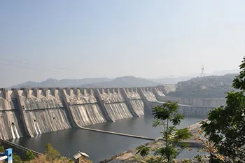
Alirajpur (also known as Ali Rajpur) is a city and a municipality in Alirajpur district in the state of Madhya Pradesh, India.
Anuppur District
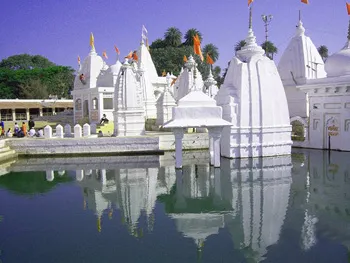
Anuppur is an administrative district of Madhya Pradesh state in central India. The district has an area of 3701 sq km, and a population of 667,155 (2001 Census)…
Ashoknagar District
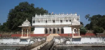
Ashoknagar is one of the 48 districts of Madhya Pradesh, situated on the north-eastern part of Malwa plateau between Parbati and the Betwa.