Shahdol District
Shahdol District is a district of Madhya Pradesh state in central India. With a total area of 5,671 square kilometers and a population of 908,148. Shahdol is an important district of Madhya Pradesh. The town of Shahdol is the district headquarters. The district is part of Rewa Division. Some of the towns in this district are Dhanpuri and Burhar. The Virateshwar Temple in Sohagpur Vangana is the most important tourist destination of Shahdol and a structural masterpiece. The district extends 110…
About Shahdol District
Shahdol District is a district of Madhya Pradesh state in central India. With a total area of 5,671 square kilometers and a population of 908,148. Shahdol is an important district of Madhya Pradesh. The town of Shahdol is the district headquarters. The district is part of Rewa Division. Some of the towns in this district are Dhanpuri and Burhar. The Virateshwar Temple in Sohagpur Vangana is the most important tourist destination of Shahdol and a structural masterpiece. The district extends 110 km. from East to West and 170 km. from North to South.
Shahdol district has been blessed with lush green forests, natural wealth of Coal, Minerals and with primitive Tribal population.There is a Virateshwar temple of Lord Shiv in Sohagpur Vanganga. Kalchuri King Maharaja Yuvraj Deva had got it built between 950 A.D. and 1050 A.D. to present it to the Acharya of Golkaki Math.District Shahdol is predominantly hilly district. It is pituresque with certain pockets and belt of SAL and mixed forests. Total Geographical area of the district is 5671 Sq. Km. Adjacents to the District Shahdol are the boarding districts Dindori, Satna, Sidhi, Umaria, Anuppur and Rewa.
Shahdol, an administrative district of Madhya Pradesh is located in the north-eastern part of the Deccan Plateau. The District is surrounded by Anuppur in the East, Mandla and Bilaspur in the South, Satna and Sidhi in the North and Umaria in the West. The district extends 110 Kms. from east to west and 170 kms. From north to south, Shahdol is a hilly district with certain belt of sal forests.
According to 2001 Census, the total population of the district is 908148, out of which 391027 are Scheduled Tribes and 67528 are Scheduled Castes.With the headquarters located at Shahdol town, the backbone of the district’s economy is its coal mines and other mineral resources.
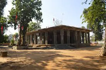
The Virateshwar Temple in Sohagpur Vangana is the most important tourist destination of Shahdol and a structural masterpiece.
Climate/Weather
The climate of the district is temperate. It rains from June to October in the district. The temperature remains the highest in the month of June and the Lowest in the Month of January. The maximum and minimum temperature of the district remains 46oC and 2.6oC respectively.
History of Shahdol
The etymology of the name as ascertained from the local residents points to its derivation from the name of the one Shahdolwa Ahir of Sohagpur village. The progenitor of the Ex-Illakadar family of Sohagpur, Jamni Bhan was the second son of Maharaja Virbhan Singh of Bagelkhand. He decided to settle at [Sohagpur] and assured maximum facilities to settler around, and also declared that places settled by clearing forests will be named after the pioneer settlers. Shahdolwa Ahir is believed to have settled the former village of Shahdolwa, about 2.5 km. from the headquarters of Sohagpur after this declaration. Later on, the place used to be the camp site for the Maharaja of Rewa and British officers on tour. More villages were grouped into the village of Shahdol as it grew to a town. The District Headquarters was shifted from Umaria to Shahdol after the merger of princely states took place in 1947.
Shahdol is named after the headquarters town Shahdol which is located on the Bilaspur-Katni Section of the South-Eastern Railways. The etymology of the name as ascertained from the local residents points to its derivation from the name of the one Shahdolwa Ahir of Sohagpur village. The progenitor of the Ex-Illakadar family of Sohagpur, Jamni Bhan was the second son of Maharaja Virbhan Singh of Bagelkhand. He decided to settle at Sohagpur and assured maximum facilities to settler around, and also declared that places settled by clearing forests will be named after the pioneer settlers. Shahdolwa Ahir is believed to have settled the former village of Shahdolwa, about 2.5 Km. from the headquarters of Sohagpur after this declaration. Later on, the place used to be the camp site for the Maharaja of Rewa and British officers on tour. More villages were grouped into the village of Shahdol as it grew to a town. The District Headquarters was shifted from Umaria to Shahdol after the merger of princely states took place in 1948.
Educational Institutions in Shahdol
Shahdol Undergraduate Degree Colleges
Shahdol Law Colleges
Shahdol Postgraduate Degree Colleges.
Some important colleges are Government PG College, Shahdol,Pt Shambhoo Nath Shukla Government PG College (Autonomous), Shahdol.
In addition to LL.B. degree, many universities of law in Shahdol and institutes for law in Shahdol offers other diploma courses in several disciplines of law, including Administrative Law, International Law, Labour Laws, Tax Laws and Corporate Laws. There are various branches of specialisation in law like civil law, criminal law, corporate law, property law, income tax law, marine law, publicinternational law , family law, labour law, press law, excise law, constitutional law, administration law, sale of goods law, trade mark, copyright and patent law etc. one can choose from.
Culture
District is very backward in the field of agriculture. Tribals of the district prefer the cultivation in the old traditional method. The size of the fields are very small and mainly the tribals are marginal farmers. The yearly yield of the products from the fields are not enough for their home use. Hence, for the rest part of the year they work on daily wages.
The living standard of tribals is very simple. Their houses are made of mud, bamboo sticks, paddy straw and local tiles. Tribal men wear Dhoti, Bandi, Fatohi and head gear. Women wear Saree named “Kaansh” saree in the local dialect. The saree is always of body colour. Women in the tribal community prefer to get their body parts hands, legs and neck encovered with colours. They wear different kinds of ornaments made of bamboo, seeds and metals.
The important coal field in the District is Sohagpur coal field. The Barakars in this area are about 3100 Sq. kms. Four coal seams have been recorded from the lower Barakars whereas a few thin seams are reported from Upper Barakars. The Lower Barakar coal of lower ash content and better quality as compared to that from Upper Barakars. In general the coal is of low rank, high moisture, high volatiles and non-cocking type. A reserve of 4064 million tonnes has been estimated from this field.
Tourist Attraction of Shahdol
VIRATESHWAR TEMPLE:
There is a Virateshwar temple of Lord Shiv in Sohagpur Vanganga. Kalchuri King Maharaja Yuvraj Deva had got it built between 950 A.D. and 1050 A.D. to present it to the Acharya of Golkaki Math. Many Archaeologists consider this temple as the temple of Karn Deva. When you reach the campus of this 70 feet hight temple you will find this beautiful example of Kalchuri Age architecture. When you ascend the five steps of the terrace of this temple, you will find Nandi and Lion as if welcoming you. The statue of Mahavir, Shiv and Parvati in dancing posture, the statue of Saraswati, Ganesh, Vishnu, Nrisingh, Vyal, beautiful young woman taking out a thorn, fighting men, Lord Krishna playing flute, beautiful erotic postures related to Kamsutra, Vinavadini, Ardhnarishwar will fascinate you. Having the statues of AgniDevata, Panchlokpal, Batuk Bhairav, Amrut Bhairav, Nag Couple etc. this temple is the beauty of District.
Hotels/Lodge/Accommodation in Shahdol
Bandhavgarh Jungle Lodge
Copyright 2016 HolidayLandmark All rights reserved
Location info
Shahdol is located at 23°17′N 81°21′E It has an average elevation of 464 metres (1522 feet).Shahdol District is situated in the North-Eastern part of the Madhya Pradesh provinces of India. Because of the division of the district on 15-8-2003, the area of the district remains 5671 Sq. Kms. It is surrounded by Anuppur in the South-East, Satna & Sidhi in the North and Umaria in the West. The district extends 110 Kms. from East to West and 170 Kms. from North to South. This district is situated between 22o38’ N latitude to 24o20’N latitude and 30o28’ E Longitude to 82o12’ E longitude.
How to reach Shahdol District
-
**Nearest Railway Station:**Burhar Railway Station
-
**Nearest Airport:**Bhopal Airport
-
**Road Transport:**Nearest bus station is Manpur
Best time to visit Shahdol District
The climate of the district is temperate. It rains from June to October in the district. The temperature remains the highest in the month of June and the Lowest in the Month of January. The maximum and minimum temperature of the district remains 46oC and 2.6oC respectively.
Timings & opening hours
Always accessible; district offices open 10:00 AM to 5:00 PM weekdays
Entry fee & tickets
Free entry to public areas
Duration needed
1-2 days per district
Safety tips
Carry identification; be aware of local customs and regulations
Things to carry
Valid ID; camera; notebook; water bottle; comfortable shoes
Nearby visiting places
District headquarters, government offices, local markets, and major regional attractions
Nearest airport, railway & bus
Bandhavgarh Jungle Lodge
Mobile network coverage
Airtel, Jio, BSNL, and Vi all provide coverage across Madhya Pradesh. 4G is reliable in Bhopal, Indore, Gwalior, Jabalpur, and along national highways. Coverage may be weaker in deep forest areas of Kanha, Bandhavgarh, and Pench national parks. Most hotels and resorts in tourist areas offer free Wi-Fi.
Food & restaurants nearby
Food options are available in the nearest town. Madhya Pradesh cuisine — dal bafla, poha, bhutte ka kees, Bhopali kebabs, and Indori namkeen — offers distinctive regional flavours.
Things to do at Shahdol District
District is very backward in the field of agriculture. Tribals of the district prefer the cultivation in the old traditional method. The size of the fields are very small and mainly the tribals are marginal farmers. The yearly yield of the products from the fields are not enough for their home use. Hence, for the rest part of the year they work on daily wages.
The living standard of tribals is very simple. Their houses are made of mud, bamboo sticks, paddy straw and local tiles. Tribal men wear
Things to visit & highlights
VIRATESHWAR TEMPLE:
There is a Virateshwar temple of Lord Shiv in Sohagpur Vanganga. Kalchuri King Maharaja Yuvraj Deva had got it built between 950 A.D. and 1050 A.D. to present it to the Acharya of Golkaki Math. Many Archaeologists consider this temple as the temple of Karn Deva. When you reach the campus of this 70 feet hight temple you will find this beautiful example of Kalchuri Age architecture. When you ascend the five steps of the terrace of this temple, you will find Nandi and
Helpline & emergency contacts
Emergency Services: Police - 100, Ambulance - 108, Fire - 101. District helpline numbers available at local tourist information centres. For wildlife/national park emergencies, contact the forest department control room. MP Tourism helpline: 1800-233-6500 (toll-free).
Nearest petrol pump
Indian Oil, Bharat Petroleum, and Hindustan Petroleum retail outlets are available in the nearest town or city. Major highways have fuel stations at regular intervals. It is advisable to fill fuel before entering remote areas, wildlife sanctuaries, and national parks where fuel stations may be limited.
Frequently asked questions
What is this district known for? Each district has unique historical, cultural, or natural attractions.
How can I travel within the district? State bus services and private taxis connect major towns within the district.
What are the main languages spoken? Hindi is widely spoken; local dialects vary by region.
What is the best time to visit? October to March for comfortable weather.
Quick facts
- Type: Destination
- State: Madhyapradesh
- Category: Districts
Map & location view
This section is being updated and will be available shortly.
Photo gallery of Shahdol District
Video gallery
Related destinations
Alirajpur District
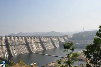
Alirajpur (also known as Ali Rajpur) is a city and a municipality in Alirajpur district in the state of Madhya Pradesh, India.
Anuppur District
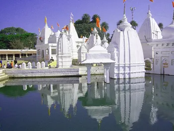
Anuppur is an administrative district of Madhya Pradesh state in central India. The district has an area of 3701 sq km, and a population of 667,155 (2001 Census)…
Ashoknagar District
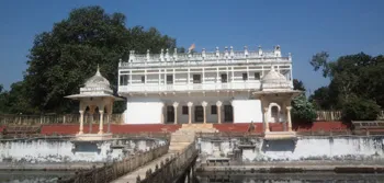
Ashoknagar is one of the 48 districts of Madhya Pradesh, situated on the north-eastern part of Malwa plateau between Parbati and the Betwa.