Rajgarh District
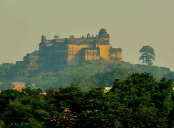
Rajgarh is a town and a nagar panchayat in Rajgarh district in the Indian state of Madhya Pradesh. It is the administrative headquarters of Rajgarh District, and was formerly a princely state under the British Raj. The old town is surrounded by a battlemented wall.Rajgarh district is one of the smallest districts in the state of Madhya Pradesh.
About Rajgarh District
Rajgarh is a town and a nagar panchayat in Rajgarh district in the Indian state of Madhya Pradesh. It is the administrative headquarters of Rajgarh District, and was formerly a princely state under the British Raj. The old town is surrounded by a battlemented wall.Rajgarh district is one of the smallest districts in the state of Madhya Pradesh.
The district of Rajgarh shares its borders with the state of Rajasthan, and the Shajapur district, Sehore district and Bhopal district. This district forms the north-western part of Bhopal Commissioner`s Division. The district has a quadrangular shape with the northern and western sides longer than the southern and eastern sides, respectively. The zigzag boundaries of the district of Rajgarh resemble a pear. Some of the major locations in this district are Zirapur, Biora, Rajgarh, Sarangpur, Khilchipur and Narsinghgarh. Rajgarh is well-connected by road railway network. With its temples, sculptures and natural beauty, Rajgarh is a major tourist attraction.
Location info
Rajgarh is located at western part of Madhya Pradesh. It borders the state of Rajasthan, and the districts of Shajapur, Sehore, and Bhopal. It forms the north western part of Bhopal Commissioner’s Division. Rajgarh District extends between the parallels of latitude 23027’ 12“ North and 24017’ 20“ North and between the meridians of longitude 76011’ 15“ and 77014’ East. It has a quadrangular shape with the northern and western sides longer than the southern and eastern sides, respectively. The zigzag boundaries of the District resemble a pear.
The total geographical area of the District is 6,154 sq.km. with a population of 12,54,085 according to census 2001. It is one of the small districts of Madhya Pradesh, both in respect of area and population. It is 145 KMs from the state capital Bhopal.
History of Rajgarh
Rajgarh princely state was part of Central India’s Bhopal Agency. It had an area of 940 sq. mi., and a population of 88,376 in 1901. Estimated revenue, 33,000 (1911); tribute (to Sindhia of Gwalior), 3640. The rulers, whose title was Rawat, were Rajputs of the Ponwar (Umat) clan. Grain and opium were the principal articles of trade.
After India’s independence in 1947, the Rawat acceded to the Indian government, and Rajgarh became part of Madhya Bharat state, which was formed out of the western half of the Raj’s Central India Agency of princely states. In 1956 Madhya Bharat was merged into Madhya Pradesh state.
The District takes its name from the headquarters town Rajgarh. Rajgarh District was constituted after the formation of Madhya Bharat in May, 1948. Prior to this the area of the present District was parceled out among the States of Rajgarh, Narsinghgarh, Khilchipur, Dewas (Senior) Dewas (Junior) and Indore. Rajgarh was the headquarters of a mediatised State, ruled by the Umat Rajputs and branch of the great paramara clan, they enjoyed a Sanad Estate under the Sultans of Delhi and Mughal emperors in succession. The first capital was Duparia, now in Shajapur District. Later on it was shifted to Dungarpur (19 Km from Rajgarh) and then to Ratanpur (19 Km. west of Narsinghgarh) and back. Inorder to avoid disturbance by the frequently passing Mughal armies, the Ruler of the Estate, Mohan Singh, acquired the present side, originally known as Jhanjhanipur from the Bhils in A.D. 1640. Finally he shifted the headquarters in the year 1645, giving the place its present name.
During the reign of Akbar (A.D. 1556-1605) a Khilat and a Sanad were granted to Udaji of Tatanpur. At that time, Sarangpur was a Sarkar in the Subah of Malwa. Its jurisdiction extended from the western part of present Sehore District to the eastern part of Ujjain District. Among its twentyfour mahals many have retained their original names and are identified as Ashtah, Talain (Talen), Agra (Agar), Bajilpur (Bijilpur), Bhorsah, Khiljipur, Jirapur, Sarangpur, Sondarsi (Sundarsi), Sosner (Sunner) Sajapur, Kayath and Navgam (Tarana)1. In 1908, Rajgarh State was divided in to seven Parganas, namely Newalganj, Biaora, Kalipith, Karanwas, Kotra, Seogarh and Talen. Narsinghgarh State was divided into four Parganas, namely Huzur (Narsinghgarh), Pachor, Khujner and Chhapera. The Parganas were place in the charge of a Tahsildar each for revenue matters and magisterial work.2 Khilchipur State was divided into three Paraganas. Sarangpur was as now, the tahsil headquarters of Dewas (Senior) and Dewas (Junior) States. Jarapur was a tahsil of Mahidpur District of former Indore State. It has now been abolished and merged in Khilchipur tahsil.
In 1645 with the permission of Rajmata, Deewan Ajab Singh defeated the Bhils in the hilly region of Rajgarh and he constructed a Palace in 1745 which was having five main gates namely, Itwaria, Bhudwaria, Surajpol, Panradia and Naya Darwaja. And it constitutes three very ancient temple namely Raj Rajeshwar Temple, Chatubhujnathji Temple and Narsingh Temple, and in which Rajmata and his 15 year old son Rawat Mohan singh was living safely. In Jhanjherpur which was capital and it is having a palace due to which this place is known as Rajgarh and it had become famous.
Educational Institutions in Rajgarh
Alphonsa Convent School .
Anand Vidya Bharti
Jyoti Girls Higher Secondary School .
Kendriya Vidyalaya
St. Francis Higher Secondary School .
St. George’s Convent School
Culture
As of the 2001 census, Rajgarh district has a total population of 1,254,085 people distributed across a total area of 6,154 square kilometers. The district itself has 6 administrative tehsils. They are Rajgar, Khilchipur, Sarangpur, Biaora, Zirapur and Narsinghgarh.
Rajgarh was previously the headquarters of a state ruled by the Umar Rajputs; they enjoyed a Sanad Estate under Sultans of Delhi, and even with the Mughal emperor successors. The first capital was Duparia, which is now in Shahjapur district. It was later shifted to Dungarpur and then to Ratanpur, before finally being shifted back.
The district as it is today was created in May 1948, after India gained independence. It included the former princely states of Rajgarh, Khilchipur, Narsinghgarh, and other parts of the states of Dewas and Indore. The district was originally part of Madhya Bharat and when it was integrated into the newly established state of Madhya Pradesh on the 1st of November, 1956, it became a district of the new state.
The district has fairly good cultivated lands, with about 412,714 hectares of total area that are sown. Of this, the total gross area being irrigated amounts to about 160,096 hectares. As of 2001, the district also has a total livestock of 794,122, and a total poultry of 138,649. Comparing this to the population of the district, it can be said that Rajgarh is a very good producer of farm and agricultural products. It is not to say, however, that the whole district is rural; as of 2001, the district has 11 registered factories and 3000 registered manufacturing units.
There are also several historical places that can be found in the district. The more popular ones include the 700 year old Chaturbhujnath Temple found in the banks of Ajnar River, in Biaora. Another temple, the 400 year old Raghunathji Temple, is found in the same area. Over at Talen, in the bank of the Ugal River, can be found the remains of the political places of Sindhia and Holkar. Also, at Chhagoda, some 15 miles away from Rajgarh, one can find several historical and famous caves. The most famous, however, is arguably the town of Narsinghgarh, with over 300 years of history, having been found in 1681 by Dewan Parasram. During autumn, the place becomes very picturesque and beautiful, especially if seen from the top of the Baijnath Mahadeo temple.
Tourist Attraction of Rajgarh
One of the most prominent places of tourist interest in the district of Rajgarh is Narsinghgarh. The Narsinghgarh town is about 300 years old having been founded in the year 1681 by Dewan Parasram. The beautiful lake in the town in which is reflected the old fort and palace still bears the name of the founder. The site of the town is the place of the temple of Shiva - then known as Topila Mahadeo, for the persons who lived there manufactured toplis or basket. From the top of the Baijnath Mahadeo temple the pleasant panorama is very appealing, with the lakes of full limpid water, land with lush green grass, the small streams racing down the slopes of the hills and the hills covered with good vegetation and as rustling wind sweeps the murmuring countryside adorned with mellowing crops, radiant in the evening sun, the brilliance of blue skies seems to evenly matched with the grandeur of the green.
One of the most beautiful temples is the Jalpamata temple, which is 4 kilometers from Rajgarh. It is on the high hill and one can have a picturesque view of the town from the top. It is covered with dense forest having different varieties of plants. During the Navaratri season devotees visit this temple in large numbers. Another major attraction is the Wildlife Sanctuary of Narsinghgarh. Migratory birds from different places visit this Sanctuary. Here in this sanctuary one can have a glimpse of local birds and migratory birds. State bird, Dhoodh Raj, is mainly seen here in this sanctuary. National bird, Peacock, is mainly seen in this sanctuary and in nearby areas. Other attractions of this district include Shyamji Sanka temple, Dargah Shareif, Biora Mandu, Khoiry Mahadev temple, etc.
Narsinghgarh Town
The town is nearly 300 years old having been founded in 1681 by Dewan Parasram. The beautiful lake in the town in which is reflected the old fort and palace still bears the name of the founder. The town is 83 Kms. from the Bhopal and is reached by a good road. The site of the town is the place of temple of Shiva - then known as Topila Mahadeo, for the persons who lived there manufactured toplis or basket. Hence the name stick. It is however in the autumnal months that the place becomes exceedingly picturesque and beautiful. From the top of the Baijnath Mahadeo temple the pleasant panorama is very appealing, with the lakes of full limpid water, with the land carpeted in lush green grass, with the small streams racing down the slopes of the hills and hills themselves covered with good vegetation and as rustling wind sweeps the murmuring countryside adorned with mellowing crops, radiant in the evening sun, the brilliance of blue skies seems to evenly matched with the grandeur of the green.
**
Shyamji Sanka Temple-Narsinghgarh**
A Sanka is a small village situated near the river Parvati and is about 5Km from Kotra , once its tehsil headquarter of Rajgarh State. Each year in the month of magh a mela is held here and is known as Shyamji-ka-mela.The famous temple of Shyamji was built in the memory of the king Sangram Singh (Shyam Singh) by his wife Bhagyawati in the 16-17th century, the king died in an encounter with a mughal soldier of Haji Wali. The temple is protected by the state govt. . It has beautiful paintings on the wall reflecting the Malwi & Rajashthani effects, the beautiful and well carved stones & bricks were used to construct the temple.
Jalpamata Temple-Rajgarh
A beautiful temple is just 4 Kms. from Rajgarh. It is on the high hill & you can have a picturesque view of the town from the top. It is covered with dense forest having different varieties of plants. The devotee come from different parts in the navratri season.
Dargah Shareif- Rajgarh
A saint HAZRAT SYED. QURBAN ALI SHAH BADAKHSHANI known as “Baba Badakshani R.A.” born in 1245 (hijri) at Badakshan & came to India in 1268 (hijri) from Badakhshan of Afganistan and later he came to Rajgarh in 1309 hijri. In the year 1914 A.D. he died on 20th of the holly month of Ramazan of 1334 hijri. Since then his death anniversary is celebrated as “URS” in the month of March from 10-12. People of all communities from all over the India and some of other countries come in to the URS for spiritual gain.
Dargah Shareef, Masjid and other buildings were founded by the Mutawalli of Dargah Shri Syed. Mushtaq Ali Rizvi Sandelvi after the death of Baba Sahib. At present all managements of Dargah Shareef and URS programme is managed by the Present Mutawalli of Dargah Shri Syed. Mushtaq Rizvi.
Chidikho-Narsinghgarh
Wild Life Sancutary of Narsinghgarh is among one of the 35 sancturies of M.P. established in 1978 under Forest Division Rajgarh Social Forestry. Sanctuary is situated on N.H.12 (Jabalpur-Jaipur) 70 Kms from Bhopal, 221 Kms from Indore, 35 Kms from Biaora and 278 Kms from Kota. (Latitude:23035’ to 23040’ North, Longitude:7702’ to 77010’ East, Height form Sea Level: 462.07 to 576.08 meter). It is covered 57.197 Sq. Km. (Reserve Forest) area. Due to its natural beauty it is one of the most beautiful place of Rajgarh district, so it is also known as “Kashmir of Malwa” region.
In the center of this sanctuary “Chidikho Lake” is situated which is one of the attraction among the tourists. This sanctuary is built by the rulers of the state and in the ancient time this sanctuary is used for hunting purpose by the rulers. Migratory birds from different places reaches here in this sanctuary. The lake situtated here is having special appearance due to which the local people named this lake as “Chidikho Lake”. Here in this sanctuary we can have a glimpse of local birds and migratory birds. State bird Dhoodh Raj is mainly seen here in this sanctuary. National bird peakock is mainly seen in this sanctuary and in nearby areas. The climatic condition is suitable for the national bird peakock. And this sancutary is having a chance to develope as Mayur Park Area of this sanctuary is sufficient for wild animals. 11 GULBAGH, CHEETAL in large number and SAMBHAR, NEELGAI are mainly found. We can see them freely roaming in this sanctuary. Near to “CHIDIKHO LAKE” JAMUN KHO,ANDHIYAR KHO, DHUWALI wild animals can be seen. Work is done for protection and preservation of wild animals.
Biora Mandu-Narsinghgarh
The village is said to be over 1000 years old having been named after a Kulmi patel. The muslim troops used to be stationed here and legend has it , that it was from here that they saw the five sola Khamba at Bihar (Narsinghgarh). It is situated on the bank of Kali Sindh river and 10Km from the Sarangpur tehsil. It was the scene of battle in 1813 & 1847
Kotra-Narsinghgarh
It was once a teshsil of Rajgarh state. It is situated 10 Km from south of Narsinghgarh. It is on the fringe of forest and some old Shikargarh (hunting place) are well laid out.
**
Khoiry Mahadev Temple-Rajgarh**
A beautiful temple of Khoiry Mahadev is just 1 Kms. from Rajgarh. It is one of the favorite picnic spot of the Rajgarh.
Hotels/Lodge/Accommodation in Rajgarh
Hp Pwd Rest House:
Located in Rajgarh at an altitude of 1400 mts amsl, this Himachal Pradesh Public Works Dept. run Rest House is open for stay for tourists who book through the B &R Division Office at Rajgarh. Rajgarh is at a distance of 350 km from Delhi and 32 km from Solan.
Amenities:
Service and Facilities at The HP PWD Rest House, Rajgarh include Parking within premises and a lawn.
The Trekkers Hostel, Rajgarh:
The Trekkers Hostel is meant for base camp accommodation for trekkers.
Copyright 2016 HolidayLandmark All rights reserved
Best time to visit Rajgarh District
October to March for travel; district offices open year-round
Timings & opening hours
Always accessible; district offices open 10:00 AM to 5:00 PM weekdays
Entry fee & tickets
Free entry to public areas
Duration needed
1-2 days per district
Safety tips
Carry identification; be aware of local customs and regulations
Things to carry
Valid ID; camera; notebook; water bottle; comfortable shoes
Nearby visiting places
District headquarters, government offices, local markets, and major regional attractions
Nearest airport, railway & bus
Hp Pwd Rest House:
Located in Rajgarh at an altitude of 1400 mts amsl, this Himachal Pradesh Public Works Dept. run Rest House is open for stay for tourists who book through the B &R Division Office at Rajgarh. Rajgarh is at a distance of 350 km from Delhi and 32 km from Solan.
Amenities:
Service and Facilities at The HP PWD Rest House, Rajgarh include Parking within premises and a lawn.
The Trekkers Hostel, Rajgarh:
The Trekkers Hostel is meant for base camp accommodation for
Mobile network coverage
Airtel, Jio, BSNL, and Vi all provide coverage across Madhya Pradesh. 4G is reliable in Bhopal, Indore, Gwalior, Jabalpur, and along national highways. Coverage may be weaker in deep forest areas of Kanha, Bandhavgarh, and Pench national parks. Most hotels and resorts in tourist areas offer free Wi-Fi.
Food & restaurants nearby
Food options are available in the nearest town. Madhya Pradesh cuisine — dal bafla, poha, bhutte ka kees, Bhopali kebabs, and Indori namkeen — offers distinctive regional flavours.
Things to do at Rajgarh District
As of the 2001 census, Rajgarh district has a total population of 1,254,085 people distributed across a total area of 6,154 square kilometers. The district itself has 6 administrative tehsils. They are Rajgar, Khilchipur, Sarangpur, Biaora, Zirapur and Narsinghgarh.
Rajgarh was previously the headquarters of a state ruled by the Umar Rajputs; they enjoyed a Sanad Estate under Sultans of Delhi, and even with the Mughal emperor successors. The first capital was Duparia, which is now in Shahjapur
Things to visit & highlights
One of the most prominent places of tourist interest in the district of Rajgarh is Narsinghgarh. The Narsinghgarh town is about 300 years old having been founded in the year 1681 by Dewan Parasram. The beautiful lake in the town in which is reflected the old fort and palace still bears the name of the founder. The site of the town is the place of the temple of Shiva - then known as Topila Mahadeo, for the persons who lived there manufactured toplis or basket. From the top of the Baijnath Mahadeo
Climate & weather
Madhya Pradesh has a subtropical climate with three distinct seasons. Winter (October–March) is the best time to visit: temperatures range from 8°C to 28°C with clear skies and pleasant days — ideal for wildlife safaris and temple visits. April–June is very hot, with temperatures reaching 42–45°C in most areas. The monsoon (July–September) brings moderate to heavy rainfall, making the landscape lush green, though wildlife parks close during peak monsoon.
Helpline & emergency contacts
Emergency Services: Police - 100, Ambulance - 108, Fire - 101. District helpline numbers available at local tourist information centres. For wildlife/national park emergencies, contact the forest department control room. MP Tourism helpline: 1800-233-6500 (toll-free).
Nearest petrol pump
Indian Oil, Bharat Petroleum, and Hindustan Petroleum retail outlets are available in the nearest town or city. Major highways have fuel stations at regular intervals. It is advisable to fill fuel before entering remote areas, wildlife sanctuaries, and national parks where fuel stations may be limited.
Frequently asked questions
What is this district known for? Each district has unique historical, cultural, or natural attractions.
How can I travel within the district? State bus services and private taxis connect major towns within the district.
What are the main languages spoken? Hindi is widely spoken; local dialects vary by region.
What is the best time to visit? October to March for comfortable weather.
Quick facts
- Type: Destination
- State: Madhyapradesh
- Category: Districts
How to reach Rajgarh District
Nearest Railway Station:Bina Junction Railway Station,shivpuriNearest Airport:The nearest airport is MaharajpurRoad Transport:The nearest bus stand is Panna
Map & location view
This section is being updated and will be available shortly.
Photo gallery of Rajgarh District
Video gallery
Related destinations
Alirajpur District
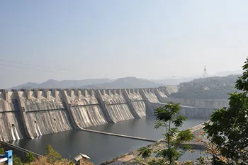
Alirajpur (also known as Ali Rajpur) is a city and a municipality in Alirajpur district in the state of Madhya Pradesh, India.
Anuppur District
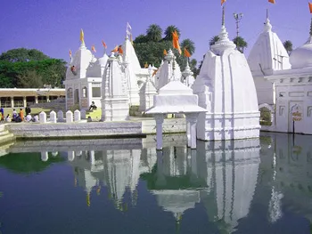
Anuppur is an administrative district of Madhya Pradesh state in central India. The district has an area of 3701 sq km, and a population of 667,155 (2001 Census)…
Ashoknagar District
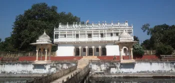
Ashoknagar is one of the 48 districts of Madhya Pradesh, situated on the north-eastern part of Malwa plateau between Parbati and the Betwa.