Harda District
Harda is a city and municipality within Harda district, Madhya Pradesh, officially formed on July 6, 1998, after its separation from Hoshangabad District. This district spans an area of approximately 2,644 square kilometers, positioned in the agriculturally rich Narmada River valley, with the river marking its northern boundary. It also borders the districts of Sehore, Hoshangabad, Betul, Khandwa, and Dewas, with the Satpura Range to the south.
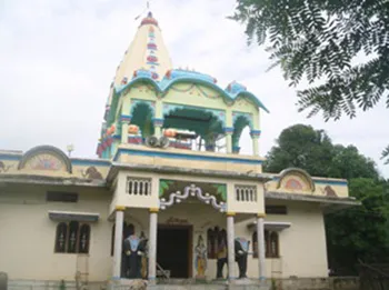
About Harda District
As of the last recorded census, Harda district has a total population of about 570,465, distributed across both urban and rural areas.
The urban population accounts for around 20.9% (119,364 people), while the rural area is home to approximately 451,101 people.
The district’s literacy rate stands at 74.04%, with male literacy at 80% and female literacy at 67%, surpassing the national average.
The population density is relatively low, with about 171 inhabitants per square kilometer, reflective of the district’s rural character.
Harda district, covering around 2,644 sq. km., lies in the Narmada River valley, which forms its northern boundary.
This agriculturally rich district has a population of approximately 570,465, as per recent estimates. Harda’s literacy rate is a notable 74%,
with male literacy at 80% and female literacy at 67%, both surpassing the national average.Harda also has historical significance,
known for producing freedom fighters during India’s independence movement. Tourist sites include the Shri Siddi Vinayak Mandir
and Shri Laxmi Narayan Bada Mandir. Formed in 1998 from Hoshangabad, Harda is part of the Jabalpur Division and features
landscapes rising towards the Satpura Range in the south.
Tourist Attraction of Harda
Copyright 2016 HolidayLandmark All rights reserved
Location info
- Location: Narmadapuram Division, Madhya Pradesh
- Headquarters: Town of Harda
- Area: 2,644 sq. km (updated)
- Population: Approximately 570,465 (2011 Census)
- Elevation: 302 meters above sea level
- Tribal Population: Predominantly Korku and Gond tribes
Climate & weather
- Summer: Hot and dry, 30°C to 45°C (86°F to 113°F), peaking in May.
- Monsoon: Heavy rain from July to September, with high humidity.
- Winter: Mild, 10°C to 25°C (50°F to 77°F), coolest in January.
History of Harda District
- Founding Villages: Harda originally included KulHarda and Mehmudabad, growing under British railway expansion.
- “Hridaynagari”: Known as the “Heart City” for its fertile land, with cultural influences from Malwa and Nimad.
- Tribal Heritage: The region is home to Gond and Korku tribes, key to its cultural identity.
- Freedom Movement: Visited by Lokamanya Tilak in 1916 and Mahatma Gandhi in 1933, pivotal to the independence effort.
- Independence Day: The national flag was raised in Harda by S.D.O Shri Beretha on August 15, 1947.
- District Formation: Established as an independent district in 1998, under Narmadapuram Division.
How to reach Harda District
- **By Air:**Devi Ahilya Bai Holkar Airport, Indore (150 km). Taxis and buses connect to Harda.
- **By Train:**Harda Railway Station (HD) has direct trains like the Malwa and Narmada Express from Bhopal, Indore, and Mumbai.
- By Road: Connected via NH-47 with bus services and taxis from nearby cities like Bhopal and Indore.
Best time to visit Harda District
October to March (winter) for pleasant weather
Timings & opening hours
District office: 10:00 AM - 5:00 PM weekdays
Entry fee & tickets
Free entry to district areas
Duration needed
1-2 days for district exploration
Safety tips
Carry water, wear comfortable shoes, keep emergency contacts handy, supervise children
Things to carry
Comfortable clothing and shoes, water bottle, camera, sunscreen, hat, sunglasses, first aid kit
Nearby visiting places
Nearby attractions include local temples, monuments, and natural landmarks; check local tourism office.
Nearest airport, railway & bus
Nearest airport: Raja Bhoj Airport, Bhopal (varies by location).
Mobile network coverage
Airtel, Jio, BSNL, and Vi all provide coverage across Madhya Pradesh. 4G is reliable in Bhopal, Indore, Gwalior, Jabalpur, and along national highways. Coverage may be weaker in deep forest areas of Kanha, Bandhavgarh, and Pench national parks. Most hotels and resorts in tourist areas offer free Wi-Fi.
Food & restaurants nearby
Food options are available in the nearest town. Madhya Pradesh cuisine — dal bafla, poha, bhutte ka kees, Bhopali kebabs, and Indori namkeen — offers distinctive regional flavours.
Hotels & accommodation nearby
Accommodation is available in the nearest town or city. MP Tourism hotels and wildlife lodges offer reliable mid-range options across the state.
Things to do at Harda District
Copyright 2016 HolidayLandmark All rights reserved
Things to visit & highlights
Nearby attractions include local temples, monuments, and natural landmarks; check local tourism office.
Helpline & emergency contacts
Police: 100, Ambulance: 108, Fire: 101; MP Tourism Helpline: 1800-233-1111; District helpline varies by location.
Nearest petrol pump
Petrol pumps available within 1-5 km of most tourist sites; major highways have regular fueling stations every 20-30 km. In remote areas, fill up at the nearest town before travelling.
Frequently asked questions
What are the visiting hours? Typically 9:00 AM to 6:00 PM varies; check before your visit.
What is the entry fee? Entry fees vary by location; ranges from free to INR 200 per person.
What is the best time to visit? October to March provides the most pleasant weather for exploration in Madhya Pradesh.
Quick facts
- Type: Destination
- State: Madhyapradesh
- Category: Districts
Map & location view
This section is being updated and will be available shortly.
Photo gallery of Harda District
Video gallery
Related destinations
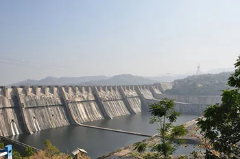
Alirajpur District
Alirajpur (also known as Ali Rajpur) is a city and a municipality in Alirajpur district in the state of Madhya Pradesh, India.
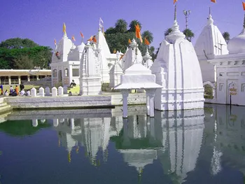
Anuppur District
Anuppur is an administrative district of Madhya Pradesh state in central India. The district has an area of 3701 sq km, and a population of 667,155 (2001 Census)…
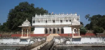
Ashoknagar District
Ashoknagar is one of the 48 districts of Madhya Pradesh, situated on the north-eastern part of Malwa plateau between Parbati and the Betwa.