Barwani District
Barwani district is one of the districts of Madhya Pradesh state of India. The administrative head quarter of the district is at Barwani. Barwani district has an area of 3665 km² and a population 1,081,039 (2001 census). The district lies in the southwestern corner of Madhya Pradesh.the Narmada River forms its northern boundary. The Satpura Range lies to its south. The district is bordered by Maharashtra state to the south, Gujarat state to the west, Dhar district to the north and Khargone…
About Barwani District
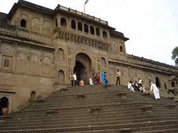
Barwani district is one of the districts of Madhya Pradesh state of India. The administrative head quarter of the district is at Barwani. Barwani district has an area of 3665 km² and a population 1,081,039 (2001 census). The district lies in the southwestern corner of Madhya Pradesh.the Narmada River forms its northern boundary. The Satpura Range lies to its south. The district is bordered by Maharashtra state to the south, Gujarat state to the west, Dhar district to the north and Khargone district to the east.Barwani is famous for its Papitas and Bawangaja (a Jain holy place 8 KM from Barwani).
The name Badwani originated from the forests of Bad which had surrounded the city in old times. Wani is the old word for the Garden. and hence city got its name Badwani which means Garden of Bads. Barwani is still pronounced as Badwani but it spells Barwani.District Barwani was formed on 25th May 1998. It was carved out of West-Nimar, Khargone district.
Climate/Weather
The temperature of Barwani in April and May goes as high as 48’C, making it the hottest place in India.
History of Barwani
Barwani was formerly the capital of the eponymous princely state. The rulers, whose title was Rana, were Rajputs of the Sesodia clan, descended from the ruling dynasty of Udaipur. Although the state lost most of its territory during the Maratha invasion in the 17th century, it never became tributary to any Maratha chief. Under the British Raj, Barwani was a state of the Bhopawar agency, a division of the Central India Agency. The state lay in the Satpura Range south of the Narmada River. It had an area of 3051 km² (1178 square miles) and a population, in 1901, of 76,136. The inhabitants were predominantly Bhil tribals. The forests were under a British official. After India’s independence in 1947, the Rana of Barwani acceded to India, and Barwani became part of the Nimar District of Madhya Bharat state. Madhya Bharat was merged into Madhya Pradesh on 1 November 1956
Educational Institutions in Barwani
Law Collegesin Badwani, Madhya Pradeshoffering Legal Education including Civil Law, Criminal Law, Business Law, Forensic Law etc. and courses such as Bachelor of Law (BL), Master of Law (ML) etc:
Government PG College, Badwani
Distance Education / Distance Learning programs and Correspondance courses offered by various Study Centers under Distance Education / Open University Scheme of Indian Universities offering courses such as MA, MSc, MBA, MCA etc:
Government PG College, Badwani
Colleges
Aadinath Institute of Information Technology & Management, Barwani[4]
Government PG College, Barwani
Government Girls College, Barwani
Barwani Polytechnic College, Barwani
Gov. PG College, Barwani
Pinnacle College of Higher Education, Barwani
Schools
K.V.Barwani[central schoool]
Panjataniyah English Medium Higher Secondary School
Harsukh Digamber Jain Higher Secondary School
Gov. Boys Higher Secondary School No.1
Gov. Boys Higher Secondary School No.2
Gov. Girls Higher Secondary School
Saraswati Shishu/vidhya Mandir
Rotery Higher Secondary School
Barwani Public School
St. Mary’s High Secondary School
St. Joseph’s Higher Secondary School
Knowledge-Rain High school
Paramount Academy
Puspkunj High School
Rajkumar Khendalwal Memorial HSCH school
Tourist Attraction of Barwani
**Bada Ganpati temple
Shree Savliya temple
Vaishno devi temple
Hanuman temple at segaon
Kalka mata temple
Mahalaxmi temple
Santoshi Mata and Ram-Krishna Temple
Moti mata temple
Shani and Sai Temple
Satyanarayan Temple
Gayatri Temple
Shri Siddhanath Mahadev Temple**
Bawangaja (Chool Giri) is an important Jain pilgrimage centre. It is 6 Kms from district headquarter Barwani. There are 11 temples on the hill and they belong to 15th century. It has world’s tallest statue of Lord Adinathji. Jain saints Kumbhakarna and Indrajeet were said to attain Nirvaan from this place only.
Beejasan is situated on the Agra-Mumbai national highway, 20 Kms from Sendhawa towards Maharashtra. It is famous for the temple of Godess Beejasani (Durga).
Hotels/Lodge/Accommodation in Barwani
Aman Palace
Mahalaxmi Guest House
Govind
Copyright 2016 HolidayLandmark All rights reserved
Location info
Barwani is located at 22.03°N 74.9°E. It has an average elevation of 178 metres (583 feet). The great Narmada River flows through Barwani (just 5 km from city).Barwani is surrounded by the great hills of Satpura and in the raining days it becomes one of the most beautiful places in central India. The city is also called the Paris of Nimar. The Nimar region is split into East and West Nimar. Nimar, in local terms, means “area beyond the Neem Trees”. Barwani lies in West Nimar. The annual rainfall of Barwani is around 15 inches, though since 2006, it has increased a lot .
Best time to visit Barwani District
October to March (winter) for pleasant weather
Timings & opening hours
District office: 10:00 AM - 5:00 PM weekdays
Entry fee & tickets
Free entry to district areas
Duration needed
1-2 days for district exploration
Safety tips
Carry water, wear comfortable shoes, keep emergency contacts handy, supervise children
Things to carry
Comfortable clothing and shoes, water bottle, camera, sunscreen, hat, sunglasses, first aid kit
Nearby visiting places
Nearby attractions include local temples, monuments, and natural landmarks; check local tourism office.
Nearest airport, railway & bus
Nearest airport: Raja Bhoj Airport, Bhopal (varies by location).
Mobile network coverage
Airtel, Jio, BSNL, and Vi all provide coverage across Madhya Pradesh. 4G is reliable in Bhopal, Indore, Gwalior, Jabalpur, and along national highways. Coverage may be weaker in deep forest areas of Kanha, Bandhavgarh, and Pench national parks. Most hotels and resorts in tourist areas offer free Wi-Fi.
Food & restaurants nearby
Food options are available in the nearest town. Madhya Pradesh cuisine — dal bafla, poha, bhutte ka kees, Bhopali kebabs, and Indori namkeen — offers distinctive regional flavours.
Things to do at Barwani District
**Bada Ganpati temple
Shree Savliya temple
Vaishno devi temple
Hanuman temple at segaon
Kalka mata temple
Mahalaxmi temple
Santoshi Mata and Ram-Krishna Temple
Moti mata temple
Shani and Sai Temple
Satyanarayan Temple
Gayatri Temple
Shri Siddhanath Mahadev Temple**
Bawangaja (Chool Giri) is an important Jain pilgrimage centre. It is 6 Kms
Things to visit & highlights
Nearby attractions include local temples, monuments, and natural landmarks; check local tourism office.
Helpline & emergency contacts
Police: 100, Ambulance: 108, Fire: 101; MP Tourism Helpline: 1800-233-1111; District helpline varies by location.
Nearest petrol pump
Petrol pumps available within 1-5 km of most tourist sites; major highways have regular fueling stations every 20-30 km. In remote areas, fill up at the nearest town before travelling.
Frequently asked questions
What are the visiting hours? Typically 9:00 AM to 6:00 PM varies; check before your visit.
What is the entry fee? Entry fees vary by location; ranges from free to INR 200 per person.
What is the best time to visit? October to March provides the most pleasant weather for exploration in Madhya Pradesh.
Quick facts
- Type: Destination
- State: Madhyapradesh
- Category: Districts
How to reach Barwani District
Nearest Railway Station:Barwani has Western Railway Reservation Counter (Ratlam Mandal) at Ambedker Park on Rajghat Road. The nearest railway station is situated at Indore, which is one of the major commercial railway station of western railway. Another nearer railway station is Khandwa on the Central Railway, which is 180 km from Barwani via State highway No 26. On the Western Railway, Ratlam, Dahod and Meghnagar are closer though not well connected by road.Nearest Airport:The nearest airport is Devi Ahilyabai Holkar Airport Indore, which is 150 KM from Barwani, provides connectivity to Mumbai, Delhi, Ahmedabad, Hyderabad, Kolkata, Raipur and Nagpur in India with major airlines operating on these routes.Road Transport:Barwani is fairly well connected to other parts of Madhya Pradesh and India with national and state highways. Although no national highway passes through. The city is connected to the Agra-Bombay national highway no.3 by Khandwa-Baroda interstate highway no.26 at the distance of 45 KM at Julwaniya. There are bus services to and from all of the major and minor cities near Barwani, including Indore, Khandwa, Ujjain, Dewas, Dhar, Ratlam, Khargone, Mumbai, Ahmedabad, and Baroda.
Map & location view
This section is being updated and will be available shortly.
Photo gallery of Barwani District
Video gallery
Related destinations
Alirajpur District
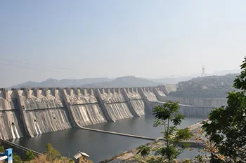
Alirajpur (also known as Ali Rajpur) is a city and a municipality in Alirajpur district in the state of Madhya Pradesh, India.
Anuppur District
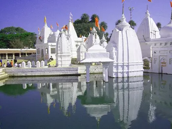
Anuppur is an administrative district of Madhya Pradesh state in central India. The district has an area of 3701 sq km, and a population of 667,155 (2001 Census)…
Ashoknagar District
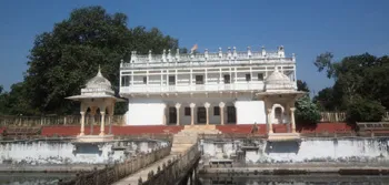
Ashoknagar is one of the 48 districts of Madhya Pradesh, situated on the north-eastern part of Malwa plateau between Parbati and the Betwa.