Kalhutti Waterfall
Kalhatty is 262 km away from Bangalore City through Mysore in Karnataka State and 100 km away from the city of Coimbatore in Tamilnadu, both are connected by air, rail and road. It is situated 2,000m above main sea level and with many water falls and rivulets. Kalhatty waterfall is a tourist land mark of Tamil Nadu with giggling brooks and rivulets galore. About 50 acres of Tea and 25 acres of coffee are under cultivation and the entire product is grown with organic manure, free from pesticides…
About Kalhutti Waterfall
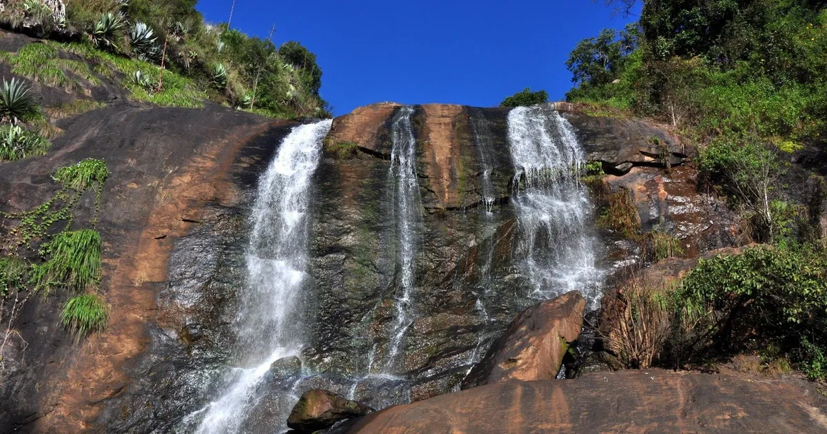
Kalhatty is 262 km away from Bangalore City through Mysore in Karnataka State and 100 km away from the city of Coimbatore in Tamilnadu, both are connected by air, rail and road. It is situated 2,000m above main sea level and with many water falls and rivulets. Kalhatty waterfall is a tourist land mark of Tamil Nadu with giggling brooks and rivulets galore.
About 50 acres of Tea and 25 acres of coffee are under cultivation and the entire product is grown with organic manure, free from pesticides and chemical fertilizers. Organic Tea and Coffee and vegetables are healthy. Other spices are also grown there like cinnamon, clove, nutmeg, pepper, cardamom, etc. Large areas which have lost forest cover are under re-plantation. There are check-dams and kilometres of water channels to provide water through sprinklers and high powered pumps, being a rain-shadow, thanks to modern technology. The Resort is set on Tea and Coffee gardens which are organically produced. There are geranium and Rose Mary cultivation which are of interest to planters.You can see herds of monkeys, needless to say a large variety of birds too. Many endangered species of flora and fauna like Sandalwood, rosewood, white cidar etc and animals like Indian Giant Squirrel, Barking Deer, Sambers, Leopards,Tiger, Elephants, Bisons etc. 220 varieties of birds are notified by the RSPB.
Climate/Weather
Winter Max 21ºC, Min 5ºC
Summer Max 25ºC, Min 10ºC
History
The most important thing that makes Ooty always a best place to visit is the climate, Eventhough the season is believed to be from April to June. It was first discovered during the British rule, by the collector of coimbatore called john Sullivan in the year 1817. The name udagamandalam is derived from the word “ottakkalmandu” which means “A village of a single stone” in Tamil language. But, afterwards people used to call this place as ooty in short form. This Region was entirely under the control of tribals called “Todas”. But, fortunately no measures were taken by any ruler to seize this region and hence it remains in its original Nature yet.
Interesting places to Visit
Avalanche :Avalanche A break in the words at Cairn Hill presents an Avalanche of views, Strangely enough of a Country about 25 km from Ooty known as the Avalanche. It is on the way to Upper-Bhavani from Ooty via Emerald Camp. The gorgeous scenery at every turn is an experience of wonder and delight. The rivers from the top of the hill at Avalanche give a magnificent sight of the Avalanche Valley and reservoir.
OOty Botanical Garden:Mr.Mc.Ivor completed the layout of Govt. Botanical Garden during the year 1857-1867. It covers an area of 22 hectares, ascending the slopes on the hill at an elevation of 2400-2500 meters above MSL. It is a treasure house of temperate flora, consisting of flowering trees, beautiful shrubs colorful lilies bulbous planets enchanting orchids, curious cacti and succulents, pleasing pteridophytes, breath taking glass house plans and charming annuals with bright colours.
Ooty Cairn Hill It is situated about 3 km on the road to Avalanche Cairn hill. It is one of the few surviving original walks. The entrance road to the bill is flanked by dense cypress trees. It is a very good picnic spot.
Ooty Children’s Park A lovely Children’s park is in the Eastern end of the lake. The lawn and the budding flowers over looking the lake water and grass filled ground will tempt every child to enjoy the atmosphere and make them play joyfully. The view of St.Thomas Church, the moving mountain railway from the railway station, the boating and rowing, the rare horse race etc. are the unique scenes in this garden.
Dodda Betta The eminent range of heights which runs North-South in the middle of the plateau, reaches its highest point at Doddabetta at about 8km East-Southeast from Ooty. Its height is 2636 meters. Doddabetta is the highest peak of the Nilgiris District. The Snow down hill (2530m), the Club hill (2448m) and the Elk hill (2466m) along with the Doddabetta, form among themselves the impressive Udhagamandalam Valley.
Glenmorgen It is about 17 km from Ooty bus stand and an ecologically rich forestry spot. There is an Electricity Board winch which carries staff from Glenmorgan view point to power house at Singara. All the 4 km of the winch travel passes through undisturbed sholas and wildlife habitat.
Ooty Horse Racing The Race Course is situated in the heart of the city. Running area about 2.4 km long and is one of the famous race courses in India. It is a very popular sport during the summer months of April, May and June.
Kathatty Water Falls It is about 13 km from Ooty on the Ooty road via the Kalhatty Ghats. Best time to visit this falls is September to November. The fall is about 40 m high. This is among the Best Places for Trekking.
Ketti Valley View Located on the road to Coonoor, which is considered to he the second largest Valley in the World. This idyllic spot is a cluster of tiny villages that extend to the plains of Coimbatore and Mysore plateau.
Ooty Lake -Boat House This lake known famously as “Ooty Lake”. The lake was constructed in 1823 - 1825 by Mr. John Sullivan, the first collector of Ooty. A wide ran 01 Boats like Pedal Boat Row Boat Aqua Bike etc are available and dancing Cars, Mini Train are added attractions here.
Tiger Hill East of Ooty town on the lower lap of Doddabetta peak lies the picturesque spot of Tiger Hill. A trek of about 3 km leads to the spot where also situated one of the drinking Water reservoirs in the town. An almost closed cave in the vicinity is associated with religious legends.
Upper Bhavani It is about 60 km from Ooty, 10 km from Korakundah and about 20 km from Avalanche. This is Naturalist’s paradise. The area is rich with undisturbed wild habitat. From Bhangithappal via Sispera one can trek to Silent Valley.
Wenlock Downs A vast expanse of understanding landscape offering Gymkhana Club, the Government Sheep Farm and Hindustan Photo Films Company besides pleasure of long stroll on quiet road.
Western Catchment It is about 20 Km 12 Mile from Parsons Valley. It consists of, Rolling Grassy downs interspersed with temperature sholas occupying depression and valleys. The landscape is extremely picturesque.
Nearest Visiting places
Kotagiri which is about 30 km. east of Udhagamandalam, 23 km. from Coonoor and 33 km. from Mettupalayam is one of the oldest and the largest of the hill stations. It is situated at a height of 6511’ above the mean sea level and it possesses an agreeable climate among the hill stations of the district. It is protected by the Doddabetta range from the violent southwest monsoon and is not affected by mists which are so common at Coonoor. The lower elevation of the place makes it warmer than Udhagamandalam. These advantages in the climate make the station a fine health resort. Kotagiri stands at the head of a fine ravine running down towards Mettupalayam.
Hotels/Lodge/Accommodation
Accommodation near Kalhutti Waterfall in the nearest town includes budget lodges, guesthouses, and forest rest houses. Book ahead on weekends.
Help Line/Phone Number
Police Station:
Armed Reserve Police Camp
, Pudumund, Ooty (Ootacamund) (Udhagamandalam), The Nilgiris, Tamil Nadu
Thondamuthur Police Station
Coimbatore, Tamil Nadu- 0422 2617258
Nearest Hospital:
Ganga Hospital
313, Mettupalayam Road, Alagesan Rd No. 2, Saibaba Koil, Coimbatore, Coimbatore, Tamil Nadu 641 043- 0422 2485000
KG Hospital
Coimbatore, Coimbatore, Tamil Nadu- 0422 2212121
Sheela Hospitals
46, Coimbatore, Coimbatore, Tamil Nadu? - 0422 2498381
Vikram Hospital And Ent Research Institute
Venkatasamy Rd, R.S. Puram, Coimbatore, Coimbatore, Tamil Nadu- 0422 2550633
Location info
-
**Address:**Ooty, Ooty District Tamil Nadu,,India
-
**District:**Nilgiri District
-
**Nearest City:**Coimbatore
-
**Best time to visit:**Through the year
How to reach Kalhutti Waterfall
-
Nearest Railway Station: Ooty
-
**Nearest Airport:**Coimbatore, 100 km
**Road Transport:**Ooty is well connected by good roads. It is 535 km from Chennai (via Salem), 89 km from Coimbatore, 18 km from Coonoor (via Gudalur), 155 km from Mysore, 187 km from Calicut, 290 km from Bangalore, 281 km from Kochi (via Coimbatore and Palakkad), 236 km from Kodaikanal (via Coimbatore and Palani)
Nearest petrol pump
- Petrol Pump : Ooty
Best time to visit Kalhutti Waterfall
Post-monsoon (October–February) when the waterfall is at its fullest with the most spectacular flow. Early morning (7–9 AM) offers the best light for photography. Avoid visiting during heavy monsoon when water levels are dangerously high.
Timings & opening hours
Best visited during daylight hours (7:00 AM–5:00 PM). The waterfall is most accessible during the dry season (post-monsoon to early summer). Access may be restricted during heavy monsoon due to dangerous water levels.
Entry fee & tickets
Entry fee: INR 10–20 per person. Parking: INR 20–50 for vehicles. Some waterfalls within forest reserves or tourism complexes may have combined entry tickets.
Duration needed
1–2 hours including the walk to the waterfall and time spent enjoying the scenery. If trekking from a farther distance, allow 3–4 hours round trip. A visit combining nearby attractions may take half a day.
Safety tips
DO NOT swim or bathe directly under the waterfall — strong currents and submerged rocks pose serious danger. Slippery rocks near the waterfall are extremely hazardous. Stay behind safety barriers. Watch for leeches during monsoon. Avoid visiting after dark. Follow forest department guidelines.
Things to carry
- Change of Clothes: You will likely get wet.
- Waterproof Bag: Protect phone, camera, and wallet.
- Comfortable Footwear with Grip: Rocks are slippery.
- Towel: For drying off.
- Insect Repellent: Waterfall areas have mosquitoes.
Nearest airport, railway & bus
Nearest airport: Madurai International Airport (IXM) for southern waterfalls, Coimbatore International Airport (CJB) for western, Salem Airport (SXV) for northern. Nearest railway station: the nearest station in the closest town. By road: most waterfalls are approachable by bus and taxi.
Mobile network coverage
Airtel, Jio, BSNL, and Vi all provide coverage across Tamil Nadu. 4G is reliable in Chennai, Coimbatore, Madurai, and along major highways. Coverage may be weaker in remote sections of the Western Ghats, deep forest reserves, and certain rural interior areas. Free Wi-Fi is widely available in hotels and cafes in urban areas.
Food & restaurants nearby
Near Kalhutti Waterfall, local food stalls offer Tamil Nadu snacks and refreshments. Visitors can enjoy fresh coconut water, roasted peanuts, bhajji, and seasonal fruits from nearby vendors. For full meals, nearby towns have restaurants serving traditional South Indian dishes like idli, dosa, rice meals, and curries. Packing a picnic is popular for families visiting the falls.
Things to do at Kalhutti Waterfall
Enjoy the spectacular view of water cascading down the rock face, especially impressive during the post-monsoon season. Take photographs of the waterfall and surrounding forest landscape. Walk on the designated trails around the waterfall to appreciate the full scale of the cascade.
Things to visit & highlights
The main waterfall cascade with its pool at the base. The surrounding forest landscape with its rich biodiversity. Viewpoints along the approach trail offering different perspectives of the waterfall. Nearby streams and rock formations.
Frequently asked questions
When is the best time to visit Kalhutti Waterfall? Post-monsoon season (October–February) when the waterfall is at its fullest. Early morning offers the best lighting for photography.
Is swimming safe at Kalhutti Waterfall? Swimming is generally not recommended due to strong currents and submerged rocks. Some areas with gentle pools may be safe for wading — check locally.
How difficult is the trek to Kalhutti Waterfall? The walk varies from an easy 5–15 minute stroll to a moderate 20–30 minute trek depending on the specific waterfall. Wear comfortable walking shoes.
Accessibility
Accessibility information is not currently available for this site. Contact the venue directly or check with your accommodation for the latest accessibility details.
Rules & restrictions
Standard visitor rules apply. Check locally for any specific restrictions at this site.
Best photography spots
The best photography spots are typically during the golden hours (early morning and late afternoon). Scout the location first to identify the best angles, and consider the direction of light at different times of day.
Quick facts
- Type: Tourist Attraction
- State: Tamilnadu
- Category: Waterfall
Visitor information
Please check locally for current visitor information.
Map & location view
This section is being updated and will be available shortly.
Photo gallery of Kalhutti Waterfall
Video gallery
Related destinations
Agasthiar Waterfall
Agasthiar Falls which is just 4 kms uphill from Papnasam where you find a wonderful waterfalls where you have water falling around 365 days. Papanasam Temple, a…
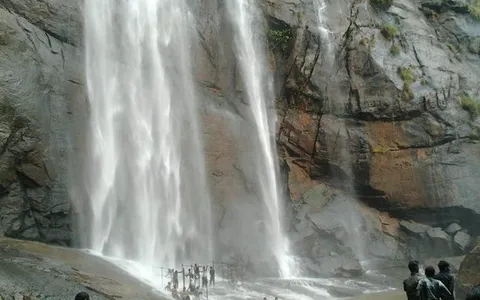
Agaya Gangai Waterfalls
Agaya Gangai waterfalls is located in Kolli Hills of the Eastern Ghats. Panchanathi, a jungle stream cascades down as the Agaya Gangai (En:Ganges of Sky), near the…
Amirthi Waterfall
Amirthi Forest Reserve, located approximately 25 kilometers south of Vellore in Tamil Nadu, is a notable destination for nature enthusiasts. The reserve encompasses…