Vattakottai Fort
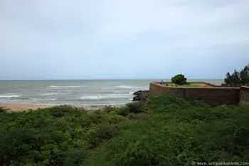
Vattakottai Fort is one of the many forts and monuments that are erected across India. It is a symbol of the military history of India, which was formerly a Dutch and then a British colony. Vattakottai Fort is a specially erected fort on the sea coastline on the southern tip of India. Vattakottai Fort is set up as the southern most sea coast defense point by the Dutch. This fort was constructed under the command of Captain De Lannoy. Vattakottai Fort is made out of stone and it is a major…
About Vattakottai Fort
Vattakottai Fort is one of the many forts and monuments that are erected across India. It is a symbol of the military history of India, which was formerly a Dutch and then a British colony. Vattakottai Fort is a specially erected fort on the sea coastline on the southern tip of India. Vattakottai Fort is set up as the southern most sea coast defense point by the Dutch. This fort was constructed under the command of Captain De Lannoy. Vattakottai Fort is made out of stone and it is a major tourist attraction today. Vattakottai Fort is also famous for the black sand beaches that is situated across its coast.
Vattakottai Fort is a seaside fort near Kanyakumari, the southern tip of India. It was built in the 18th century as a coastal defence-fortification and barracks in the erstwhile Travancore kingdom.
It was constructed under the supervision of Captain Eustachius De Lannoy, an ex-Dutch naval officer of the VOC, who became commander of the Travancore army (the very army that defeated him in the Battle of Colachel) in the 18th century, after he earned the trust of the Travancore King Marthanda Varma. De Lannoy constructed Vattakottai, as part of the defence-fortifications he undertook throughout Travancore.
Interesting places to Visit
Kanyakumari Beach: The Kanyakumari beach with multi-colored sand and rocky shoreline is definitely one of the most beautiful beaches in south India and offers a great change from all other beaches. The waves that hit the shore are quite strong and frequent, that means that one does not get to enjoy a step into the shallow water or a sea bath.
Vivekananda Memorial Rock It is about 500 meters away from mainland**.** This memorial stands on one of two rocks separated by about 70 meters**.** It was built in 1970. This memorial is dedicated to Swami Vivekananda, the greatest social reformer. Swamy Vivekananda was supposed to have meditated on the rock where the memorial stands today. A meditation hall is also attached with the memorial.
Gandhi Mandapam :Not far from the Kumari Amman Temple is the Gandhi Mandapam, constructed at the spot where the urn containing the ashes of Mahatma Gandhi was kept for public view before a portion of its contents was immersed in the three seas. It resembles an Oriyan temple and was designed so that on Gandhiji’s birthday (2nd October), the sun’s rays fall on the place where his ashes were kept.
Hotels/Lodge/Accommodation
Hotel Singaar in Kanyakumari
Hotel Sea View in Kanyakumari
Hotel Samudra in Kanyakumari
Hotel Trisea in Kanyakumari
Help Line/Phone Number
Police Station:
Kanyakumari Police Station Phone:246224
Asaripallam Police Station
Nagercoil, Kanyakumari, Tamil Nadu
Write a review
Office Of The Superintendent Of Police
Nagercoil, Kanyakumari, Tamil Nadu
Kottar Police Station
Nagercoil, Kanyakumari, Tamil Nadu
Nearest Hospital:
CSI Hospital: 222222
Vijayakumar Hospital: 275045
Abdul Kadher Hospital: 240804
Catherine Booth Hospital: 275516
Dr. Kumarsamy Health Center: 270636
Kumaran Nursing Home: 231418
Irudhayams Hospital: 241561
Bedesta Hospital: 232233
Jeyasekhran Hospital: 271620
Krishnakumar Hospital: 230021
J. Mathias Hospital: 223137
Manju Nursing Home: 273849
Holy Cross Hospital: 230897
Moses Mathias Hospital: 232601
Moris Mathias Hospital: 276009
The Ellora caves, locally known as ‘Verul Leni’ is located on the Aurangabad-Chalisgaon road at a distance of 30 km north-northwest of Aurangabad, the district headquarters. The Ellora caves is one of the World Heritage Sites in India. The Elora caves are one of the wonders of the time and speak volumes about the excellent craftsmanship of the Ellora artists, sculptors and painters. The structures at Ellora caves are not creation of a particular period but were built over a long period of time from the 6th century AD to 10th century. The structures at Ellora comprise of Buddhist, Hindu and Jain cave temples and monasteries……more
Jaikwadi dam, also known as Nath Sagar is located near Paithan.It is about 50 km from Aurangabad, built on river Godavari and about 110 km from Ahmednagar. Its area is 1300 km². It supplies water to Aurangabad City and generates power.The power station is at the foot of dam and is generating 12 MW power with reversible type generator.The Jaikwadi Dam supplies water to Aurangabad City and generates ample hydroelectric power……more
Copyright 2016 HolidayLandmark All rights reserved
Location info
-
**Address:**Vattakottai Fort Kanyakumari
-
District: Kanyakumari
-
Nearest City: Kanyakumari
-
Best time to visit: Throughout the Year
Climate & weather
With the tropic climate, Kanyakumari has April to June the hottest with temperature reaching out to maximum 350C. November to February is the coolest period with temperature hovering around 210C. Northeast Monsoon brings gentle sweep of rains between October and December.
History of Vattakottai Fort
It was constructed under the supervision of Captain Eustachius De Lannoy during the reign of Mathandavarma (1729-58). The fort is made of granite blocks and, today, a part of the fort extends into the sea. It is a protected site under the Indian archaeological department. A major renovation of the fort was undertaken recently by the department, and the site is now a popular tourist spot. Another interesting feature near the site is a beach of black sands.
How to reach Vattakottai Fort
-
**Nearest Railway Station:**Tirunelvelli (90 kms)
-
**Nearest Airport:**Trivandrum (80kms)
-
**Road Transport:**Kanyakumari is very well connected to all the major cities in the Southern India.there are good number of buses to every cities
Best time to visit Vattakottai Fort
With the tropic climate, Kanyakumari has April to June the hottest with temperature reaching out to maximum 350C. November to February is the coolest period with temperature hovering around 210C. Northeast Monsoon brings gentle sweep of rains between October and December.
Timings & opening hours
9:00 AM to 5:00 PM daily; closed on Mondays
Entry fee & tickets
INR 25 for Indians, INR 300 for foreign nationals; additional INR 25 for camera
Duration needed
2-3 hours
Safety tips
Wear comfortable walking shoes; carry water; be cautious on steep steps and uneven surfaces; avoid climbing restricted areas
Things to carry
Comfortable walking shoes; sunscreen; hat; water bottle; camera; sunglasses
Nearby visiting places
Historical monuments, palaces, museums, and local markets within the city
Nearest airport, railway & bus
Hotel Singaar in Kanyakumari
Hotel Sea View in Kanyakumari
Hotel Samudra in Kanyakumari
Hotel Trisea in Kanyakumari
Mobile network coverage
Airtel, Jio, BSNL, and Vi all provide coverage across Madhya Pradesh. 4G is reliable in Bhopal, Indore, Gwalior, Jabalpur, and along national highways. Coverage may be weaker in deep forest areas of Kanha, Bandhavgarh, and Pench national parks. Most hotels and resorts in tourist areas offer free Wi-Fi.
Food & restaurants nearby
Forts in MP (Gwalior, Mandu, Orchha) have snack stalls and chai points near the entrance. Gwalior and Mandu have the best food options near their fort complexes. The nearest town offers traditional meals — dal bafla, poha, and kebabs.
Things to do at Vattakottai Fort
Explore the fort ramparts and bastions, visit the palace chambers and durbar halls, photograph the architecture, watch the sound and light show (if available), and enjoy panoramic views from the top.
Things to visit & highlights
Palace complex, museum (if within fort), ramparts and viewpoints, nearby temples and stepwells, and the old city area around the fort.
Nearest petrol pump
Indian Oil, Bharat Petroleum, and Hindustan Petroleum retail outlets are available in the nearest town or city. Major highways have fuel stations at regular intervals. It is advisable to fill fuel before entering remote areas, wildlife sanctuaries, and national parks where fuel stations may be limited.
Frequently asked questions
What is the history of this fort? Most MP forts date back to the medieval period, built by Rajput or Maratha rulers between the 10th and 18th centuries.
How much time is needed to explore? Typically 2-3 hours for a thorough visit.
Is there a guide available? Local guides are available at the entrance; audio guides may also be available.
Are there food facilities inside? Basic refreshment stalls are usually available; full meals are available nearby.
Accessibility
Historic forts typically have uneven stone pathways, steep staircases, and no ramps. Forts are built on elevated ground — reaching them requires a climb on foot or by vehicle to the base followed by stairs. Visitors with mobility issues may find the outer grounds and lower levels more accessible than the upper ramparts. Wear sturdy footwear and allow extra time.
Rules & restrictions
Do not climb on unstable walls or beyond marked boundaries. Some bastion platforms are partially collapsed. Graffiti and defacement are illegal. Alcohol and smoking are not permitted inside most historic sites. Drones may require permission. Large bags may be checked at the entrance. Photography is permitted but tripods may need special permission. Respect heritage rules — these monuments are protected under the Ancient Monuments and Archaeological Sites and Remains Act.
Best photography spots
The ramparts offer the best panoramic views — arrive early morning or late afternoon for golden light across the landscape. The bastions and arched windows make excellent natural frames. Wide-angle lenses capture the scale of the fortifications; telephoto lenses isolate details of the stonework and distant views. Sunset silhouettes of the fort walls against the sky are iconic.
Quick facts
- Type: Tourist Attraction
- State: Madhyapradesh
- Category: Forts
Visitor information
Please check locally for current visitor information.
Map & location view
This section is being updated and will be available shortly.
Photo gallery of Vattakottai Fort
Video gallery
Related destinations
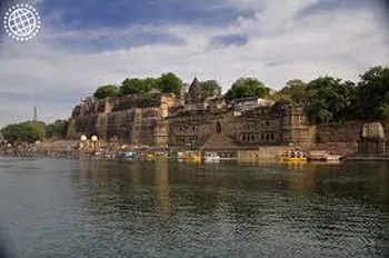
Ahilya Fort
Ahilya Fort at Maheshwar (Madhya Pradesh, India) is an experience straight out of the 18th century. Situated high above the banks of the sacred Narmada River,
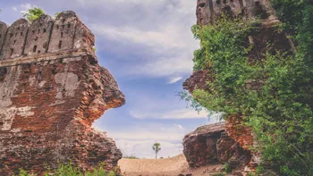
Alamparai Fort
Backwaters is very scenic- Good and safe for a swim. Local fisherman offer to take you for a ride on the boat-charges will be in the range of Rs. 200-500 for 30…
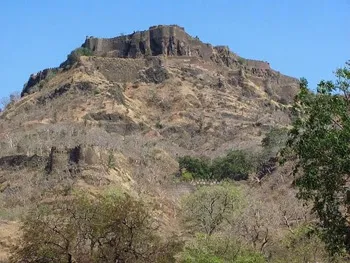
Asirgarh Fort
The Chanderi Fort is located in the small historical town of Chanderi in the Ashoknagar District of Madhya Pradesh. The Chanderi Fort is the most conspicuous…