Tiruchirapalli Rock Fort
Tiruchirappalli, situated on the banks of the river Cauvery is the fourth largest city in Tamil Nadu. It was a citadel of the early Cholas which later fell to the Pallavas. Trichy is a fine blend of tradition and modernity built around the Rock Fort. Apart from the Fort, there are several Churches, Colleges and Missions dating back to the 1760s. The town and its fort, now in Trichy were built by the Nayaks of Madurai. This city has given great Tamil scholars whose contributions to the Tamil…
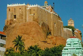
About Tiruchirapalli Rock Fort
Tiruchirappalli, situated on the banks of the river Cauvery is the fourth largest city in Tamil Nadu. It was a citadel of the early Cholas which later fell to the Pallavas. Trichy is a fine blend of tradition and modernity built around the Rock Fort. Apart from the Fort, there are several Churches, Colleges and Missions dating back to the 1760s. The town and its fort, now in Trichy were built by the Nayaks of Madurai. This city has given great Tamil scholars whose contributions to the Tamil literature have been very significant.
Tiruchirapalli Rock Fort is an historic fort and temple complex built on an ancient rock situated in the town of Tiruchirapalli in the state of Tamil Nadu in India. The 83 metre rock fort situated in the center of town is a major landmark in the town of Tiruchirapalli; it is visible from a long distance. This is also a major tourist spot among which the most famous being the Pallava era Ganesa temple and the Nayaka era fort. The fort complex has witnessed fierce battles between Madurai Nayakas and Bijapur, Carnatic and Maratha forces. The fort played an important part during the Carnatic wars, helping lay the foundations of the British Empire in India.
Interesting things to Visit
**Tiruvanaikkaval :**Jambukeswara Temple Situated 2 km east of Srirangam, this beautiful Shiva temple steals the show from the larger Ranganathaswami temple due to its excellent architectural design. The temple is named after the elephant, which is believed to have worshipped Lord Shiva here. Installed under an ancient Jambu tree, the lingam is partially submerged by water and meant to represent God incarnate as Water.
Gangaikondan Cholapuram : Gangaikonda Cholapuram is located in Udayarpalayam Taluk (also spelt as Taluka) of Perambalur district, at a distance of 100-km from Trichy. Rajendra I, a Chola ruler established Gangaikonda Cholapuram as his capital city and built a beautiful temple dedicated to Lord Shiva. Apart from the gigantic Nandi, there are some eye-catching sculptures including a dancing Ganesha, a lion-headed well and an amazing piece depicting Rajendra being crowned by Lord Shiva and Parvati.
Sri Ranganathaswami Temple : At Srirangam Situated 7km from Trichy is Srirangam, the abode of the Supreme Lord, Sri Ranganatha, the reclining form of Lord Vishnu. The temple of Ranganatha, the largest in India, is of particular veneration to all Hindus. Srirangam is also listed as one of the Nava Graha Sthalas, or temples representing the nine planets of our solar system.
Viralimalai Sanctuary : Viralimalai is a small town located about 30 km from Tiruchirappalli and 40 km from Pudukkottai. It is famous for its Murugan temple and the Peacock Park. The town is blessed with a large number of wild peacocks, which roam around the Murugan temple.
Nearest Visiting places
Samayapuram
20 km from Trichy. This is a very important place of pilgrimage, famous for its temple dedicated to the Goddess Samayapuram Mariamman. Its one of the abodes of Shakti in India. Ph 0431-2670460
Gunaseelam
24 km from Trichy on the North bank of Cauvery River. in Triuchirapalli Musiri Road. There is a Vaishnavite Temple and the name of the God is Lord Prasanna Venkateshwarar. Gunaseelam Temple is a place for worship, festivals and also for mental relief or alleviation.
Sri Kokarneswarar Temple
Vayaloor
8 km from Trichy. Located on the outskirts of Trichy. There is a small Lord Muruga Temple set in the midst of lush green vegetation.
Uthamar Koil
Uthamar Koil in Karumbanur is one of the most famous shrines in 108 Vaishnavik Padalshtalam. This temple is situated eight kilometers North of Trichy Fort Station , 4 km North of Srirangam Railway station. Here is the temple where the Lord Creator – Brahma, the lord for the well being of the universe – Vishnu and the destroyer of universe – Siva take their abode. This place is also known as “ Kadambavanam” or “Trimurthishektram”.
Hotels/Lodge/Accommodation
Ramyas Hotels Pvt Ltd
Williams Rd, Tiruchchirappalli, Tiruchirappalli, Tamil Nadu 620001 - 0431 2415128
Hotel Sangam
Collector Office Road, Tiruchirapalli, Tamil nadu 620001 - 0431 2414700
Ashby Hotel
Rockins Rd, Tiruchchirappalli, Tiruchirappalli, Tamil Nadu 620001 - 0431 2460652
Jennys Residency
3/14 Mc Donald’s Road, Tiruchirapalli, Tamil nadu 620001- 0431 2414414
Hotel Femina
Williams Rd, Tiruchchirappalli, Tiruchirappalli, Tamil Nadu - 0431 2414502
Help Line/Phone Number
Police Station:
Police Station
, Thiruchirapalli, Tiruchirappalli, Tamil Nadu
Gandhi Market Police Station
W B Road, Thiruchirapalli, Tiruchirappalli, Tamil Nadu
Srirangam Police Station
THERKU VASAL, Srirangam, Tiruchirapalli, Tiruchirappalli, Tamil Nadu
Thiruverumbur Police station
Thiruverumbur, Tiruchirappalli, Tamil Nadu- 0431 2557234
Nearest Hospital:
Institute Of Opthalmology -Joseph Eye Hospital
,Kilapudur, Tiruchirapalli, Tiruchirappalli, Tamil Nadu- 0431 2460622
Sowmanasya Hospitals Pvt Ltd
6, K K Nagar, Chinthamani, V N Nagar, Tiruchirapalli, Tamil nadu 620002 - 0431 2704304
Rangashri Child Care Clinic
New 76, Srirangam, Gandhi Road, Tiruchirapalli, Tamil nadu 620006- 0431 2435600
Kavery Medical Centre & Hospital
Thennur, Tiruchirapalli, Tamil nadu 620017- 0431 4022555
The Ellora caves, locally known as ‘Verul Leni’ is located on the Aurangabad-Chalisgaon road at a distance of 30 km north-northwest of Aurangabad, the district headquarters. The Ellora caves is one of the World Heritage Sites in India. The Elora caves are one of the wonders of the time and speak volumes about the excellent craftsmanship of the Ellora artists, sculptors and painters. The structures at Ellora caves are not creation of a particular period but were built over a long period of time from the 6th century AD to 10th century. The structures at Ellora comprise of Buddhist, Hindu and Jain cave temples and monasteries……more
Jaikwadi dam, also known as Nath Sagar is located near Paithan.It is about 50 km from Aurangabad, built on river Godavari and about 110 km from Ahmednagar. Its area is 1300 km². It supplies water to Aurangabad City and generates power.The power station is at the foot of dam and is generating 12 MW power with reversible type generator.The Jaikwadi Dam supplies water to Aurangabad City and generates ample hydroelectric power……more
Copyright 2016 HolidayLandmark All rights reserved
Location info
-
**Address:**Rock Fort ,Tiruchirapalli ,Tamil Nadu
-
District: Tiruchirapalli
-
Nearest City: Tiruchirapalli
-
Best time to visit: December-March
History of Tiruchirapalli Rock Fort
The history of the stone Rock Fort Temple is related to the history of Tiruchirappalli, which itself has a long history. The history of Trichy dates back to the centuries before the Christian era, when it was a citadel of the Chola dynasty. In the 12th century, Cholas were defeated by the Vijayanagar kings of Hampi, who also defeated the invading Muslims. The Nayaks of Madurai came to power in less than fifty years later and went on to construct the ravishing Rock Fort temple. They were the ones who firmly established Tiruchirappalli as the trading city.
How to reach Tiruchirapalli Rock Fort
-
**Nearest Railway Station:**Trichy junction
-
**Nearest Airport:**Trichy 5kms
**Road Transport:**Trichy is well connected by road with important places of South India. City bus service, tourist taxis, auto rickshaws and cycle rickshaws are available for local transportation.
Best time to visit Tiruchirapalli Rock Fort
October to March; avoid summer heat (April-June)
Timings & opening hours
9:00 AM to 5:00 PM daily; closed on Mondays
Entry fee & tickets
INR 25 for Indians, INR 300 for foreign nationals; additional INR 25 for camera
Duration needed
2-3 hours
Safety tips
Wear comfortable walking shoes; carry water; be cautious on steep steps and uneven surfaces; avoid climbing restricted areas
Things to carry
Comfortable walking shoes; sunscreen; hat; water bottle; camera; sunglasses
Nearest airport, railway & bus
Ramyas Hotels Pvt Ltd
Williams Rd, Tiruchchirappalli, Tiruchirappalli, Tamil Nadu 620001 - 0431 2415128
Hotel Sangam
Collector Office Road, Tiruchirapalli, Tamil nadu 620001 - 0431 2414700
Ashby Hotel
Rockins Rd, Tiruchchirappalli, Tiruchirappalli, Tamil Nadu 620001 - 0431 2460652
Jennys Residency
3/14 Mc Donald’s Road, Tiruchirapalli, Tamil nadu 620001- 0431 2414414
Hotel Femina
Williams Rd, Tiruchchirappalli, Tiruchirappalli, Tamil Nadu - 0431 2414502
Mobile network coverage
Airtel, Jio, BSNL, and Vi all provide coverage across Madhya Pradesh. 4G is reliable in Bhopal, Indore, Gwalior, Jabalpur, and along national highways. Coverage may be weaker in deep forest areas of Kanha, Bandhavgarh, and Pench national parks. Most hotels and resorts in tourist areas offer free Wi-Fi.
Food & restaurants nearby
Forts in MP (Gwalior, Mandu, Orchha) have snack stalls and chai points near the entrance. Gwalior and Mandu have the best food options near their fort complexes. The nearest town offers traditional meals — dal bafla, poha, and kebabs.
Things to do at Tiruchirapalli Rock Fort
Explore the fort ramparts and bastions, visit the palace chambers and durbar halls, photograph the architecture, watch the sound and light show (if available), and enjoy panoramic views from the top.
Climate & weather
Madhya Pradesh has a subtropical climate with three distinct seasons. Winter (October–March) is the best time to visit: temperatures range from 8°C to 28°C with clear skies and pleasant days — ideal for wildlife safaris and temple visits. April–June is very hot, with temperatures reaching 42–45°C in most areas. The monsoon (July–September) brings moderate to heavy rainfall, making the landscape lush green, though wildlife parks close during peak monsoon.
Nearest petrol pump
Indian Oil, Bharat Petroleum, and Hindustan Petroleum retail outlets are available in the nearest town or city. Major highways have fuel stations at regular intervals. It is advisable to fill fuel before entering remote areas, wildlife sanctuaries, and national parks where fuel stations may be limited.
Frequently asked questions
What is the history of this fort? Most MP forts date back to the medieval period, built by Rajput or Maratha rulers between the 10th and 18th centuries.
How much time is needed to explore? Typically 2-3 hours for a thorough visit.
Is there a guide available? Local guides are available at the entrance; audio guides may also be available.
Are there food facilities inside? Basic refreshment stalls are usually available; full meals are available nearby.
Accessibility
Historic forts typically have uneven stone pathways, steep staircases, and no ramps. Forts are built on elevated ground — reaching them requires a climb on foot or by vehicle to the base followed by stairs. Visitors with mobility issues may find the outer grounds and lower levels more accessible than the upper ramparts. Wear sturdy footwear and allow extra time.
Rules & restrictions
Do not climb on unstable walls or beyond marked boundaries. Some bastion platforms are partially collapsed. Graffiti and defacement are illegal. Alcohol and smoking are not permitted inside most historic sites. Drones may require permission. Large bags may be checked at the entrance. Photography is permitted but tripods may need special permission. Respect heritage rules — these monuments are protected under the Ancient Monuments and Archaeological Sites and Remains Act.
Best photography spots
The ramparts offer the best panoramic views — arrive early morning or late afternoon for golden light across the landscape. The bastions and arched windows make excellent natural frames. Wide-angle lenses capture the scale of the fortifications; telephoto lenses isolate details of the stonework and distant views. Sunset silhouettes of the fort walls against the sky are iconic.
Quick facts
- Type: Tourist Attraction
- State: Madhyapradesh
- Category: Forts
Visitor information
Please check locally for current visitor information.
Map & location view
This section is being updated and will be available shortly.
Photo gallery of Tiruchirapalli Rock Fort
Video gallery
Related destinations
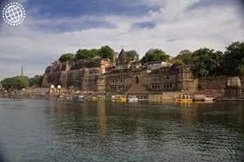
Ahilya Fort
Ahilya Fort at Maheshwar (Madhya Pradesh, India) is an experience straight out of the 18th century. Situated high above the banks of the sacred Narmada River,
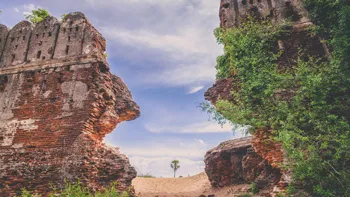
Alamparai Fort
Backwaters is very scenic- Good and safe for a swim. Local fisherman offer to take you for a ride on the boat-charges will be in the range of Rs. 200-500 for 30…
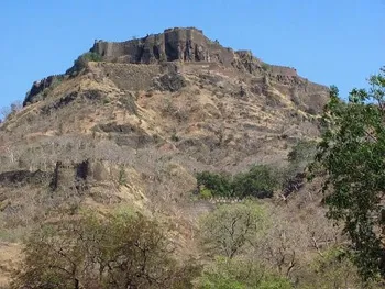
Asirgarh Fort
The Chanderi Fort is located in the small historical town of Chanderi in the Ashoknagar District of Madhya Pradesh. The Chanderi Fort is the most conspicuous…