Kemmannugundi
Bangalore -> Nelamangala (Take left to take Mangalore road) ->Channarayapatna-> Hassan -> Belur-> Chikkamaglur-> Kemmannugundi -> Hebbe Falls -> Kemmannugundi -> Bababudan Giri -> Chikkamaglur-> Belur-> Hassan
Summary
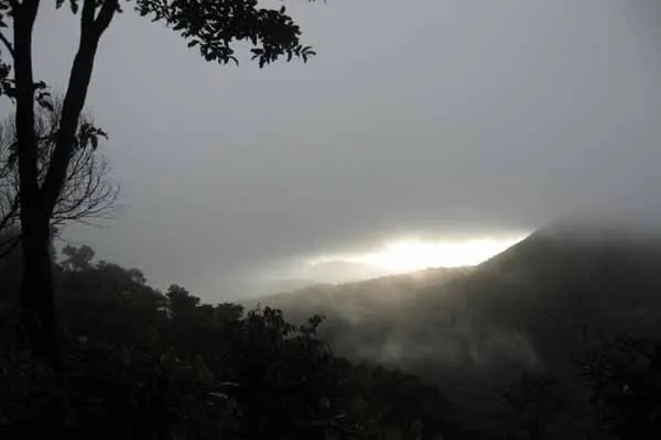
The picturesque hill station of Kemmangundi is located at a height of 1434 metres above sea level. It was the summer retreat of Krishnaraja Wodeyar IV. Ringed by the Baba Budangiri Range and blessed with silver cascades, mountain streams and lush vegetation, Kemmangundi’s beautifully laid-out ornamental gardens and enchanting mountains and valleys views are a treat to the eye. The spectacular sunset view from the Raj Bhavan is a photographer’s delight. For the adventurous at heart, Kemmangundi offers many peaks to scale and intricate jungle paths to explore.
275 Kms from Bengaluru, near Chickmagalur, Bababudangiri hills are heaven on earth in the Western Ghats . Luxuriant green grass, moss infested trees, sparkling waterfalls, rugged hills and pure air seems generously God gifted. The dense mist reduces the visibility to just a few meters. The wind almost blows you off the hill. Sometimes it appears as if the mountain has conspired with the rain and the wind and is trying to throw away the unwelcome intruders. Also the daytime temperature drastically falls from 34 C to below 10 C by nightfall.
There are very exceptional and challenging treks between Mullayanagiri, Bababudangiri and Kemmangundi. The trek from Kaimara to Mullayanagiri is steep. Mullayanagiri is the highest peak in South India standing at 1919 m. The 15 Kms trek along the ridges of the steep mountains crosses the Attigundi waterfall and concludes at Bababudangiri. One route will take you to the beautiful hill station Kemmangundi via Gali kere. This trek is about 25 Kms.
Location info
-
**Address:**300+ kms from Bangalore
-
**District:**Tarikere taluq in Chikamagalur district in West Karnataka.
-
**Nearest City:**Bangalore
-
Best time to visit: October to March.
Climate & weather
Kemmannugundi enjoys a salubrious climate all through the year. The maximum temperature here is about 28 degree C.
How to reach Kemmannugundi
-
**Nearest Railway Station:**Chikkamagalur,Tarikere. Kemmannugundi is connected by road to Chikmagalore, Bangalore and Shimoga.
-
**Nearest Airport:**Bangalore International airport
-
Road Transport:
Hotels & accommodation nearby
1.Kemman gundi, tarikere
2.Horticulture Department GuestHouse
3.Forest Guest House
4.P.W.D. Guest House
Nearest visiting places
- Belavadi
It is a big Hoysala temple, 12 km from Halebid. There are few visitors. King BIddiga converted to Hinduism under the influence of a philosopher and called himself Vishu Vardhana. At first he built this temple and defined Vishnu in it
- Sringeri
Sringeri is a monastic temple town started by Shankara, who promoted the Advaitha philosophy in the 9h century. The temple was built in the 14th century with the support of Vijayanagara
- Hebbe Falls
Hebbe Falls are situated about 10 km away from the famous hill station Kemmangundi in Karnataka, India. This waterfalls are inside a coffee estate and can be reached either by walk or four-wheeler
- Kalhatti Falls
Kalhatti Falls start at the top of the Chandra Drona Hill, from a height of 45m to flow before the Veerabhadreshwara Temple dedicated to Lord Shiva. Situated 10km from Kemmangundi, Kalahatti is about 250 km form Bangalore
- Manikyadhara Waterfall
Manikyadhara Falls is situated near Kemmangundi of Chikmagalur district. It is located on the Baba Budan Giri HIlls, which is a sacred place for both Muslims and Hindus. It is one of the main attractions of Baba Budan Giri or Dattapeeta
- Sirmane / Sirmane falls
Sirimane falls, a tributory of Tunga river which decends from the Western Ghats ranges near Sringeri in Chikmagalur District of Karnataka. Sirimane falls is one of the pretty waterfalls, located about five kilometres from Kigga, and is around 22 km away from Sringeri
- Bababudangiri Hills
Bababudangiri shrine (also known as Dattatreya Peeta or Dattatreya Peetha) is a shrine located on Bababudangiri hill in the Chikmagalur District of the state of Karnataka in India.This peak is one of the highest in Karnataka
- Gangamoola Hills
Located in the Samse Taluk of Chikmagalur district, the Gangamoola hill is surrounded by thick forests. It is the origin of three mighty rivers, the Tunga, Bhadra and Nethravathi.The highlights of the region are a Goddess Bhagavathi shrine and a Varaha image, 1.8 metres high, within a cave, which become inaccessible during the monsoons
- Horanadu Hills
Horanadu the holy city of Chickmagalur district of Karnataka, is famous for the Annapoorneshwari Temple. Dedicated to Goddess Annapurneshwari, Goddess of Food and Grains.It is believed that one who visits the temple and takes the blessing of the Deity one shall never go hungry in their life
- Kudremukh Hills
The unspoilt Kundadri hill station in Karnataka situated in Teerthahalli taluk of Shimoga, still remains one of the favorite spots for tourists keen in mountain trekking. The mountains are unexplored and one can feel the excitement in discovering new pathways to the peak
- Horanadu Temples
Horanadu the holy city of Chickmagalur district of Karnataka, is famous for the Annapoorneshwari Temple. Dedicated to Goddess Annapurneshwari, (Goddess of Food and Grains) this temple was built in 1973.It is believed that one who visits the temple and takes the blessing of the Deity one shall never go hungry in their life.
- Shringeri Temples
Situated in southwest region of Karnataka, Chikmagalur is around 200 km from the capital city Bangalore.90 km west of Chikmagalur town is Sringeri situated on the banks of river Tungabhadra. Sringeri was discovered by Sri Sankaracharya as a place where even natural animosities did not exist, as he saw a frog in labour protected from the scorching rays of the sun by a raised hood of a cobra
- Bhadra Wildlife Sanctuary
38 kms from Chikmagalur, this sanctuary is must for wildlife enthusiasts. Gaur, chital, sambar, elephants and tigers are some of the wildlife found here. This place is truely mysterious, magical and mind-blowing. The secrets of the jungle unwind as you go deep into the seemingly silent forest
- Muthodi Wildlife Sanctuary
The Muthodi Forest Reserve is one of the four main parts of the Bhadra Wild life Sanctuary, the other three being Tanikecoil, Lakkavalli and Hebbe.38 kms from Chikmagalur, this sanctuary is must for wildlife enthusiasts. Gaur, chital, sambar, elephants and tigers are some of the wildlife found here
- Kudremukh National Park
Kudremukh National Park, Karnataka is one of the most popular national parks in India. Located in Mangalore, it is surrounded by Kudremukh or the Horse Face range overlooking the Arabian Sea. The topography of Kudremukh National Park, Karnataka is marked by deep ravines and steep cliffs
Helpline & emergency contacts
-
**Police Station:**100
-
**Nearest Hospital:**Tarikere, kemman gundi
-
Society/Community Phone Number
Mobile network coverage
Airtel, Jio, BSNL, and Vi all provide coverage across Karnataka. 4G is reliable in Bangalore, Mysore, Mangalore, Hubli, and along highways. Coverage may be weaker in deep forest areas of Bandipur, Nagarhole, and certain Western Ghats sections. Most hotels, resorts, and cafes in tourist areas offer free Wi-Fi.
Food & restaurants nearby
Food options are available in the nearest town. Karnataka cuisine ranges from coastal seafood to Udupi vegetarian to Coorg’s pandi curry. Dosa, idli, bisi bele bath, and filter coffee are iconic.
Nearest petrol pump
Petrol pumps are available in the nearest town or on the approach road — check locally for the closest option.
Accessibility
Accessibility information is not currently available for this site. Contact the venue directly or check with your accommodation for the latest accessibility details.
Rules & restrictions
Standard visitor rules apply. Check locally for any specific restrictions at this site.
Best photography spots
The best photography spots are typically during the golden hours (early morning and late afternoon). Scout the location first to identify the best angles, and consider the direction of light at different times of day.
Best time to visit Kemmannugundi
October to February is the ideal trekking season in Karnataka — pleasant temperatures and clear skies. Post-monsoon (October-November) offers lush green landscapes and flowing waterfalls. March to May can be hot for trekking. Monsoon (June-September) treks are challenging with slippery trails and leeches.
Timings & opening hours
Trekking is recommended during daylight hours (6:00 AM to 5:00 PM). It is strongly advised to complete the trek and descend before sunset. Forest entry permits may be required — check with the local forest office.
Entry fee & tickets
Entry fee may apply if the trek is within a forest area or national park — typically ₹50-₹100 per person. Some trekking routes are free. Guide fees (if mandatory): ₹500-₹1500 depending on the route and group size.
Duration needed
The trek duration varies from 2-6 hours round trip depending on the route and fitness level. Moderate difficulty — suitable for beginners with reasonable fitness. Some sections may be steep. Plan for 3-5 hours including rest stops and summit time.
Safety tips
Always trek with a local guide or in a group — do not trek alone. Start early (by 6:00-7:00 AM) to avoid the midday heat and complete the trek before dark. Carry sufficient water (at least 2 litres). Wear proper trekking shoes with good grip. Watch for leeches during monsoon. Inform someone about your trek plan.
Things to carry
Trekking shoes, 2-3 litres of water, snacks/energy bars, first aid kit, insect repellent, sunscreen, hat, raincoat (monsoon), torch/flashlight, mobile phone with backup battery, whistle for emergencies, and a small backpack.
Nearest airport, railway & bus
Nearest railway station depends on location — typically in the district headquarters. Nearest airport: Kempegowda International Airport (BLR) or Mangalore International Airport (IXE). Buses to the base village are available from the nearest town.
History of Kemmannugundi
Kemmannugundi is a popular trekking destination in the Western Ghats of Karnataka, offering challenging and scenic trails through lush forests and rocky terrain. The peak/area is known for its panoramic views of the surrounding hills, valleys, and forests. The region has traditionally been home to indigenous communities who have lived in harmony with the forest for generations.
Things to do at Kemmannugundi
The primary activity is trekking to the summit/viewpoint. Along the way, enjoy the diverse flora and fauna of the Western Ghats. Bird watching and photography are rewarding. At the summit, spend time enjoying the panoramic views. Camping is permitted in designated areas on some routes.
Things to visit & highlights
The summit/viewpoint offering panoramic views of the Western Ghats, the forest trails themselves with diverse vegetation, any caves or rock formations along the route, and nearby waterfalls that can be visited after the trek.
Frequently asked questions
Do I need a guide for the trek? Hiring a local guide is strongly recommended — they know the terrain, weather patterns, and can share local knowledge. Some treks require a mandatory forest guide.
What fitness level is required? Most treks in Karnataka are moderate difficulty. A reasonable level of fitness and comfortable walking shoes are essential.
Is camping allowed? Camping may be permitted in designated areas on certain trekking routes. Check with the local forest office beforehand and carry all necessary equipment.
Quick facts
- Type: Tourist Attraction
- State: Karnataka
- Category: Trekking
Visitor information
Please check locally for current visitor information.
Map & location view
This section is being updated and will be available shortly.
Photo gallery of Kemmannugundi
Video gallery
Related destinations
Amedikallu
Amedikallu is one of the notable places to visit in Karnataka.

Agumbe Trek
Agumbe, at an altitude 826 M, is a small village in the Shimoga district. This is the same enthralling location which offered an idyllic setting for R.K Narayan's…
Amedikallu
Bangalore -Nelamangala-Kunigal-Channarayapatana-Hassan-Sakaleshpura-Shiradi-Kokkada-Dharmasthala