
Jhabua |
About: |
|
Jhabua is a predominantly tribal district located in the western part of Madhya Pradesh. It is surrounded by Panchamahal and Baroda districts of Gujrat, Banswara district of Rajsthan and Dhar and Ratlam districts of Madhya Pradesh. River Narmada forms the southern boundary of the district. The terrain is hilly, undulating typically known as "Jhabua hills topography". In this Jhabua hill topography the difference between the highest and the lowest points is varies between 20 to 50 meters. But this difference goes on increasing as we move towards south of Jhabua. In Alirajpur division which is in the south of Jhabua the areas is almost entire hilly and intersected by narrow valleys and low Vindhayan ranges covered with jungles. But most part of Jhabua is without any forest cover because of low fertility of land and soil erosion even mere existence becomes a hard problem and with the failure of rains the Bhils take to crime. Jhabua is sparsely populated area with the total population of 13.94 lakhs according to 2001 census. The district is devoid of vegetation cover except Katthiwada and other patches and is full of undulated, hilly areas; The area suffers from poor and skeletal soils with shallow to very shallow depth and erratic rainfall , high temperature .The area comes under Agroclimatic zone No. 12 namely Jhabua hills covering an area of 0.68m ha. ( 1.5 % of geographical area of MP) .The district has three distinct sub zones namely Petlawad (Malwa), Jhabua (Low rainfall) and Katthiwada (High rainfall)zones. Jhabua is a sparsely populated and predominantly tribal district located in the western part of Madhya Pradesh. In Jhabua, the district centre of "National Informatics Centre " was established in Collectorate building in the year 1989 to extend informatics services to all the Govt. Departments in the district. Since its inception, NIC district Centre Jhabua is providing the required support services in design, development & implementation of appropriate MIS/Databases at the district level , training, assistance in electronic communication and processing of various data etc. The NIC district Centre Jhabua has imparted training to many employees of various user departments in the district. The Centre is providing necessary support and technical guidance to Govt. departments having their own computers. The district has a total population of 13,94,561 where 7,02,053 are males and 6,92,508 are females.Jhabua is a predominantly Adivasi district, and suffers from high rates of illiteracy and poverty. Almost half of the population lives below the poverty line. The Bhil and Bhilala peoples inhabit the interior of the district. The Bhils celebrate Bhagoria, a tribal festival which coincides with Holi, with great fervour. Jhabua's undulating and uneven surface does not support much agricultural productivity. The district is famous for the handicraft industry which is the main source of income for the local inhabitants. There are also many industries in the district. The district has some beautiful tourist destinations. A few of them are Bhabhara, Deojhiri,and Kathiwada.The great freedom fighter Chandra Shekhar Azad was born and spent his childhood in a village called Bhavra (now Azadnagar) in Jhabua district and arjunpal is also a freedom fighter belong bhabhra. Today the Jhabua district is divided into two parts (from May 2008) Alirajpur & Jhabua. Aliarajpur, Jobat, Udaigarh, Bhabra, Sondawa & Katthiwada are the 6 blocks of new district Alirajpur. Jhabua District now consist of Habua, Meghnagar, Ranapur, Rama, Thandla, Petlawad blocks. |
Location info: |
| Jhabua forms the western-most district of Madhya Pradesh with its headquarters located at Jhabua town. The district is surrounded by Panchamahal and Baroda districts of Gujarat, Banswara district of Rajsthan and Dhar and Ratlam districts of Madhya Pradesh. Narmada forms the southern boundary of the district. The district forms a part of Indore division. Jhabua district is predominantly inhabited by tribals. |
Climate/Weather: |
|
Climate is generally moderate and seasons are well defined. The summers are hot , winters are short and the monsoon season is generally pleasant. The average rainfall in the district is about 800mm. Most of the rainfall occurs in monsoon season while there is also a little of rainfall in winter season. |
History of Jhabua |
|
Jhabua was the capital of a princely state of the British Raj's Central India, in the Bhopawar agency. Its area, with the dependency of Rutanmal, was approx 1776 square miles. After India's independence in 1947, its rulers acceded to India, and Jhabua became part of the newly created Madhya Bharat state, which in 1956 was merged into Madhya Pradesh. Bhavara (now, Azad Nagar) Region of Jhabua district is birth place of great freedom fighter Chandrashekhar Azad. |
Educational Institutions in Jhabua: |
|
Law Collegesin Jhabua, Madhya Pradeshoffering Legal Education including Civil Law, Criminal Law, Business Law, Forensic Law etc. and courses such as Bachelor of Law (BL), Master of Law (ML) etc: Government Law College, Jhabua Government College, Jhabua Distance Education / Open University Scheme of Indian Universities offering courses such as MA, MSc, MBA, MCA etc: Government PG College, Jhabua |
Langauges: |
| Hindi, Bhili and Bhilali. |
Culture: |
|
Inhabited by the tenacious and hardworking tribes - the Bhils and Bhilalas, the district is highly drought-prone and degraded waste lands form the face for Jhabua. Although almost half of the population lives below the poverty line, the tribals still revel in their traditional colorful festivities and continue to make merry on the occasions like "Bhagoriya". The women make lovely ethnic items including bamboo products, doll, bead-jewellery and other items that have for long decorated the living rooms all over the country. The men have since ages adorned "Teer-Kamthi", the bow and arrow, which has been their symbol of chivalry and self defence. Bows & Arrows are made in all the blocks of the district.The bhils use them for their self-defense.The artistic bows & arrows shown in the picture are used for interior decoration and as gift items.Chomal,traditionally used as cushion to carry matkas on the head,or more decorated ones in marriages & other auspicious ceremonies. Today well decorated chomals, with beautiful colors , form the part of drawing rooms of rich & famous. Bandi (Half coat) it is the traditional suit of tribals of this district.It was very much liked by the former prime minister Mr.Rajiv Gandhi, during his Jhabua visit.Modern Youth also like the bandi very much.Galsan mala (bead necklace) is traditionally worn by the tribal women.They come in very beautiful colors. Now bead necklaces are made keeping in mind the latest designs & fashions.Undoubtedly today they are the first choice of all the women. Block Prints are made by the tribal artisan of the district.Artisans use different types of natural dyes & blocks in different designs to print the clothes.The block prints are used in household purpose & other daily use clothes.The block prints are so attractive & durable that it has caught the attention of housewives.Now used mainly as bed covers, table clothes,curtains & dress wear |
How to reach Jhabua? |
|
Nearest Railway Station: Nearest railway station Megh Nagar. Distance Megh Nagar to Jhabua: 16 Km. |
|
Nearest Airport: Nearest Airport Indore (150km) is connected to Bombay by IndianAirlines Continental Airways also operates flights from Bombay to Indore. |
|
Road Transport: Good Motorable roads connect Jhabua with Ahmedabad (250 kms),Bhopal (344 kms), Delhi (750kms), Indore (147kms) etc.Regular bus services connect Jhabua with Indore, Bhopal, Ratlam, Mandu, Dhar etc. |
Tourist Attraction of Jhabua: |
|
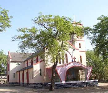
Bhabhara: It is a village in jobat Tahsil lying at a distance of 32 km. West-north-west of Jobat on Jobat-Dohad Road. The famous freedom fighter, Chandra Shekhar Azad is said to have been born here. Now a small memorial has been erected here in this honour. The population of Bhabra was 3,098 in 1991. It is the headquarters of the Tahsil and Tribal Development Block. It has a dispensary a branch post office, a co-operative society, a middle school and a police station house. Deojhiri: A village of 320 souls in 1971, Deojhiri is 8 km. North-east of Jhabua on Ahmedabad-Indore State Highway No.22. It lies 1 km. To the west of the road, on Sunar river. As the name of the village denotes there is an ancient temple of Lord Shiva( Deo, a diety) and jhiri or a perennial spring. The spring has been built up into a kund. A samadhi of some religious is held on Baisakh Poornima, which falls mostly in the month of april according to Gregarian calender. The village have a panchayat bhawan , a primary school and sub-health centre. Kathiwada: Kathiwara is a small village among the beautiful environs of the North-Western off-shoot of the Vindhyachal. Formerly it was the seat of a petty state, now forming part of Alirajpur Tahsil, it is about 32 km. Due north-west of Alirajpur but the bus router leads via Borjhar, Bhabra and Bhajina and measures 60 km. Since the place lies on a hieght and receives a higher rainfall, it is generally cooler than the northern parts of the District. There are the development Block, Nyaya Panchayat, Sub range Office and higher secondary School. Lakhmani Gram: Lakhmani gram is a small village located on the bank of the Sukar river. It is accessible 8 km. East of Alirajpur on Kukshi road. There is a newly constructed jain temple in this village. The village come in to prominace among archeologists, nistorians and lovers of plastic art in about 1925 when the jain images ensnrined in this temple were unearthed accidentally from a field . The images have been carved out of milky-white marble and black marble called sanmoosa. In addition images of Hindu doities and remains of Hindu temple have been found. The scultures belong to the style of 10th-11th century. Since the recovery of the images the place is held as a tirth ( Holy place) and an annual fair is held. There is a gram panchayat and a primary school at the village. Malwai: Malwai is located 5 km. South of Alirajpur on the unmetalled road leading to Alirajpur and Walpur, before it bifurcates for Umrali. It settles on the northern foothills of the Vindhyachal Range in Alirajpur Tahsil. There is am ancient but small shiva temple in ruinous condition. The platform is rectangular but several conical columns rising from the base reach up to the kalash , which has fallen. The front portion of the cone has also fallen. Many beautiful carvings and images in the row of Penals are Visible whicn can be assigned to 12th-13th century. Amkhut: Amkhut village is 24 km. North-west of Alirajpur on Alirajpur-Kathiwara Fairweather Road. The place is located among the forests of the Vindhachal range. It enjoys a natural beauty and cool climate . The Canadian Christian Mission established its centre here ami amidst the tribal villages. The village has a gram panchayat, a police out post, a primary school and rest house maintained by the Forest Department. The village has been electrified. |
Hotels/Lodge/Accommodation in Jhabua: |
|
Tourist Hotel: |
.jpg)
.jpg)
.jpg)
.jpg)