
Tungabhadra River
Tungabhadra River |
About: |
| The Tungabhadra River is a revered river in southern India that flows through the states of Karnataka and Andhra Pradesh before merging with the larger Krishna River in Andhra Pradesh. It is the principal tributary of the Krishna River. In the ancient Indian epic, the *Ramayana*, the Tungabhadra River was referred to as the Pampa (although a different river in Kerala now carries that name).
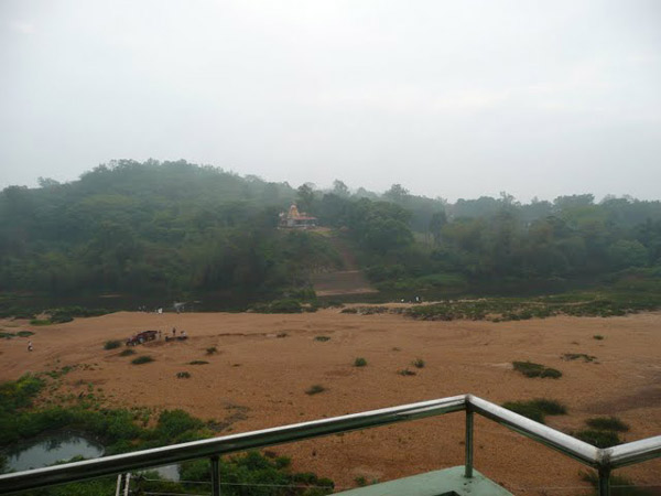
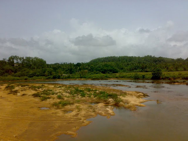
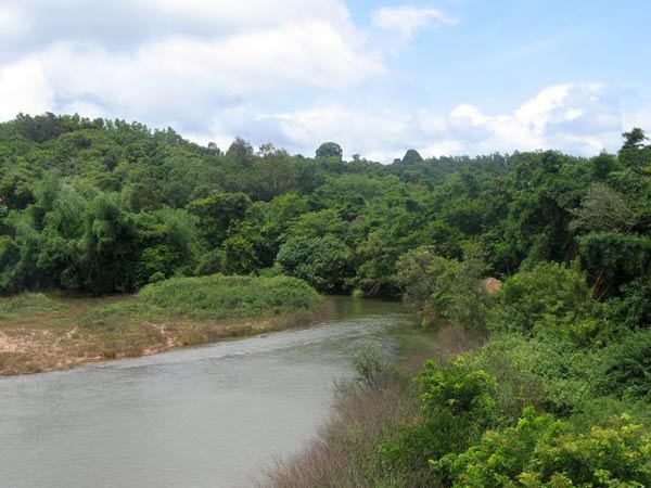
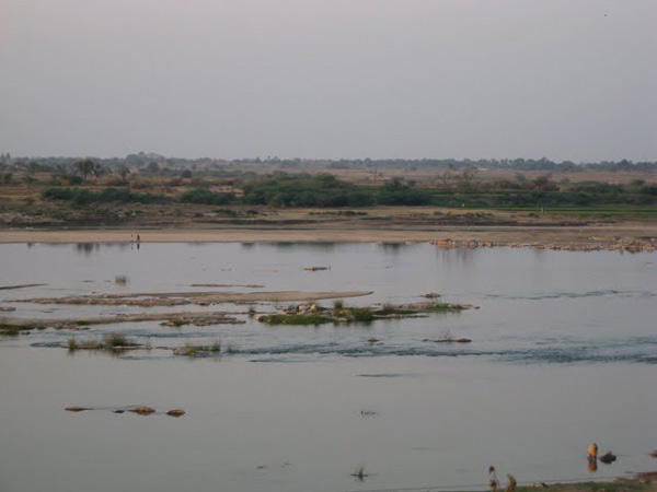
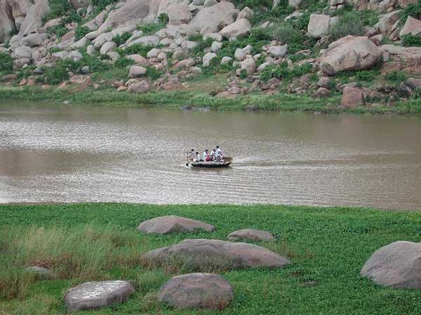
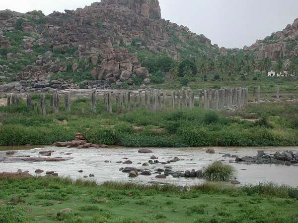
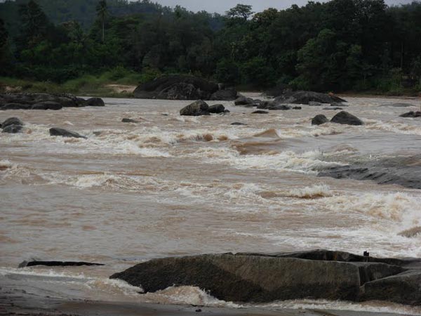
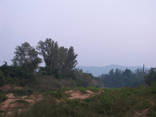
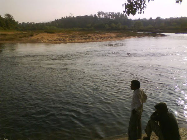
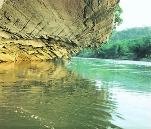
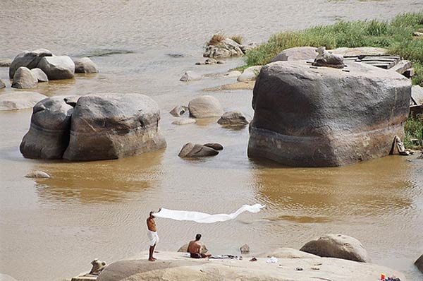
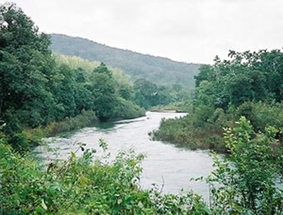
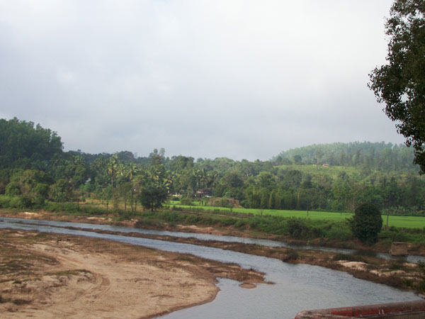
The Tungabhadra River originates from the confluence of the Tunga and Bhadra rivers, both of which descend from the eastern slopes of the Western Ghats in Karnataka. From there, it flows in a northeasterly direction, cutting through rugged terrain characterized by boulder-strewn ridges that rise from the ancient granite formations of the Deccan Plateau. This region of the river is particularly scenic and wild. The landscape around the Tungabhadra is dominated by massive piles of granite in hues of grey, ochre, and pink. The river has carved its way through the softer rock layers of the Hampi landscape, creating a narrow gorge where granite hills hem in the river, forming a dramatic ravine. Amidst this breathtaking scenery lie the ruins of Vijayanagara and Hampi, once the heart of the powerful Vijayanagara Empire. Overlooking the sacred Tungabhadra, these ruins create a landscape steeped in myth and tradition, with sacred associations to numerous deities in Indian mythology. The granite outcrops slowly disappear as the river flows south and the land opens into a long, broad plain ending at the rising slopes of the Sandur hills, rich in iron and manganese, beyond which is the town of Hosapete. A dam, the Tungabhadra Dam, was constructed at Hosapete in the middle of the 20th century to harness the river water, aiding the growth of agriculture and industry in this region. The Tungabhadra River then flows east, joining the Krishna in the Andhra Pradesh state. From here the Krishna continues east to empty into the Bay of Bengal. x The wedge of land that lies north of the Tungabhadra River, between the Tungabhadra and the Krishna, is known as the Raichur Doab. Tungabhadra is a major river in the south Indian peninsula. Hampi is located on the south bank somewhere in the middle of this river's path. In this area the river takes a number of twists are turns owing to the rocky terrain. The river has immense significance in forming the political & religious history of Hampi. The river along with along with the boulder-strewn hills formed the northern barrier of the capital. It was not easy for an invading army cross the river without the fate of a sure defeat. The river is in fact formed by the union of two rivers Tunga and Bhadra and hence the name. Both Tunga & Bhadra Rivers are originated on the eastern slops of the Western Ghats. Tungabhadra flows in a more or less northwest direction before joining the eastern river Krishna. The Krishna River finally ends into the Bay of Bengal. In modern India a huge dam and hydroelectric project is constructed across Tungabhadra (about 20 kilometer southwest of Hampi), curtailing the original vigor of the river in this part. The Vijayanagara kings took advantage of the river by constructing a host of irrigation canals and aqueducts. A highly networked water supply system fed the manmade water bodies in the urban core of the palace area. Many of the ancient canals are still in use to irrigate the surrounding agriculture fields. |
Location info: |
| Address: The Tungabhadra River flows through the states of Karnataka and Andhra Pradesh, merging with the Krishna River in Andhra Pradesh. It passes near significant landmarks like the ancient city of Hampi, a UNESCO World Heritage site. |
| District: Ballari (Hampi is located in Ballari District, Karnataka) |
| Nearest City: Hospet (Hospet is the nearest major town, while Hampi is a historical village near the river.) |
| Best time to visit: The best time to visit the Tungabhadra River and the surrounding areas is from October to February, during the cooler, more pleasant months when the weather is ideal for exploring the ruins and the scenic river landscapes. |
Climate/Weather: |
| The region around the Tungabhadra River, especially near Hampi, experiences a tropical climate with three distinct seasons: |
| Summer (March to June): Summers are hot and dry, with temperatures often soaring above 35°C (95°F), making it less ideal for outdoor activities. Daytime temperatures can sometimes exceed 40°C (104°F). |
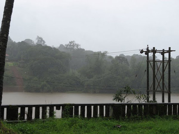
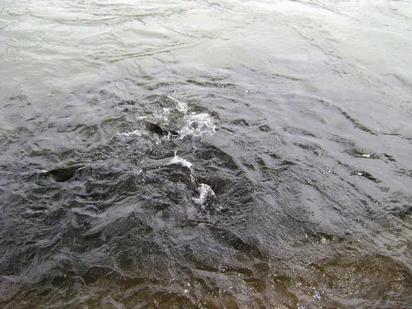
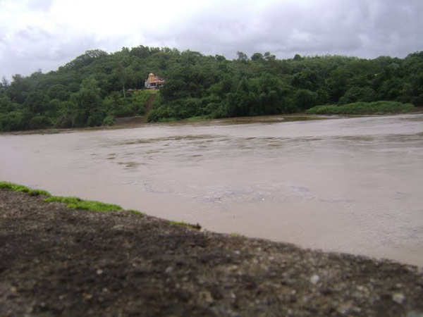
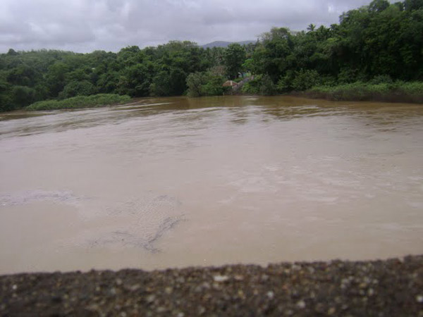
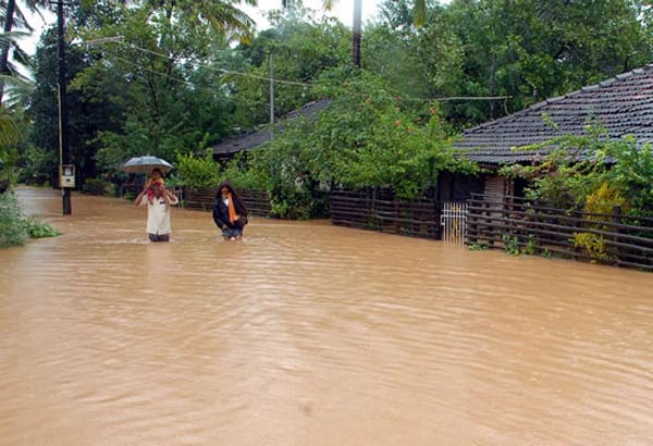
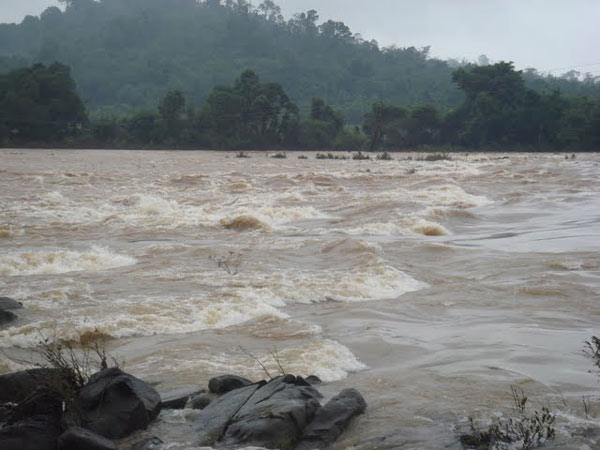
| Monsoon (July to September): The region receives moderate to heavy rainfall during the monsoon season, with the river swelling due to rain in the Western Ghats. While the landscape turns lush and green, outdoor exploration can be challenging due to frequent rain showers. |
| Winter (October to February): Winters are the most pleasant time to visit, with cool and comfortable temperatures ranging from 15°C to 28°C (59°F to 82°F). The weather is ideal for exploring the ruins, temples, and river landscapes. |
History: |
| The Tungabhadra River has played a significant role in the history of southern India, especially as the lifeline of the powerful Vijayanagara Empire. The river's strategic importance made it a natural boundary between kingdoms, and it is intertwined with ancient Indian mythology and religious traditions. |
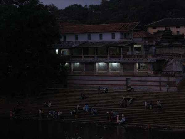
| In the ancient epic *Ramayana*, the Tungabhadra River was known as Pampa. The river is associated with several sacred legends and deities, adding to its importance in Hindu culture. It is believed that Lord Rama and Hanuman met near this river, and several pilgrimage sites are found along its banks. |
| During the 14th to 16th centuries, the river was central to the development of the **Vijayanagara Empire**, whose capital was the prosperous city of Hampi, situated along its banks. The city flourished as a hub of culture, art, and architecture. The ruins of Hampi, now a UNESCO World Heritage site, stand testament to the grandeur of this ancient kingdom. |
| In more recent history, the Tungabhadra River has remained crucial for agriculture and irrigation in the region, with the construction of the Tungabhadra Dam in the mid-20th century, which transformed the local economy by providing water resources for farming and generating hydroelectric power. |
Interesting things to do: |
|
Interesting things to Visit: |
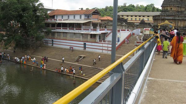
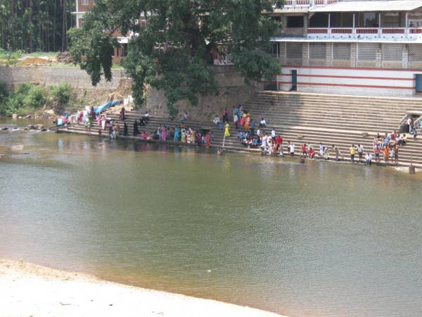
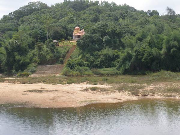
| Temples:- 108 Shiva lingas carved at the bank of the river. There are a number of ancient and holy sites on the banks of the Tungabhadra River. At Harihara there is a temple dedicated to Harihareshwara. Surrounding the modern town of Hampi, are the ruins of Vijayanagara, the site of the powerful Vijayanagara Empire's capital city and now a World Heritage Site. The site, including the Vijayanagara temple complex ruins, are being restored. Alampur, on the left - northern bank of the river, known as Dakshina Kashi in Mahaboobnagar Dist. nbout 25 km from Kurnool is another important place, wherein the Early Chalukyas built a cluster of temples. The Nava Brahma Temples complex is one of the earliest models of temple architecture in India. Jogulamba is the presiding deity. The Moola Brindavana of Guru Raghavendra is located on banks of Tungabhadra at Mantralayam.
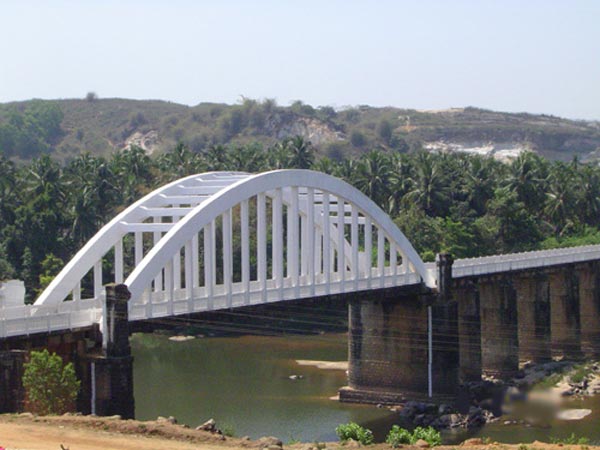
Dams:- About 15 km downstream from Shimoga at Gajanur across the River Tunga a dam is constructed. At Lakkavalli about 15 km upstream of Bhadravati across the Bhadra a dam is constructed. Both are multipurpose dams and irrigate lands in Shimoga, Chikkamagalur, Davanagere and Haveri. Dam on River in Hosapete, Bellary Dist TungaBhadra dam is constructed across river Tungabhadra, a tributary of River Krishna. The dam is built near the town of Hosapete in Karnataka. It is considered as a multipurpose dam or project. Its storage capacity is 135 Tmcft. Owing to siltation the capacity has been reduced by about 30 Tmcft. If there is seasonal and late rains, the dam distributes the estimated quantity of 235 Tmcft. The dam is filled as when the water is let into the cnals during the rainy season. The main architect of the dam was Dr. Thirumalai Iyengar, an engineer from Madras. As Tungabhadra Dam was constructed by him, so a general purpose hall in this place was named after him. Multipurpose dams are the one's which help in generation of electricity, irrigation of land, Prevention and control of floods etc. It has become a picnic or tourist spot over the years. The dam is near to world famous heritage site Hampi. At Sunkesula, about 25 km upstream from Kurnool a barrage was constructed at about 1860s by the British Engineer, hailed as Bhagiratha for Andhras, Sir Arthur Cotton. Originally was intended to be used for navigation also. As the road and rail transportation increased it is now an irrigation project, for Kurnool and Kadapa Districts, carrying water through the renowned K.C.Canal.(Kurnool - Cuddapah canal- Till recently Kadapa was spelled "Cuddapah"). Recently the barrage is replaced by the Kotla Vijayabhaskara Reddy Project- a permanent dam. It impounds about 15,000,000,000 cubic feet (0.42 km3) of water and irrigates about 300,000 acres (1,200 km2) of land in Kurnool and Kadapa districts. |
Mobile range info: |
| Mobile network coverage around the Tungabhadra River, especially in popular areas like Hampi, is generally good. Major telecom providers such as Jio, Airtel, Vodafone, and BSNL offer decent connectivity in the towns of Hospet and Hampi. However, as you move further into rural or remote areas along the riverbanks and nearby hills, the network might become spotty or unavailable in certain stretches. |
| If you plan to explore the more isolated parts of the river or engage in hiking or nature activities around the Tungabhadra River, it's advisable to download maps and necessary information in advance and inform someone of your itinerary, as connectivity may be unreliable in those areas. |
How to reach? |
| Nearest Railway Station: The nearest railway station to the Tungabhadra River and Hampi is Hospet Junction (HPT), which is about 13 km from Hampi. Hospet is well connected to major cities like Bangalore, Hyderabad, and Hubli. From the station, you can hire a taxi or take a local bus to reach Hampi. |
| Nearest Airport: The nearest airport is Jindal Vijaynagar Airport (VDY) in Toranagallu, around 40 km from Hampi. However, this airport has limited connectivity. For better connectivity, the Hubli Airport (HBX), located about 160 km away, or the Kempegowda International Airport in Bangalore (approximately 350 km away), are better options. From these airports, you can hire taxis or take buses to reach Hampi. |
| Road Transport: Hampi is well connected by road. Regular bus services are available from Hospet to Hampi, including state-run KSRTC buses and private services. You can also hire taxis or drive from nearby cities like Bangalore (350 km), Hyderabad (380 km), or Hubli (160 km). The road journey is scenic, especially during the cooler months. |
Nearest Visiting Places: |
|
Nearest Petrol Pump: |
|
Hotels/Lodge/Accommodation: |
|
Things to carry: |
|
Tips & Suggestions: |
| Problems:- Industrial pollution has damaged the Tungabhadra river. Industries and mining located on its banks in the Chikkamagalur, Shimoga, Davangere, Haveri, Bellary, Koppal and Raichcur Districts of Karnataka and Kurnool and Mahaboobnagar in Andhra Pradesh (almost all the districts along the course of the river) generate enormous amounts of effluents. According to Mr. M. Shankar, "It is disturbing to note that nearly three crores of litres of effluents were being released to the Tunga from the city, Shimoga)every year." (The Hindu, June, 06, 2008). This is the contribution of one city, which like Bhadrvathi and Hospet, cannot boast of being an industrial city. As such it is one of the most polluted river in the country.
Down river from the industries, the water has turned dark brown and has a pungent odour. Altogether, the Tungabhadra River pollution has affected 1,00,000 people in the sub-basin as most villages used the river water, previously obtained through the ancient tank system, for drinking, bathing, irrigating crops, fishing and livestock water. The livelihood of village fishermen has been harmed by regular fish kills that have exhausted Tungabhadra's fisheries |
Help Line/Phone Number: |
| Police Station: Hampi Police Station - Contact Number: +91 8394 241 344 |
| Nearest Hospital: Kamalapur Government Hospital - Contact Number: +91 8394 241 243 (Located about 4 km from Hampi) |
| Society/Community Phone Number: Hampi Tourism Information Center - Contact Number: +91 8394 241 433 |
| Tourist Assistance Help Line: Karnataka Tourism Helpline - Toll-Free Number: 1800 425 11125 |
| Emergency Services: Ambulance: 108, Fire: 101 |


Tungabhadra River Nearest Attraction |
| Hampi Archeology |
| Hampi, as it is popularly known today was the medieval capital of the Hindu empire Vijayanagara (the City of Victory). Hampi in the Karnataka state of India is listed as one of the UNESCO World Heritage Sites.....more |
| Hampi Historical |
| Listed as a World Heritage Site, Hampi the city of ruins is one of the most captivating historical sites of South India. It houses as many as 500 monuments, each with a story behind it, reflecting a fascinating history reaching the pinnacle of glory and then stumbling to a decline of utter neglect.....more |
| Ittagi |
| There is a huge tank 7 km from Kukkanur in Ittagi village facing this tank is Mahadeva temple and a hist of small temples. It has a classic later Chalukyas plan, with a garbagruha (shrine) and a front hall (antarala) leading to the mandapa.....more |
SELECT YOUR HOLIDAY DESTINATION
-
Aero Sports in Karnataka
-
Archaeology in Karnataka
-
Beaches in Karnataka
-
Bird Sanctuaries in Karnataka
-
Bouldering Spot in Karnataka
-
Camping in Karnataka
-
Cave Explorations in Karnataka
-
Culturals Place in Karnataka
-
Dams in Karnataka
-
Districts Of Karnataka
-
Fairs in Karnataka
-
Festivals in Karnataka
-
Go Karting in Karnataka
-
Hill Stations in Karnataka
-
Historical Places in Karnataka
-
Holiday Resorts in Karnataka
-
Islands in Karnataka
-
Landscape in Karnataka
-
Mountain Biking in Karnataka
-
National Parks in Karnataka
-
Orbit Network
-
Para Sailing in Karnataka
-
Pilgrims Destinations In Karnataka
-
River rafting in Karnataka
-
Rivers in Karnataka
-
Rock Climbing in Karnataka
-
Safari in Karnataka
-
Temples in Karnataka
-
Trekking in Karnataka
-
Water Sports in Karnataka
-
Waterfalls in Karnataka
-
Wildlife Sanctuaries in Karnataka