
Kaveri River
Kaveri River |
About: |
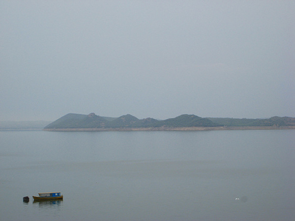
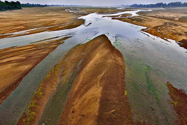
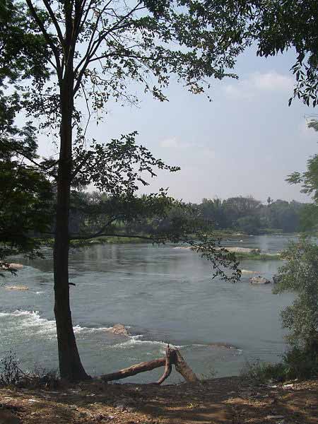
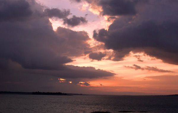
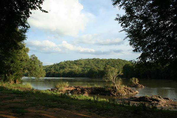
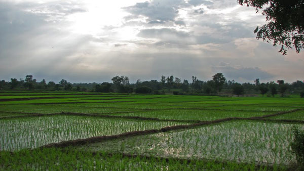
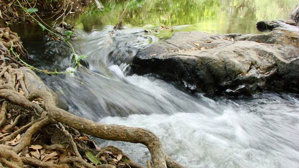
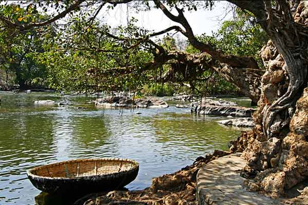
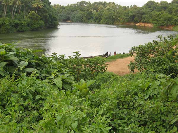
| The Kaveri (Cauvery) River is one of the major rivers of southern India, revered as sacred by Hindus. It originates from Talakaveri in the Brahmagiri Hills of Karnataka's Western Ghats and flows southward and eastward through Karnataka and Tamil Nadu before finally emptying into the Bay of Bengal through multiple mouths. The river spans approximately 805 kilometers, making it one of southern India's most significant rivers. Its source at Talakaveri in Karnataka flows all the way to the Bay of Bengal, forming a large and fertile delta in Tamil Nadu's Thanjavur district. The Kaveri River basin covers about 72,000 square kilometers, which supports extensive agricultural activity.
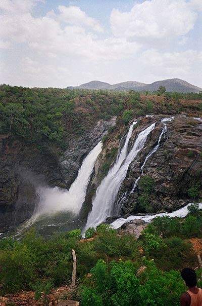
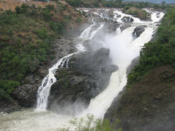
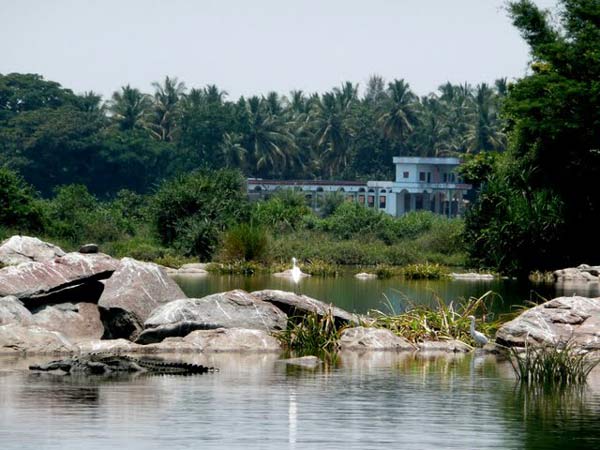
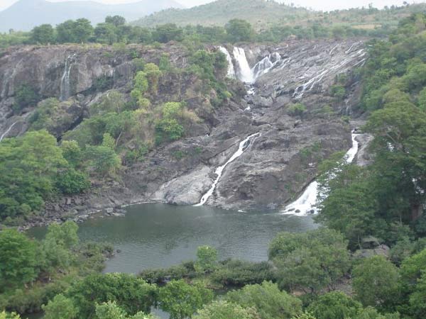
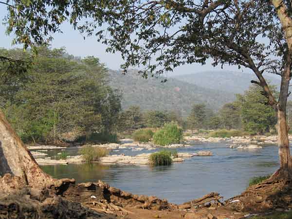
The Kaveri River has numerous tributaries, including the Shimsha, Hemavati, Arkavathy, Honnuhole, Lakshmana Tirtha, Kabini, Bhavani, Lokapavani, Noyyal, and Amaravati rivers. As it flows, the river creates several iconic scenic spots. Notable among these are Srirangapatna, an island known for its historic sites and temples; Shivanasamudra Falls, a majestic waterfall and hydroelectric power site; Hogenakal Falls, celebrated for its beautiful views and therapeutic waters; and Srirangam in Tamil Nadu, a spiritual and cultural center hosting the famous Ranganathaswamy Temple. As the Kaveri nears Tamil Nadu's Thanjavur district, it branches out to form a vast, fertile delta. This delta is essential for rice cultivation and contributes significantly to the agricultural landscape before the river merges into the Bay of Bengal. The Kaveri River is invaluable for agriculture, hydroelectric power, and drinking water across the region, playing a vital role in supporting the economy and livelihoods of millions in Karnataka and Tamil Nadu. The origin of the River Kaveri is at the Talakaveri (Western Ghats) of Karnataka. River Kaveri originates in the Brahmagiri hills in Kodagu. This place is called Talakaveri or the head of Kaveri. The river starts its journey from the small pond called as Kundike pond, the two tributaries known as Kanake and Sujyoti joins it later in the course. All these three rivers meets at the point called Bhagamandala. It lies at an altitude of 1350 meters and generally flows from the direction of south to the eastward direction. The river has an approximate length of 760 km. It flows in the state of Karnataka and Tamil Nadu and finally merges into Bay of Bengal. The major tributaries of the river Kaveri include Shimsha river, Arkavathy river, Honnuhole river, Hemavati river, Lakshmana Tirtha river Kabini river, Bhavani river, Lokapavani river and the Amaravati river. |
Location Info: |
|
Address: The Kaveri River originates at Talakaveri, located in the Brahmagiri Hills of the Western Ghats, within Kodagu district, Karnataka. District: Kodagu (Coorg) District Nearest City: Madikeri, approximately 48 km from Talakaveri Best Time to Visit: April to November |
Climate/Weather: |
| Pleasant all year round. Monsoon is from June to September. Winter (Oct to Jan) Min- 14°C Max- 26°C Clothing- Thick Cotton, Light Wool & Sneakers Summer (Feb to Jun) Min- 20°C Max- 32°C Clothing- Light Cotton & Sneakers Monsoon (Jul to Sep) Min- 18°C Max- 30°C Clothing- Umbrella, Raincoat & Sneakers |
| Autumn (Sep to Oct): Min- 16°C Max- 28°C Clothing- Light Wool & Sneakers |
| Spring (Mar to Apr): Min- 18°C Max- 30°C Clothing- Light Cotton & Sneakers |
History: |
| The history of this region is deeply rooted in ancient civilizations, with evidence of human settlements dating back to prehistoric times. The area flourished under various powerful dynasties, each leaving a distinctive imprint on the cultural and architectural landscape.
Early Period: The early history of the region is marked by the emergence of small settlements and tribes that practiced agriculture and built the foundation of the civilization. Gradually, these settlements expanded, leading to the establishment of the first organized societies. Chola Dynasty: The Chola Empire, one of the longest-ruling dynasties in South India, reached its zenith between the 9th and 13th centuries. The Cholas are celebrated for their patronage of Tamil culture, literature, and temple architecture. Iconic temples such as the Brihadeeswara Temple were constructed during this time, which now stands as UNESCO World Heritage Sites. The Chola rulers were known for their maritime power and trade, establishing connections with Southeast Asia and even reaching as far as China. Vijayanagara Empire: After the decline of the Cholas, the Vijayanagara Empire rose to prominence around the 14th century, covering much of South India. Renowned for their military prowess, the Vijayanagara kings fostered a golden era of arts, literature, and religion. The famous city of Hampi, now a UNESCO World Heritage Site, was the capital and became a thriving center for commerce, spirituality, and art. The empire also focused on irrigation advancements, establishing a robust agricultural economy that supported the population. Colonial Era: In the 16th century, European powers began establishing their presence. The Portuguese, Dutch, French, and eventually the British saw strategic and economic potential in the region. The British East India Company expanded their influence, leading to full colonial control by the 19th century. Colonial rule introduced Western education, railways, and modern industries, fundamentally transforming the region's socio-economic structure. However, it also led to significant cultural suppression and economic exploitation, which fueled the independence movements of the early 20th century. Post-Independence Era: Following independence in 1947, the region experienced rapid modernization and development. Infrastructure, educational institutions, and healthcare systems were established, creating a strong foundation for today's vibrant society. Many historical sites were preserved as national monuments, attracting researchers and tourists alike. Today, the region remains a blend of ancient heritage and modern growth, with cities thriving in information technology, agriculture, and tourism, all while preserving their rich historical heritage. The legacy of these diverse periods is still visible in the region’s architecture, language, arts, and festivals. Historical sites, temples, forts, and artifacts provide a window into the past, offering visitors a unique journey through thousands of years of civilization. |
Interesting Things to Do: |
|
| Coorg is an ideal place for outdoor activities, food and shopping! |
Interesting things to Visit: |
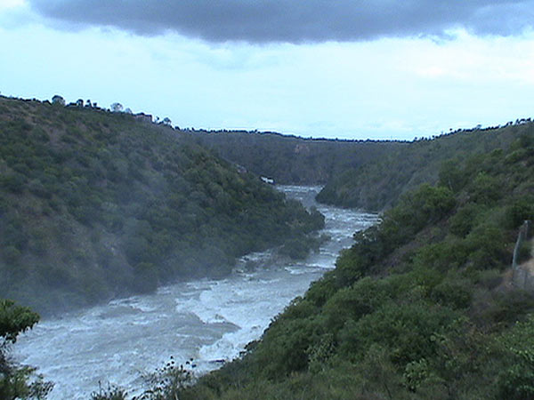
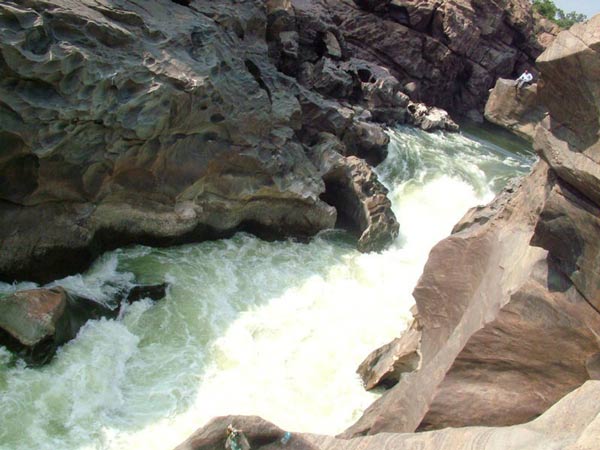
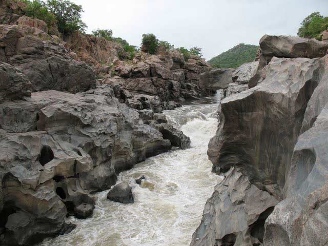
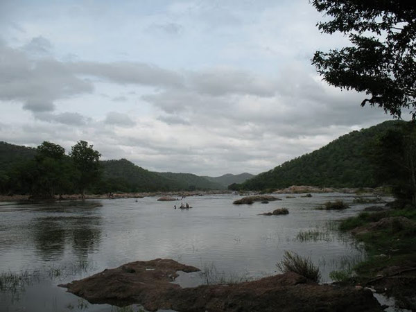
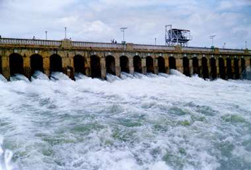
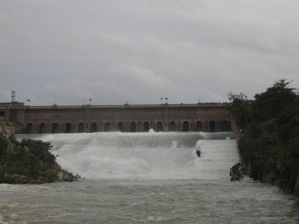
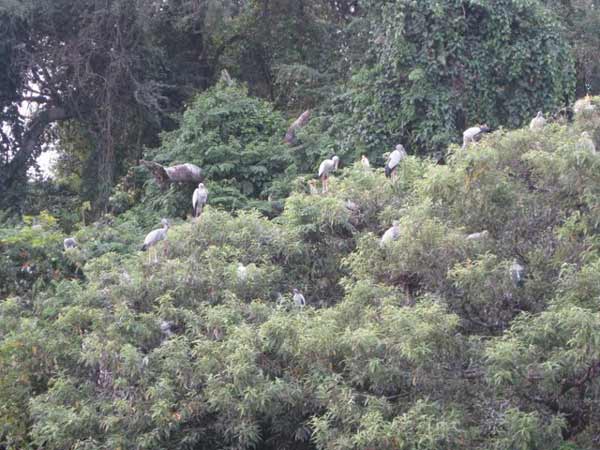
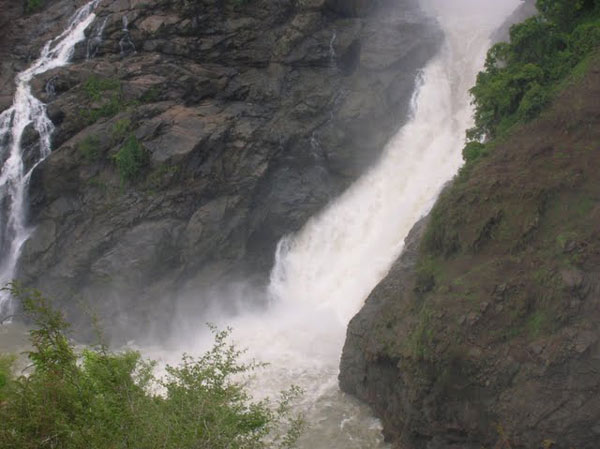
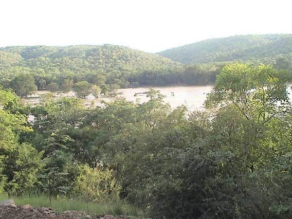
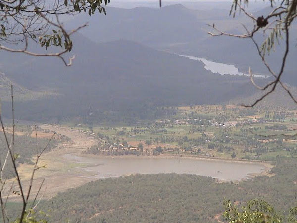
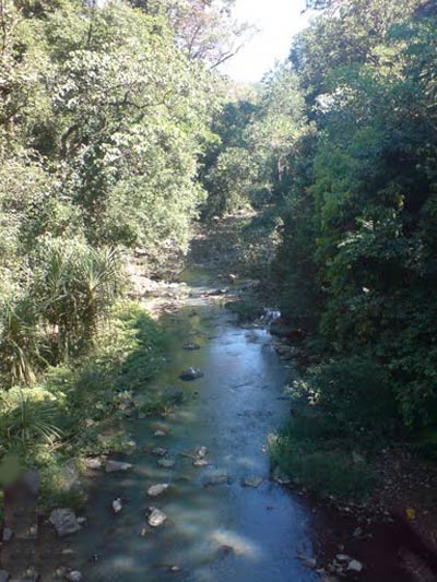
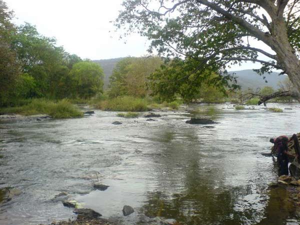
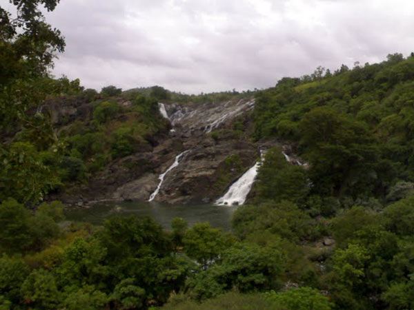
| The river course of Kaveri starts from its origin and ends at the mouth of the river, when it empties into the Bay of Bengal. The river starts it journey at Talakaveri in the Brahmagiri hills in Kodagu, however there not much flow at this point all round the year. This region forms the principal drainage area of this district, and is already a major river when it leaves the Western Ghats near Kushalanagara. River Kaveri in Karnataka has several channels with dams. In its course through Karnataka, the channel is broken up by twelve "anicuts" or dams for the reason of irrigation. From the anicut at Madadkatte, an artificial channel is diverted at a distance of 72 miles, irrigating an area of 10,000 acres and ultimately bringing its water supply to the town of Mandya. River Kaveri in Tamil Nadu features lovely waterfalls and gorges, which serves as great tourist spots. The River Kaveri enters the Indian state of Tamil Nadu through Krishnagiri district and along its course structure many gorges and waterfalls; among them the most famous is the Hogenakkal falls in Dharmapuri District. The three minor tributaries of River Kaveri, flowing in this state are Palar, Chennar and Thoppar above Stanley Reservoir in Mettur , where the dam has been constructed. |
Mobile Range Info: |
| Most major mobile network providers offer coverage in this region, including [mention prominent service providers like Airtel, Jio, Vodafone, etc.]. While network connectivity is generally strong in urban areas and around tourist sites, remote locations and dense forest areas may experience weak or no signal. It is advisable to carry a fully charged mobile power bank if you plan to travel to off-grid areas. |
How to Reach? |
| Nearest Railway Station: Mysore Junction, approximately 146 km away. |
| Nearest Airports: Bangalore International Airport (about 260 km away) and Mangalore Airport (around 135 km away). |
| By Road: Kodagu is accessible via the Mysore - Mangalore highway (NH48). The district headquarters, Madikeri, is located 260 km from Bangalore, 120 km from Mysore, and 136 km from Mangalore. Additionally, Madikeri is about 115 km from Cannanore and Tellicherry. Regular bus services are available from these locations to Madikeri. |
Nearest Visiting Places |
| Abbey Falls: Located about 10 km from Madikeri, this picturesque waterfall is surrounded by coffee plantations and lush greenery. |
| Raja's Seat: Situated in Madikeri, this scenic spot offers panoramic views of the valley, especially beautiful at sunrise and sunset. |
| Dubare Elephant Camp: Located around 30 km from Madikeri, this elephant camp provides a unique experience to interact with elephants and learn about their care. |
| Talakaveri: The origin of the river Kaveri, located approximately 48 km from Madikeri, this spot is of religious significance and offers serene landscapes. |
| Nisargadhama: A scenic island about 28 km from Madikeri, Nisargadhama is a beautiful picnic spot with bamboo groves, sandalwood, and teak trees, along with boating and elephant rides. |
| Bylakuppe: Located around 40 km from Madikeri, Bylakuppe is one of the largest Tibetan settlements in India and features the famous Namdroling Monastery (Golden Temple). |
| Mandalpatti: A beautiful viewpoint around 20 km from Madikeri, accessible by jeep, offering stunning views of the Western Ghats. |
Nearest Petrol Pump |
| Madikeri Petrol Pump: Located in the heart of Madikeri town, this is one of the closest fuel stations for travelers exploring the Kodagu region. |
| Kushalnagar Petrol Pump: Approximately 30 km from Madikeri, in the town of Kushalnagar, providing easy access for those traveling towards Dubare Elephant Camp and Nisargadhama. |
| Virajpet Petrol Pump: Situated around 35 km from Madikeri, in Virajpet town, convenient for those heading towards southern parts of Kodagu. |
| Suntikoppa Petrol Pump: Located about 15 km from Madikeri on the way to Kushalnagar, offering a quick refueling option for travelers on this route. |
| Mangalore Highway Petrol Pumps: Numerous fuel stations are available along the Mysore - Mangalore highway (NH48) for travelers entering Kodagu from nearby cities. |
Hotels/Lodge/Accommodation |
| Luxury Stays: |
| Taj Madikeri Resort & Spa: A luxurious resort with stunning valley views, private villas, and premium amenities in Madikeri. |
| Coorg Wilderness Resort: A high-end resort nestled in greenery, offering plush rooms, a pool, spa, and fine dining experiences. |
| Evolve Back, Coorg: A premium resort with elegant cottages, infinity pools, and nature trails, ideal for a luxurious retreat. |
| Mid-Range Stays: |
| Heritage Resort Coorg: A peaceful getaway with traditional-style rooms, wellness services, and easy access to Madikeri’s attractions. |
| Club Mahindra Madikeri Resort: A family-friendly resort with spacious accommodations, spa services, and recreational activities. |
| Budget Stays: |
| Hotel Coorg International: An affordable hotel in Madikeri, offering essential amenities and proximity to local tourist spots. |
| Homestays: Authentic Coorgi experiences in homely settings, including options like Chilipili Estate Stay and Silver Brook Estate Homestay. |
| Guesthouses: Budget-friendly options like Greenline Stay and Crystal Homestay in Madikeri, ideal for travelers on a budget. |
Things to Carry |
| Weather-Appropriate Clothing: Lightweight, breathable clothes for the day and warm layers for cooler evenings, as temperatures can vary. |
| Rain Gear: An umbrella or raincoat, especially if visiting during the monsoon season, as Kodagu experiences heavy rainfall. |
| Comfortable Footwear: Sturdy shoes for trekking and exploring hilly terrain, as well as a pair of comfortable sandals. |
| Insect Repellent: Essential for protection against mosquitoes and insects, particularly if you plan on trekking or camping. |
| Sunscreen and Sunglasses: Sunscreen to protect against UV rays and sunglasses for daytime travel in open areas. |
| Water Bottle: A reusable water bottle to stay hydrated, especially during outdoor activities and treks. |
| First Aid Kit: Basic medical supplies, including any personal medications, band-aids, and antiseptics. |
| Power Bank and Chargers: A power bank for keeping devices charged while traveling, as well as necessary chargers. |
| Camera: For capturing the scenic beauty of Coorg, don’t forget your camera or smartphone with ample storage space. |
| Snacks: Energy bars or light snacks, especially if you plan to trek or visit remote areas where food options may be limited. |
| Identification: Carry valid ID proof for hotel check-ins and emergencies. |
Tips & Suggestions |
| Respect Local Culture: Kodagu has a rich cultural heritage; respect local customs, especially in temples and traditional areas. |
| Plan for the Weather: Coorg has a tropical climate with a heavy monsoon season from June to September. Pack rain gear if visiting during these months. |
| Start Early for Sightseeing: Many scenic spots are best enjoyed in the morning hours when it’s less crowded and cooler. |
| Hire Local Guides: For places like trekking spots or wildlife reserves, hiring a local guide can enhance the experience and ensure safety. |
| Stay Cautious with Wildlife: Coorg is home to various wildlife. Avoid feeding or disturbing animals and stick to designated paths during nature walks or treks. |
| Sample Local Cuisine: Coorg has a unique cuisine, especially known for its pork dishes, bamboo shoot curry, and coffee. Don’t miss out on local eateries. |
| Carry Cash: While Madikeri and some main areas have ATMs, many smaller areas and local businesses may not accept cards. |
| Book Accommodation in Advance: Coorg is a popular destination, so booking hotels or homestays ahead of time is advisable, especially during peak season. |
| Eco-Friendly Practices: Help preserve Kodagu’s beauty by disposing of waste properly, minimizing plastic use, and respecting natural surroundings. |
| Be Mindful of Restricted Areas: Some areas, especially near military bases or forests, may have restricted access; always adhere to signs and regulations. |
Help Line/Phone Number |
| Emergency (Police, Fire, Ambulance): Dial 112 for any emergency services. |
| Kodagu District Police Station: +91 8272 225 599 (for assistance with local law enforcement and safety issues) |
| Madikeri General Hospital: +91 8272 220 900 (for medical emergencies in and around Madikeri) |
| Karnataka Tourism Helpdesk: 1800 425 5900 (toll-free number for tourism-related queries) |
| Forest Department, Coorg: +91 8272 221 193 (for inquiries about trekking, wildlife safety, and forest permits) |
| Taxi and Transportation Services: Local taxi services are available at +91 8272 220 567 (for transport assistance and local guides). |
| Coorg Tourist Information Center: +91 8272 229 005 (for assistance with sightseeing and tourism information) |
| Nearest Petrol Pump Assistance: Contact nearby petrol pumps for directions or assistance: Madikeri Fuel Station +91 8272 225 456. |
| Hotel and Accommodation Helpdesk: Assistance with accommodation is available through major hotels like Taj Madikeri Resort: +91 8272 265 900. |

Kaveri River Nearest Attraction |
| Cauvery Nisargadama |
| This place is located in the Kodagu (Coorg) district of Karnataka very close to Kushal Nagar. Nisargadhama is around 120 kms from Mysore and around 260 kms from Bangalore. Located 4 kms before Kushal Nagar (when driving from Mysore), it is a small and circular island formed by the branching of river Cauvery....more |
| Kabini WildLIfe Sanctuary |
| Kabini is one of the most popular wildlife destinations of Karnataka, probably because of its easy accessibility, lush green landscape surrounding a large picturesque lake, and fantastic sightings of large herds of elephants. It is 80 km away from Mysore and 205 km from Bangalore, and comprises the south-eastern part of Nagarole National Park....more |
| Brahmagiri Wildlife Sanctuary |
| Brahmagiri Wildlife Sanctuary, located in Kodagu District covers an area of about 181 sq km. It is surrounded by evergreen and semi-green forests as well as shola grasslands....more |
| Pushpagiri Wildlife Sanctuary |
| Pushpagiri Wildlife Sanctuary is one of 21 Wildlife Sanctuaries of India's Karnataka state. This sanctuary is located near Mandalpatty in Somwarpet taluk of Kodagu district and has some attractive scenery. Spread over 102 sq km, the sanctuary is situated in the Western Ghats and has thick evergreen and semi-evergreen forests....more |
| Talakaveri Wildlife Sanctuary |
| Talakaveri Wildlife Sanctuary is a wildlife sanctuary in Southern Karnataka state of South India. It is located in Kodagu district and is spread over 105 km2 and lies in the Western Ghats. This sanctuary is named after Talakaveri, the origin of the Cauvery River which lies on the eastern edge of the sanctuary....more |
| Rajiv Gandhi National Park |
| Nagarhole National Park, also known as 'Rajiv Gandhi National Park,' is located 94 km from Mysore in Karnataka in Southern India. It is spread between Kodagu and Mysore districts. Located to the northwest of Bandipur National Park, Kabini reservoir separates the two....more |
| Abbey Waterfall |
| Karnataka boasts of some scenic and exotic hill stations that are frequented by those seeking the green and serene. Among them one such location would be the Abbey falls. This waterfalls also known as the Abbi falls....more |
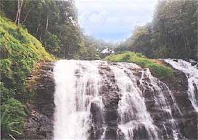
| Irpu / Iruppu Waterfall |
| Irpu falls (or Iruppu falls) is situated at outskirts of Brahmagiri mountain range of Kodagu district. The falls is formed by Lakshmana theertha river when it jumps down in two tiers from a height of 52 mtrs (approximately 170 ft). The Irpu Falls, also known as the Lakshmana Tirtha Falls....more |
| Mallalli Waterfall |
| Mallalli falls is situated in the foots of pushpagiri hills. It in about 18 kms from somwarpet, the falls is 2 kms inside the main road. Mallalli Falls is situated in Coorg and is around 25 kms from Somwarpet and 260 kms from Bangalore....more |
| Nisargadhama Falls |
| Nisargadhama Falls in Karnataka is about 25km on the way to Madikeri from Bangalore. 2 kilometers from Kushalnagar, Nisargadhama is a beautiful island carved by the Cauvery. Karnataka's geographical topography is dominated by the Western Ghats that is the source of many rivers flowing though out the land....more |
| Lakshmana Tirtha River |
| The Lakshmana Tirtha is a river of India that has its origin in Kodagu district and flows eastward. It joins the Kaveri River in the Krishna Raja Sagara lake. Kodagu is a district of Karnataka State in Southern India. It is also known by its anglicised name of Coorg. It occupies about 4,100 square kilometers (1,580 mi2) of land in the Western Ghats of Southwestern Karnataka....more |
| Harangi Dam |
SELECT YOUR HOLIDAY DESTINATION
-
Aero Sports in Karnataka
-
Archaeology in Karnataka
-
Beaches in Karnataka
-
Bird Sanctuaries in Karnataka
-
Bouldering Spot in Karnataka
-
Camping in Karnataka
-
Cave Explorations in Karnataka
-
Culturals Place in Karnataka
-
Dams in Karnataka
-
Districts Of Karnataka
-
Fairs in Karnataka
-
Festivals in Karnataka
-
Go Karting in Karnataka
-
Hill Stations in Karnataka
-
Historical Places in Karnataka
-
Holiday Resorts in Karnataka
-
Islands in Karnataka
-
Landscape in Karnataka
-
Mountain Biking in Karnataka
-
National Parks in Karnataka
-
Orbit Network
-
Para Sailing in Karnataka
-
Pilgrims Destinations In Karnataka
-
River rafting in Karnataka
-
Rivers in Karnataka
-
Rock Climbing in Karnataka
-
Safari in Karnataka
-
Temples in Karnataka
-
Trekking in Karnataka
-
Water Sports in Karnataka
-
Waterfalls in Karnataka
-
Wildlife Sanctuaries in Karnataka